Iroquois River (Kankakee River)
| Iroquois River | ||
|
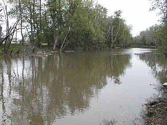
Iroquois River in Newton County , Indiana |
||
| Data | ||
| Water code | US : 410927 | |
| location | Illinois , Indiana (USA) | |
| River system | Mississippi River | |
| Drain over | Kankakee River → Illinois River → Mississippi River → Gulf of Mexico | |
| source | 5 km northwest of Rensselaer 40 ° 57 ′ 55 ″ N , 87 ° 12 ′ 23 ″ W |
|
| muzzle |
Kankakee River Coordinates: 41 ° 4 ′ 27 " N , 87 ° 48 ′ 59" W 41 ° 4 ′ 27 " N , 87 ° 48 ′ 59" W. |
|
| Mouth height |
181 m
|
|
| length | 267 km | |
| Catchment area | 5535 km² | |
| Discharge at the Chebanse A Eo gauge : 5415 km² |
MQ 1924/2016 Mq 1924/2016 |
51.5 m³ / s 9.5 l / (s km²) |
| Left tributaries | Sugar Creek | |
| Small towns | Rensselaer , Watseka | |
| Communities | Iroquois | |
The Iroquois River is a left tributary of the Kankakee River in the US states of Indiana and Illinois . It has a length of 267 km and drains an area of 5535 km². The mean discharge is 51.5 m³ / s.
course
The Iroquois River has its source in Jasper County , Indiana, 3 miles northwest of Rensselaer . It initially flows a short distance north, then east and finally south. It flows through the small town of Rensselaer and now flows about 80 km in a westerly direction before it crosses the border into Illinois. He passes the village of Iroquois . At Watseka the Sugar Creek flows into the river from the left. The Iroquois River now flows about 50 km to the north and finally flows into the Kankakee River 7 km southeast of the city of Kankakee .
Web links
Individual evidence
- ↑ a b Iroquois River in the Geographic Names Information System of the United States Geological Survey
- ^ I Fish Illinois: Iroquois River . Illinois Dept. of Natural Resources. Retrieved June 30, 2017.
- ↑ USGS 05525000 IROQUOIS RIVER AT IROQUOIS, IL
