Isla de Las Palomas
| Isla de Las Palomas Isla de Tarifa |
||
|---|---|---|
| The dam to the island | ||
| Waters | Strait of Gibraltar | |
| Geographical location | 36 ° 0 '11 " N , 5 ° 36' 34" W | |
|
|
||
| length | 650 m | |
| width | 540 m | |
| surface | 30 ha | |
| Residents | uninhabited | |
|
Plan of the port of Tarifa (1813) with Isla de Tarifa , which already has the embankment connection to the mainland (south is below left) |
||
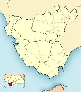
The Isla de Las Palomas , including Isla de Tarifa called, is a small, rocky island 150 meters south of the southern tip of the Spanish mainland in the town of Tarifa (and the city properly), province of Cadiz , Andalusia . In earlier times the island was also called Isla Junioas .
geography
Punta de Tarifa is the southernmost point of mainland Spain and continental Europe . The cape is considered to be the border point between the Mediterranean Sea , especially the Strait of Gibraltar , and the open Atlantic . Near the cape is the Faro de Punta de Tarifa lighthouse , built in the 18th century, which rises 43.8 meters above sea level and 33 meters above the surrounding area.
The Isla de Las Palomas, with its almost round floor plan, is 650 meters long, with a maximum width of 540 meters. The area is measured at around 30 hectares .
The island has been connected to the mainland by a navigable dam since 1808 . This is known as the Camino de la Isla de Las Palomas . The distance over the dam to the mainland is 150 meters.
history
In the north-eastern part of the island, the remains of at least five Phoenician tombs from the sixth and fourth centuries BC are evidence of From Phoenician rule during this period.
During Roman times , the island's limestone was systematically mined in quarries , which still characterizes the island's surface today.
Fortifications were built on the island by the 17th century at the latest.
In 1808 the dam was built from the mainland to the island by Antonio González Salmón, who a few years earlier was also responsible for the pier that formed the port of Tarifa.
In the middle of the 20th century, the island became the site of a barracks and came into the possession of the Spanish Ministry of Defense. In 1988 the barracks were given up, and the island was once again open to the public as Dominio Público Marítimo Terrestre (about public sea-land area ).
For installation of the natural park Parque natural del Estrecho (about Natural Park of the Strait ) in 2003, the island was included because of their special ecological value and in the nature park.
Individual evidence
- ↑ a b Turismo Tarifa: Isla de Las Palomas ( Memento of the original from May 2, 2014 in the Internet Archive ) Info: The archive link was inserted automatically and has not yet been checked. Please check the original and archive link according to the instructions and then remove this notice.
- ↑ The IHO defines the border between the Atlantic and the Mediterranean as a line from Cape Trafalgar to Cape Spartel , around 15 kilometers further west. Then the island is completely in the Mediterranean: Limits of Oceans and Seas , p. 16
- ↑ Una torre almenara llena de tecnología
- ↑ [1] Prados Martínez, F .; Castañeda Fernández, V. y García Jiménez, I .: El mundo funerario fenicio-púnico en el Campo de Gibraltar. Los casos de la necrópolis de Los Algarbes y la isla de las Palomas (Tarifa, Cádiz) , in: Mainkake, Vol. 1, No. 32, 2010, pp. 251-278
- ↑ Archive link ( Memento of the original from October 3, 2010 in the Internet Archive ) Info: The archive link was inserted automatically and has not yet been checked. Please check the original and archive link according to the instructions and then remove this notice. Criado Atalaya, Francisco Javier: Las relaciones entre el municipio de Tarifa y la Corona durante el reinado de Carlos II. In: Almoraima, Vol. 18
- ↑ Archived copy ( memento of the original from April 22, 2015 in the Internet Archive ) Info: The archive link was inserted automatically and has not yet been checked. Please check the original and archive link according to the instructions and then remove this notice. Carlos Ruiz Bravo: ronología II: Edades Moderna y Contemporánea , In: Aljaranda, No. 71
- ↑ Congreso de los Diputados: Boletín Oficial de la Cortes Generales, 16 de enero de 2002
- ^ Junta de Andalucía: El Consejo de Gobierno aprueba el Plan Gestor de uso y gestión del Parque natural del Estrecho


