Cape Trafalgar
Coordinates: 36 ° 10 '57 " N , 6 ° 1' 58" W.
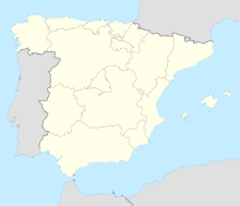
The Cape Trafalgar ( Spanish / Portuguese Cabo Trafalgar , Latin promontory Iunonis ; Arabic رأْس الطرف الأَغر, DMG raʾs aṭ-ṭaraf al-ʾaġar , probably fromرأْس الطرف الغرب, DMG raʾs aṭ-ṭaraf al-ġarb 'Cape of the West') is located in the south of the Andalusian province of Cádiz ( Spain ), about 40 km southeast of the provincial capital Cádiz , at the northwest end of the Strait of Gibraltar . The elevation at the headland, the Tómbolo de Trafalgar , is protected as a national Spanish monument.
geography
The headland consists of a solid elevation more than 6 m high, 400 m long in an east-west direction and 400 m wide. Behind it there are sandy beaches, dunes and a shallow, often dry lagoon .
Directly to the west and east of the cape are the towns of Zahora and Los Caños de Meca , in the vicinity Vejer de la Frontera , Conil de la Frontera and Barbate .
geology
The solid material of the elevation consists on the one hand of geologically young sandstone with an abundance of lime from the shells of mussels and snails. This material is 100,000 years old and older. In addition, there is silt with an age of 90,000 years and younger.
When the sea level rose with the end of the last ice age 16,000 to 6,500 years ago, the hill initially became a small island off the mainland. Offshore water currents on both sides of the island then deposited the sandbank over time, which now connects it to the mainland.
The sea also created the structures in the rock that can be seen at Cape Trafalgar, as in many other places on the Spanish coast:
- Salty water penetrates the porous rock and grains of salt crystallize out. They exert pressure on the surrounding rock and cause cracks to form. If the crystals are washed out again, further small cavities are created. These promote erosion and the typical, spongy, rough fine structure of the rock surface is created.
- On the flat rock face in front of the hill, the tides cause water eddies to form pot-like depressions, so-called marmitas . Some of these depressions, recognizable by the particularly even rounding of the edge, were made by human hands. For the production of columns, material was carved out of the rock.
history
The remains of a Moorish- Spanish settlement as well as a fish conservation workshop and a Juno temple from Roman times were discovered at the cape .
At the top of the cape is the ruin of an Arabic light and observation tower ( Almenara ). It was part of a whole chain of towers in this stretch of coast that go back to the 13th century.
The Cape became famous through the Battle of Trafalgar on October 21, 1805, when the British fleet under Admiral Nelson destroyed the united Spanish-French fleet and Nelson was killed. Trafalgar Square in London was named in memory of this event .
In 1860 a 34 m high lighthouse was built on the elevation.
tourism
Cape Trafalgar is a popular excursion and vacation destination. Strong winds on the Costa de la Luz favor kitesurfing .
Web links
- Official website of the Provincial Government of Andalusia (Junta de Andalucia) (English-German)
Individual evidence
- ↑ Las torres almenara. visited on July 4, 2010.


