Jackson Creek (Maribyrnong River)
| Jackson Creek | ||
|
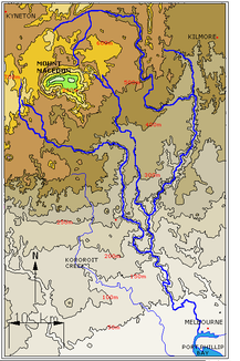
Relief map of the Maribyrnong River and its source streams |
||
| Data | ||
| location | Victoria , Australia | |
| River system | Yarra River | |
| Drain over | Maribyrnong River → Yarra River → Port Phillip Bay → Bass Strait | |
| source | near Gisborne in the Great Dividing Range 37 ° 27 ′ 1 ″ S , 144 ° 27 ′ 29 ″ E |
|
| Source height | 459 m | |
| muzzle |
Maribyrnong River Coordinates: 37 ° 40 ′ 10 ″ S , 144 ° 48 ′ 16 ″ E 37 ° 40 ′ 10 ″ S , 144 ° 48 ′ 16 ″ E |
|
| Mouth height | 41.6 m | |
| Height difference | 417.4 m | |
| Bottom slope | 5.9 ‰ | |
| length | 71.1 km | |
| Left tributaries | Riddels Creek | |
| Right tributaries | Longview Creek | |
| Reservoirs flowed through | Rosslynne Reservoir | |
| Medium-sized cities | Sunbury | |
| Small towns | Gisborne, Clarkefield | |
|
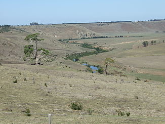
Jackson Creek at Clarkefield |
||
The Jackson Creek is a creek in the southern Australian state of Victoria .
course
It is a headwaters of the Maribyrnong River and flows out of the Rosslynne Reservoir near Gisborne . The reservoir, which is fed by several unnamed streams, is located on the Great Dividing Range .
Jackson Creek flows east from Gisborne and then turns south west of Clarkefield . It passes Sunbury east of the city center, then continues its course in a south-easterly direction and merges with Deep Creek to form the Maribyrnong River. South of the village of Riddles Creek , Riddels Creek flows from the north and Longview Creek from the south .
West of Melbourne Airport , near the Calder Freeway , Jackson Creek flows through Organ Pipes National Park a few kilometers before its confluence with Deep Creek.
See also
Individual evidence
- ↑ a b c Map of Jackson Creek, VIC . Bonzle.com
- ^ A b Steve Parish: Australian Touring Atlas . Steve Parish Publishing Pty. Ltd. Archerfield QLD (2007). ISBN 9781741932324

