
Organ Pipes National Park
| Organ Pipes National Park | |||
|---|---|---|---|
 |
|||
|
|||
| Location: | Victoria , Australia | ||
| Specialty: | Basalt formations | ||
| Next city: | Melbourne | ||
| Surface: | 1.21 km² | ||
| Founding: | 1972 | ||

The Organ Pipes National Park ( OPNP ) is a national park in the south of the Australian state of Victoria (Australia) and has an area of 121 hectares. It was created primarily to preserve the ancestral flora and fauna, as well as to preserve the geological features of Jackson Creek , a source river of the Maribyrnong River in northwest Melbourne . It lies in a deep gorge on the barren Keilor Plains .
In the park there is 400 million year old volcanic rock that formed the particularly hexagonal basalt columns , the "Organ Pipes". They are arranged in layers as if they had been welded together. The rock formations were uncovered by the Maribyrnong River's slow digging into the basalt plateau, which lasted several centuries. The study of fossils in the volcanic rock led to the realization that the area must have been covered by the sea about 400 million years ago.
A support group, the Friends of Organ Pipes (FOOPS), is helping to reintroduce the original flora and fauna in the park, complementing the work of Parks Victoria , under which the Organ Pipes have been declared a national park. The park is important for the entire region as a "teaching center on geology, flora and fauna of the Keilor Plains, as well as the restoration of destroyed natural areas". With its entry in the United Nations IUCN list for national parks and protected areas under Category III (natural monuments), the need to preserve and preserve special natural areas was recognized.
The national park is administered by Parks Victoria .
geography

The national park is about 20 km northwest of downtown Melbourne and is accessible from the Calder Highway . Jackson Creek, which forms the center of the park, borders the Local Government Area Hume City to the north and the Local Government Area Brimbank City to the south . The Deep Creek and the Keilor Plains are also part of the area. Other green spaces in the area include the Holden Flora Reserve (65 ha), the Holden School Site (25 ha), the Derimut Grassland Reserve (154 ha) and the Laverton and North Grassland Reserve (52 ha).
The Organ Pipes National Park is right next to the M79 (Calder Freeway). The road network around the park consists of the Calder Freeway to the south and the Calder Park Raceway also south, but closer to the entrance.
Of the total area of 121 ha, 107.3 ha (88.6%) are protected areas, 13 ha (10.8%) leisure areas, 0.7 ha (0.6%) visitor centers and 2 ha (1.6%) commercial areas.
The park is drained by Jackson Creek, Deep Creek, and Emu Creek. These are the headwaters and tributaries of the Maribyrnong River, which has a catchment area of 1,300 km².
climate
The park is located in a rain shadow area. According to records from nearby Melbourne Airport since 1972, the annual rainfall in the park averages 580mm. Rain falls mainly in winter and spring. There are occasional heavy rains in this area, for example in September 1993 when severe flooding in the Maribyrnong Valley washed away part of the vegetation, tore away the viewing platform and damaged the banks of the stream.
history
Before the immigration of Europeans
The earliest settlement took place by the Aborigines of the Voivurrung of the Kulin Alliance in the valleys of the Yarra River and the Maribyrnong River. The Jackson Creek formed part of the boundary between the areas of the Marin-Bulluk and the Wurundjeri-Willam . They were hunters and gatherers who lived on the plants and animals of the forest and thus already damaged the environment to a certain extent. At that time, the Themeda grass and feather grass were planted on the Keilor Plains and sown again every year after they burned down. The climate and rainfall favored the growth of the traditional grass varieties on the wide plain. Animal species such as kangaroos , dingo , marsupials , nosebased, and platypus were common. It served as a habitat for bird species such as cockatoo , hunter's nest , quail , finch and hawk . The vegetation with meadows full of flowering plants was also lush.
The presence of indigenous people has been proven by archaeological finds from storage areas and individual artifacts in the park. The Jackson Creek area provided shelter, water and many sources of food for the original settlement.
After colonization by Europeans
European settlers from Tasmania settled in the area in the early 19th century . They were mainly responsible for the introduction of various exotic animal and plant species into the area. They did so because they found the land barren and populated with strange animals like kangaroos. They introduced entirely new families of plants, such as wolfberry hedges for property boundaries and trees such as oaks , willows and pines , to create an environment similar to their former home. Kangaroos were hunted, rabbits and other animals killed for their valuable furs. This permanently damaged the ancestral flora and fauna. It is said that “tall artichoke brushes covered the river valleys and slopes, horehound and black nettle had spread everywhere, goat thorn covered slopes and plains, and other weeds filled the valley cuts. Erosion channels dug into the slopes. Rubbish collected here and there. "
At that time there was a settlement by the Organ Pipes and a suspension bridge over Jackson Creek to reach the school and the surrounding fields. The Hall family lived here from 1870 to the 1920s; their plum groves are still there today. The time of the European settlers is also marked by remains in the form of basalt walls. The log cabins in the park were built by the Halls, later used by the Hayes family , and a Jackson Bay fig tree stands next to the visitor center. The Bartlett family lived here from 1934 to 1948 and the last owner was EA Green . His property became Crown property and the property of the EA Green Charitable Foundation and was finally given to Organ Pipes National Park in 1972.
National park
In order to eliminate the environmental damage, the well-meaning environmentally conscious citizens decided to rehabilitate the area. The first step was to convert an area of 65 hectares, which the EA Green Charitable Foundation had made available, into a national park. On March 12, 1972, the country was declared a national park under Chapter 2 of the National Parks Act 1971 (Vic.) . This decree had several goals, but in particular envisaged the improvement of the ecosystem through direct and indirect interventions. A direct intervention was the planting of native plants and seedlings, an indirect intervention was the weeding of weeds. As a result, the ancestral large plants and undergrowth are now re-established.
20 hectares were added under the National Parks (Amendment) Act 1978 (Vic.) In 1978 , and an additional 36 hectares of state-owned land (Crown Land), including land purchased for the park, was added on June 4, 1997. The National Parks Act requires the park director to "preserve and protect the natural environment of the park and its natural and other monuments." In addition to the necessary research, the law also stipulates the use of the park by the public for leisure and education. The park is also considered a "geological monument".
The choice fell on this location because of the interesting geological features such as the Organ Pipes and the Tessalated Pavement .
geology

The Keilor Plains , where the geomorphological and geological sights are located, are part of the larger Western Volcanic Plains in South Australia , which are considered the third largest lava field in the world. This field arose from repeated lava ejects more than a million years ago (Tertiary (Geology) | Young Tertiary), which overlaid steeply sloping sedimentary rocks from the Ordovician to the Silurian . Jackson Creek cut deep into it.
Sedimentary rocks and fossils found in the park are also dated to be 400 million years old. They are a sign that this area was once part of a sea. The rocks in the park are mostly dark gray or brown in color. Graptolites are considered to be fossilized sea slugs, sea worms or extinct floating animals. Around a million years ago, huge streams of lava from the surrounding volcanoes called Trapp spread across the country.
Open rocks made of mudstone and connected basalt structures exist in many places in the form of basalt cliffs, scree slopes and sedimentary layers . Several such geological landmarks, all of volcanic origin, can be seen in the park:
Organ pipes
Jackson Creek, which joins Deep Creek to form the Maribyrnong River, has slowly dug a deep valley into the basalt plateau made of hard, dark rock and exposed the old volcanic formations such as the hexagonal basalt columns of the "Organ Pipes" ( German organ pipes ). The lava deposits are around 70 meters high in the stream bed. As the lava cooled over the course of a few years, the outer, already cooled layer isolated the still liquid interior, which developed into exact, similar basalt columns as it also cooled. The cooling caused a shrinkage and this shrinkage caused - as has been scientifically proven - tensions in the rock. Vertical tensions could be balanced by the elastic, molten rock below, but not the horizontal tensions, and so the basalt cracked. Usually the rock jumps in hexagonal structures, but there are also octagonal pillars. Further contraction occurred as the rock gave off its residual heat; the tension was released in horizontal cracks, making some rocks look like pieces of Dutch cheese. Today the rock formation towers up to 20 meters and is considered the best example of connected columns in Victoria.
The unusual shape of the Organ Pipes at Jackson Creek is due to the rare column structure that only appears in places where a watercourse created the post-volcanic valley. The Organ Pipes are so named because they look like the pipes of an organ. The diameter of each pipe in the formation is approximately one meter. Only some pillars are exactly vertical, while most of the other small pillars in the area are inclined or horizontal.
Tessellated Pavement
The Tessellated Pavement ( German mosaic pavement ) is an arrangement of basalt columns that was created by the erosion by Jackson Creek. You can see it in the form of a mosaic paving approx. 750 meters upstream from the Organ Pipes. It will probably be damaged over time by the large number of visitors.
Rosette skirt
The Rosette Rock is a basalt rosette , a radial arrangement of basalt columns. It is about 500 meters upstream from the Organ Pipes and is an overhanging rock on the northern bank of the stream. It is also made of basalt, but the radial arrangement of the columns is reminiscent of the spokes of a huge wheel. Its formation is attributed to the cooling of "a lava pocket, presumably in a spherical cave that was formed by an earlier lava flow".
Scoria Cone
The Scoria Cone ( German volcanic cone ) made of basalt at the parking lot at the entrance to the park is a remnant of a weathered cone shape. The parking lot is probably on the remains of the weathered volcanic cone. The explanation for this phenomenon is “that at about the same time as the larger volcanoes in the north were producing lava (about 800,000–1 million years ago), this cone ejected molten rock in a series of explosions, which formed the volcanic cone. The Scoria Cone is brownish and the basalt there has many air pockets that come from the gas pockets of the liquid lava . "
Sandstone layer
The sandstone layer in Jackson Creek is dated to around 400 million years. It consists of quartz and quartzite pebbles . You can see it halfway between the parking lot and the Organ Pipes. The layer is part of a deep channel, a former creek bed that was buried by a lava flow and later came back to daylight through the digging of Jackson Creek. In such channels was during the gold rush in Ballarat dig for gold.
Volcanic soils
The volcanic soils in the park formed on the basalt rock bed, are found in the valleys and have very flat slopes. The soil types are classified as zonal types, the red-brown soil (dominant type in the park with low permeability), gray soil (in flat zones, with high permeability) and uniform medium-coarse loam (on steep southern slopes of low layer thickness and well drained). Azonal types of alluvial soils (fertile soils in the park, consisting of clay and pebbles, which are suitable for the cultivation of tolerant plant species, such as the river eucalyptus , the river cylinder cleaner), colluvial soils (at the foot of steep slopes, of dark gray or dark brown color , suitable for many plant species) and lithosols (red-brown soil on steep slopes, suitable for box thorns and acacias), as well as other lithosols made of prebasaltic sands and pebbles (at the bottom of the Gray Box Gully and in the lower slopes of Jackson Creek) also occur.
The soils in the park suffer from erosion, weeds, human use and cave construction by animals, sometimes by rabbits. Because of their low water retention capacity, they are unsuitable for growing most plants. The desertification was countered by extensive replanting.
flora

The intensive resettlement of native plants in an otherwise deserted plain with weeds (where the native plants are mainly thistles and box thorns) began with the designation of the area as a national park in 1972. The work began with the removal of introduced plant species and the replanting of natural ones Vegetation continued. Since 2002, large areas have been replanted with trees and bushland, systematic planting of native grass species, trees and other plants began, so that large swaths of kangaroo grass (Themada trianda) were created. The replanting project, which has been carried out for decades, shows results in the emergence of many ecosystems. Seven species of acacia can be seen blooming at the same time, as well as many other native plants.
Six types of vegetation, according to the replanting program carried out by the park administration with the help of the FOOPS, are found in three zones of landforms, which show the soils that result from the geological layers below them. These landforms are the plains and the steep slopes. Since the designation as a national park, an overall picture rich in blossoms has spread, consisting of 124 native plant species, including 20 rare or threatened ones. Some important of these species in the re-created grasslands of the basalt plain are windmill grass (Chloris truncate), red- footed grass (Bothriochloa macra; red or purple in color, grows in late summer), wallaby grass (Danthonia), silk grass or Queensland bluegrass (Dicanthium sericeum) , the kangaroo grass (Themeda triandra; grass with a high protein content ) and the Murray pine ( Callitris glaucophylla ).
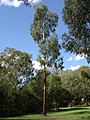
On the banks of the Jackson Creek there are scattered native plant species such as the red eucalyptus (also manna eucalyptus or black acacia) in the alluvial forest, reed species as well as bush and grassland. A white cypress , one of the two species found in the Melbourne area, can also be found in this valley. Silk grass and red foot grass can also be found in the park following Sydenham Park .
However, the growth of natural vegetation impairs the view of the geologically interesting formations.
Manna Gum (Eucalyptus vinimalis)

Australian black acacia (Acacia melannoxylon)


fauna

|

|
|
|
Echidna
|
Short head gliding bag, implemented from Toolern Vale
|
The diverse fauna in the Organ Pipes National Park can be observed in the alluvial forest, in the layered stepland and in the grassland. The fauna includes birds, mammals like the gray kangaroo and the swamp wallaby , reptiles like the long-necked turtle , the bearded dragon and the red-bellied Black Snake and echidnas . The park administration's replanting program also allowed various animal species to reproduce. A mammal survey conducted in 1988 in Organ Pipes National Park by the Arthur Rylah Institute for Environmental Research found bats to be the most diversified range of native mammals.
There was a very successful 20 year bat nest box program. Bird species such as the wedge-tailed eagle also multiply. The growling common frog and many native species of fish such as the mountain galaxy reappeared. The short-headed glider , who lived in this area until 1916, was released back into the park in 1989 from Toolern Vale . This was one of many Friends of the Organ Pipes National Park projects . In total, the park administration counted 15 native mammal species, 88 bird species, 13 reptile species and six amphibian species.
Management plan
A management plan was approved in 1996 by the Conservation an Management of Parks, Victoria under Section 17 of the National Park Act 1975 (Vic.), According to which nature is preserved, the public is given wide access to the natural and cultural monuments of the national parks and tourism is promoted shall be. As a result, the park was divided into administrative zones that allow a geographical context to manage the park, to implement measures appropriate to the special needs of the individual zones, to avoid conflicting activities and to be able to occasionally check the progress made. Measures adopted to make a destroyed ecosystem almost natural include the containment of weeds by mechanical and chemical means including the occasional burning, weeding of harmful weeds, pest control, verification of rabbit population size and care destroyed land through major replanting programs with erosion control, maintenance of seed banks and breeding stations.
An information center, maintained by the park administration, provides information on the rock strata in the park, the Aboriginal people who lived nearby, early European settlements, the replanting project of the once-deserted park, and the park's role in the national park system in preserving ecology in the area.
Attractions
With the Organ Pipes, the Tessellated Pavement, the Rosette Rock and many other attractions, the park is a magnet for tourists. There is a visitor center and picnic area by the parking lot, as well as short hiking trails over a fairly steep slope down to Jackson Creek and the rocks.
The park is in the approach lane of Melbourne Airport and in the vicinity of Calder Park Raceway , so noise from planes and racing cars can affect the visit. The birds and other animals are not disturbed by this, and you can see swamp wallabies and gray kangaroos during an early morning or evening visit.
Web links
swell
- Parks Victoria: Organ Pipes National Park Management Plan . Parks Victoria, Kew, Victoria 1998, ISBN 0-7306-6703-0 (English, online [accessed January 4, 2017]).
- Robin Taylor: Wild Places of Greater Melbourne . Csiro Publishing, 1999, ISBN 0-9577471-0-1 (English, limited preview in Google Book Search [accessed January 4, 2017]).
Individual evidence
- ^ The Australian Entomologist . The Entomological Society of Queensland (2000). P. 106
- ↑ a b c d e f Management . S. i, iv-v, 1-2
- ↑ a b c d e f g h i j k l m n o p q r s t u v w x y Organ Pipes National Park, a guide for teachers an visitors . Department of Conservation & Environment, Melbourne, Victoria 1992, ISBN 0-7306-2635-0 (English, online ( memento of October 12, 2012 in the Internet Archive ) [accessed January 4, 2017]). Organ Pipes National Park, a guide for teachers an visitors ( Memento of the original from October 12, 2012 in the Internet Archive ) Info: The archive link was inserted automatically and has not yet been checked. Please check the original and archive link according to the instructions and then remove this notice.
- ↑ a b c d e f g h Organ Pipes National Park . Parks Victoria ( Memento from February 26, 2011 in the Internet Archive )
- ↑ a b c d e f g h Organ Pipes National Park Visitors Guide . Parks Victoria ( Memento of March 30, 2011 in the Internet Archive )
- ↑ Management . Pp. 1-9
- ↑ a b c Management . Pp. 1-3
- ↑ a b c d e f Management . P. 7
- ↑ Taylor . Pp. 171-175
- ↑ a b Management . P. 11
- ↑ a b Management . P. 8
- ↑ Murray Gray: geodiversity: Valuing and Conserving Abiotic Nature . Wiley, 2004, ISBN 0-470-09081-2 , pp. 151 ff . (English, limited preview in Google Book Search [accessed January 4, 2017]).
- ↑ Taylor , p. 174
- ^ R. Irvine & R. Bender: Initial Results form Bat Roosting Boxes at Organ Pipes National Park . The Victorian Naturalist. Volume 112. Edition 5. P. 212–217 ( Memento from June 10, 2004 in the Internet Archive )
- ^ Taylor , p. 173
- ↑ Taylor , p. 175
- ↑ Management . Pp. 8-9
- ↑ Management . P. 5
A Alfred | Alpine | B Barmah | Baw Baw | Brisbane Ranges | Burrowa-Pine Mountain | C Chiltern-Mount Pilot | Churchill | Cobboboonee | Coopracambra | Croajingolong | D Dandenong Ranges | E Errinundra | F French Island | G Grampians | Great Otway | Greater Bendigo | Gunbower | H Hattah-Kulkyne | Heathcote-Graytown | K Kara-Kara | Kinglake | L Lake Eildon | Lind | Little Desert | Lower Glenelg | Lower Goulburn | M Mitchell River | Mornington Peninsula | Morwell | Mount Buffalo | Mount Eccles | Mount Richmond | Murray-Sunset | O Organ Pipes | P Point Nepean | Port Campbell | S Snowy River | T Tarra-Bulga | Terrick Terrick | The Lakes | W Warby-Ovens | Wilson's Promontory | Wyperfeld | Y Yarra Ranges