Jauksaddle
| Jauksaddle | |||
|---|---|---|---|
| Compass direction | east | west | |
| Pass height | 1611 m above sea level A. | ||
| location | on the Speikkogel near St. Georgen im Lavanttal , Lower Carinthia | ||
| Watershed | Bäreneckgraben ( Lavant ) | Krennbach / Kreuzbach ( Feistritz ) | |
| expansion | Forest path | ||
| Mountains | Koralpe : Speikkogel / Kleinalpl | ||
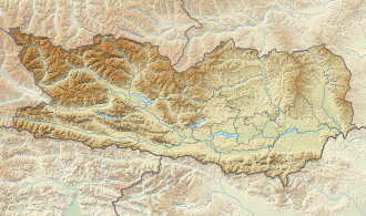
| Map (Carinthia) | |||
|
|
|||
| Coordinates | 46 ° 45 '16 " N , 14 ° 59' 11" E | ||
The Jauksattel is a 1611 m above sea level. A. high pass in the southern Koralm in Carinthia .
Location and landscape
The saddle is located south of the Großer Speikkogel ( 2140 m above sea level ), the highest mountain in the Koralm. The name comes from Slavic Jug , Carinthian / Styrian-Slovenian Jauk 'south', that's the name of the southern ridge of the Speikkogelstock. The Kleinalpl rises to the south ( 1759 m above sea level ).
The main ridge of the Styrian Randgebirge turns south-east on the Speikkogel to the Radlpass , and then heads east to the Possruck (Kozjak) . The Kleinalpl is somewhat exposed by the valleys of the Feistritz (Mučka Bistrica) , a tributary of the Drau (Drava) near Muta (Hohenmauthen) . In the international standardized orographic division of the Alps (SOIUSA / IVOEA), the Kleinalpl group (II / A-20.II.A.3) is therefore separated from the main Koralm group of the Speikkogel (A.2) on the Jauksattel. To the south the ridge leads to the Hühnerkogel (Košenjak) , the southern spur of the Koralpe.
The Bäreneckgraben flows westwards over the Ragglbach near Maria Rojach to Lavant . To the east below the Kreuzbach (in the upper course of the Krennbach) runs south over the Krumbach to Feistritz in the Soboth area .
The saddle belongs to the municipality of St. Georgen im Lavanttal . Neither the Jauksattel nor the Koralm main ridge are the state border here, this crosses between the valleys and leads over the Dreieckkogel ( 1528 m above sea level ), and follows old rulership borders .
Development and ways
From the Speikkogel southwards, the Carinthian border path , the Styrian state circular walk , the Jakobsweg and the Lavanttaler Höhenweg lead together . The former and the latter lead at the pilgrims' cross south of the pass west around the Kleinalpl summit towards the Soboth pass, the others south-east over the Dreieckkogel to the town of Soboth. The Koralpen crossing runs to the north . Otherwise the area is opened up with numerous forest roads.
The Koralm tunnel , which is currently under construction , will largely run directly under the saddle. With the culmination of its roof profile , it will be almost 1,300 meters below.
Individual evidence
- ↑ As in Yugoslavs 'South Slavs'; compare the wind Jauk , ' (south) foehn ': In western Styria, the downwind from the west over the Koralpe is called Jauk , it could also be specifically meant 'saddle over which the Jauk blows'.
- ↑ Jakobsweg West Styria: 8 stage from Jakobskirche Soboth to Lavamünd weitwanderwege.com - route description.
- ↑ Lavanttaler Höhenweg Soboth - Jauksattel :: Wolfsberg . freizeitkarte.at - route description of the stage.
- ↑ Crossing the Koralpen - West Styrian border mountains. Tour 187. In Günter Auferbauer: Eastern Alps . Volume 5 of the Alpine Club Ski Guide. Bergverlag Rother, 1987, ISBN 9783763352258 , p. 237 ff
