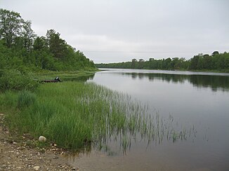
Kaamasjoki
| Kaamasjoki | ||
|
Kaamasjoki |
||
| Data | ||
| Water code | FI : 71.9 | |
| location | Lapland ( Finland ) | |
| River system | Paatsjoki | |
| Drain over | Kettujoki → Juutuanjoki → Paatsjoki → Barents Sea | |
| source | near the Norwegian border 69 ° 28 ′ 8 ″ N , 26 ° 26 ′ 29 ″ E |
|
| Source height | ~ 500 m | |
| muzzle | in Mutusjärvi coordinates: 69 ° 3 '30 " N , 27 ° 3' 21" E 69 ° 3 '30 " N , 27 ° 3' 21" E |
|
| Mouth height | 146.2 m | |
| Height difference | 353.8 m | |
| Bottom slope | 2.2 ‰ | |
| length | 161 km | |
| Catchment area | 1780 km² | |
| Left tributaries | Syysjoki | |
| Right tributaries | Kielajoki , Pieltojoki | |
| Flowing lakes | Vastusjärvi | |
The Kaamasjoki River is located in the Finnish part of Lapland .
The Kaamasjoki has its source near the Norwegian border in Lapland. It flows first in an easterly and south-easterly direction and then turns south and south-west. It takes in the tributaries Kielajoki , Pieltojoki and Syysjoki , flows through the lake Vastusjärvi and then flows into the Mutusjärvi . Kettujoki and Juutuanjoki form its continuation to Inarijärvi .
The Kaamasjoki is a popular, moderately difficult river for multi-day canoeing trips.
Web links
Individual evidence
- ↑ a b JÄRVIWIKI - Mutusjärvi (71.241.1.001)
