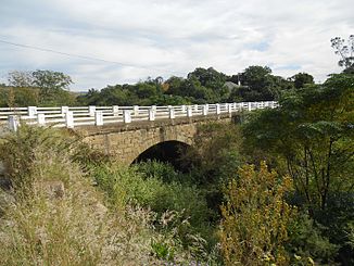
Kat River
|
Kat River Katrivier |
||
|
Victoria Bridge at Fort Beaufort |
||
| Data | ||
| location | South Africa | |
| River system | Great Fish River | |
| Drain over | Great Fish River → Indian Ocean | |
| source | Katrivier Dam 32 ° 34 ′ 30 ″ S , 26 ° 46 ′ 33 ″ E |
|
| Source height | 793 m | |
| muzzle | Great Fish River Coordinates: 32 ° 59 ′ 46 " S , 26 ° 47 ′ 5" E 32 ° 59 ′ 46 " S , 26 ° 47 ′ 5" E |
|
| Mouth height | 196 m | |
| Height difference | 597 m | |
| Bottom slope | 4 ‰ | |
| length | 150 km | |
| Catchment area | 1715 km² | |
| Left tributaries | Fairbairn River | |
| Reservoirs flowed through | Katrivier Dam | |
The Kat River ( Afrikaans : Katrivier ) is a river in the Eastern Cape Province of South Africa .
River course
The 150 kilometer long Kat River begins at the Katrivier Dam near Seymour . Several source rivers, including the Elands River, which has its source at Elandsberg , lead to the reservoir. A little downstream, the Fairbairns River flows into the Kat River. It rises on Katberg, which is one of the winter mountains . The Kat River flows south in large meanders , passes the towns of Blinkwater and Fort Beaufort and flows into the Great Fish River .
Today's meaning
The water of the Kat River is used for artificial irrigation of citrus plantations in the Kat River Valley as well as for drinking water supply to the cities of Seymour and Fort Beaufort.
history
In 1829 the authorities of the Cape Colony settled around 250 Khoikhoi and Coloreds in the Kat River valley in order to set up a buffer zone to the Xhosa . The settlers of the Kat River Settlement ran agriculture there, supported by missionaries , and were therefore no longer available as cheap labor for the Boers . After some of them fought against the Cape Colony in the border wars in the middle of the 19th century, they lost their property. The remaining settlers were driven out around 1900 through excessive credit and finally with the establishment of the Homeland Ciskei from 1961.
In 1969 the Katrivier Dam was built near Seymour. The dam consists of four arches and is around 50 meters high.
Web links
- Description of the use of the Kat River (English, PDF; 748 kB)
Individual evidence
- ↑ Description of the use of the Kat River ( Memento of the original from October 5, 2015 in the Internet Archive ) Info: The archive link was automatically inserted and not yet checked. Please check the original and archive link according to the instructions and then remove this notice. (English, PDF; 748 kB), accessed on July 17, 2013
- ↑ Timeline at sahistory.org.za , accessed on July 16, 2013
- ↑ Description of the film Kat River - The End of Hope ( Memento from July 17, 2013 in the web archive archive.today ), accessed on July 17, 2013
