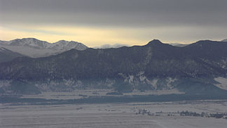
Katun comb
| Katun comb | ||
|---|---|---|
|
Tjungur and Kutscherla estuary in the foreground, Katun ridge in the background |
||
| Highest peak | Belucha ( 4506 m ) | |
| location |
Republic of Altai ( Russia ), East Kazakhstan ( Kazakhstan ) |
|
| part of | Russian Altai | |
|
|
||
| Coordinates | 49 ° 48 ′ N , 86 ° 20 ′ E | |
| rock | Slate , granite | |
|
Katun comb at Multa |
||
The Katun Ridge ( Russian Катунский хребет ) is a mountain range in the Russian Altai in the south of the Russian Republic of Altai on the border with Eastern Kazakhstan .
The Katun ridge forms the watershed between the Katun and Argut rivers and the Buchtarma tributary Belaja Berel . The mountain range extends over a length of 150 km in the east-west direction and reaches the Belukha with 4506 m its maximum height. In the southwest, west and northwest, the Katun ridge is surrounded by the upper reaches of the Katun. The Katun tributaries Akkem , Kutscherla and Multa arise on the northern flank of the mountain range.
Slate and granite are the predominant rocks. The central part of the mountain range is dominated by alpine mountain peaks with a total of 386 glaciers . The entire glacier area is 279 km². Larch and Swiss stone pine forests can be found up to heights of 2000 to 2200 m .
Web links
Individual evidence
- ↑ a b c Article Katun comb in the Great Soviet Encyclopedia (BSE) , 3rd edition 1969–1978 (Russian)


