Kutscherla
|
Kutscherla Кучерла, Кочурла |
||
|
Location of the Kutscherla in the catchment area of the Katun (orange) |
||
| Data | ||
| Water code | RU : 13010100312115100004103 | |
| location | Altai Republic ( Russia ) | |
| River system | If | |
| Drain over | Katun → Ob → Arctic Ocean | |
| source | Kutscherla Glacier on the Belucha 49 ° 46 ′ 46 ″ N , 86 ° 24 ′ 36 ″ E |
|
| muzzle | near the village of Kutscherla in the Katun coordinates: 50 ° 9 ′ 45 " N , 86 ° 20 ′ 14" E 50 ° 9 ′ 45 " N , 86 ° 20 ′ 14" E
|
|
| length | 50 km | |
| Catchment area | 635 km² | |
| Discharge at the Kutscherla A Eo gauge : 627 km² Location: 2 km above the estuary |
MQ 1963/2000 Mq 1963/2000 |
13.5 m³ / s 21.5 l / (s km²) |
| Flowing lakes | Kutscherla Lake | |
|
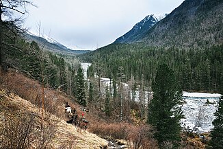
Water colored white by glacial milk |
||
|
At the lower reaches of the Kutscherla |
||
|
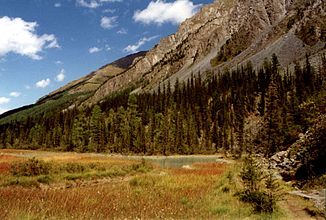
Kutscherla lake, view down the valley |
||
The Kutscherla ( Russian Кучерла ) is an approximately 50 km long right tributary of the Katun , the left and larger source river of the Ob in southwestern Siberia . It rises from the glacier of the same name on the northwest flank of the Katun mountain range in the Central Asian Altai Mountains . A special feature is the milky white water, which is created by adding fine rock flour - the so-called glacier milk.
Just like the neighboring Akkem Valley, which runs almost parallel to the east, the still green high valley in the lower reaches is an important access point to the Belucha ( 4506 m ), the highest peak in the Russian Altai .
The access begins on the lower reaches of the Katun near Gorno-Altaisk , the capital (and only city) of the Russian Autonomous Republic of Altai , or up the valley near Inja , where the Russian M52 highway leads towards Mongolia .
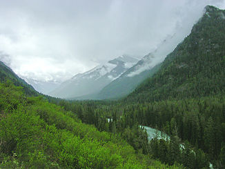
The valley of the Kutscherla runs mainly in a south-north direction. Coming from below, where the Kutscherla flows into the Katun with an alluvial cone , it is covered with diverse vegetation and its slopes are forested. The ascent begins at a height of around 900 m on the edge of the Uimon steppe . After 35 km you come to Lake Kutscherla ( 1786 m ) ( ⊙ ), the lower bank of which is suitable for a mountaineering camp. A little higher, a narrow path leads over a gap into the neighboring Akkem valley to the east . At the top, the Kutscherlatal is closed by a moraine landscape of the glacier that covers the western flank of the Belucha.
Web links
Individual evidence
- ↑ a b Kutscherla in the State Water Directory of the Russian Federation (Russian)
- ↑ Kutscherla at the Kutscherla gauge - hydrographic data from R-ArcticNET


