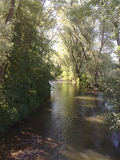
Little Danube (Ilm)
| Little Danube | ||
|
The Little Danube in Vohburg |
||
| Data | ||
| Water code | EN : 1352 | |
| location |
Bavaria, district of Pfaffenhofen an der Ilm, district of Eichstätt |
|
| River system | Danube | |
| Drain over | Danube → Black Sea | |
| origin | The confluence of the left Wellenbach and the right Ilm flood channel on the southern edge of Vohburg an der Donau 48 ° 45 ′ 35 ″ N , 11 ° 36 ′ 48 ″ E |
|
| Source height | below 356 m above sea level NN | |
| muzzle | Before the Danube bridge to Pförring over from the right into the Danube Coordinates: 48 ° 47 '38 " N , 11 ° 41' 27" E 48 ° 47 '38 " N , 11 ° 41' 27" E |
|
| Mouth height | below 352 m above sea level NN | |
| Height difference | 4 m | |
| Bottom slope | 0.14 ‰ | |
| length | 28.6 km from Moosgraben – Wellenbach – Kleine Donau |
|
| Catchment area | 109.21 km² from Moosgraben – Wellenbach – Kleine Donau |
|
| Small towns | Vohburg on the Danube | |
| Communities | Münchsmünster , Pförring | |
The Little Danube is a floodplain watercourse in the right river level of the Danube at and below Vohburg an der Donau and the lower course for part of the water of the Ilm. After a run of over 28 km on the main line, including over 7 km of the lower course on the name section, it flows into the Danube from the right across from Pförring in the Eichstätt district in Upper Bavaria .
course
Headwaters
The main line of the Little Danube is being built under the name Moosbach a little southeast of the parish village Hög (Markt Reichertshofen ) in the forest next to the Munich-Nuremberg railway line . After an arc to the west, the stream runs approximately north-northeast, at last under the name Wellenbach , where it then converges on the southern outskirts of Vohburg an der Donau in the right floodplain with the Ilm flood canal coming from the south, thus creating the Little Danube .
The Ilm is divided into three arms a little above at the so-called “lock” (see there). The right arm flows under the old name with the remaining water to the east in the direction of Oberwöhr / Münchsmünster. The middle arm leads almost half a kilometer north to Neumühle, where it joins the left arm, the Ilm flood canal. A little over half a kilometer more, this canal, which continues northwards, flows together with the left wave brook to form the Little Danube.
Name underflow
The Little Danube then strives on its course near the river in the right flood plain roughly northeast at an acute angle to the Danube, into which it flows 7.2 km below its confluence, just before the Danube bridge to Pförring , from the right.
history
The Little Danube used to be a small southern tributary of the Danube . It flowed in the south past the castle hill of Vohburg, the main arm in the north, with which the castle was on an island in the Danube. Today there is no longer any inflow from the Danube, but the floodplain feeds itself from the above-mentioned upper courses. The Little Danube originally flowed into the Danube just below Vohburg and across from Dünzing. The estuary was then relocated further and further downstream several times for flood protection.
particularities
Because the floods of the Ilm are almost completely diverted into the Little Danube via the dividing weir on the Neumühle, the water level in this area fluctuates violently and swells particularly after prolonged rainfall and when the snow melts . In order to largely protect the city from floods in the future, flood protection measures have been taken in recent years .
Individual evidence
- ↑ a b Height according to the contour diagram on the BayernAtlas. See the → web links .
- ↑ a b c d According to the list of brook and river areas in Bavaria - Lech to Naab river area . See the → web links .
Web links
- Course of the Little Danube on the BayernAtlas.
- Directory of brook and river areas in Bavaria - Lech to Naab river area (PDF; 2.8 MB)
