
Little head
| Little head | ||
|---|---|---|
 View from the Bergbaude Schronisko Dom Śląski (Schlesierhaus) north to the Kleine Koppe |
||
| height | 1377.4 m npm | |
| location | near Karpacz ; Lower Silesian Voivodeship ( Poland ) | |
| Mountains | Giant Mountains ( Sudetes ) | |
| Coordinates | 50 ° 44 '47 " N , 15 ° 43' 48" E | |
|
||
| rock | granite | |


The Little Koppe (Polish Kopa ) is a 1377.4 m npm high spur of the Równia pod Śnieżką (Koppenplan) plateau on the Polish side of the Giant Mountains , part of the Sudetes . It is located near Karpacz (Krummhübel) in the Lower Silesian Voivodeship in the north-north-west neighborhood of Schneekoppe ( 1603.2 m ), which rises on the Czech border .
geography
location
The Little Koppe is located in the central part of the Giant Mountains on the northern slope of its main ridge - on the Východní Slezský hřbet (Eastern Silesian Ridge) . To the north-northeast, the landscape of the spur located in the Karkonoski Park Narodowy (Giant Mountains National Park) falls into the Polish town of Karpacz (Krummhübel) . The border to the Czech region of Královéhradecký with the town of Pec pod Sněžkou (Petzer) runs almost 800 m south of the peak of the spur .
The Łomnica (Great Lomnica) rises southwest of the spur on the Koppenplan . While its upper course near the source separates the spur from the 1.3 km south-southeast towering Schneekoppe, the Łomnica flows through Karpacz, and it flows into the Bóbr (Bober) .
The neighboring mountains on the Czech-Polish border include the Schneekoppe, the Czarna kopa ( 1410.6 m ; German Black Koppe ; pol. Svorová hora ) in the east-southeast and the Smogornia ( 1488.6 m ; German Mittagsberg ; Tsch. Stříbrný hřbet ) in the west-northwest.
Nearby peaks
| Turek | ||
| White meadow |
.svg)
|
Black head |
| Studniční hora | Schneekoppe |
Flora, fauna and nature conservation
The upper areas of the spur are overgrown by mountain pines . On the slopes below there is a mountain coniferous forest , which consists mainly of spruce.
In areas of tourist use, the location is problematic for plants and animals. Therefore, the Polish Karkonoski Park Narodowy was founded in 1959 in order to preserve selected areas of the Giant Mountains. The marked paths must not be left.
tourism
After the Second World War , the area began to be developed for tourism. In 1959 the first chairlift was built - the 2229 m long Zbyszek . From the valley station (approx. 815 m ) near the south-western outskirts of Karpacz to the mountain station (approx. 1350 m ) around 230 m northwest of the Sporn summit, the lift overcomes an altitude difference of around 535 m.
Although there are now six more, much more modern lifts, this 1-seater chairlift is still valued by hikers, in the summer from the mountain station, past the Schronisko Dom Śląski ( Silesian House ; approx. 1400 m ), the way shorten up to the Schneekoppen summit.
In winter, the ski slopes of the Polish ski area Kopa begin at the height of the mountain station , which, together with the slopes around 1.6 km west-northwest of the Sporn summit near the Mały Staw (small pond) , is the Schronisko Strzecha Akademicka ( Hampelbaude ; approx. 1258 m ) is one of the twelve most important in Poland and, despite its small size, is popular with the majority of Polish guests; at Mały Staw there is the Samotnia mountain hut ( pond hut ; approx. 1195 m ).
gallery
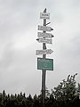
Sign tree ( 1342 m ); not at the spur summit

Schronisko Dom Śląski (Silesian House)

Schronisko Strzecha Akademicka (Hampelbaude)


Individual evidence
- ↑ a b c Geoportal 2 , on geoportal.gov.pl