Koblewe
| Koblewe | ||
| Коблеве | ||

|
|
|
| Basic data | ||
|---|---|---|
| Oblast : | Mykolaiv Oblast | |
| Rajon : | Berezanka district | |
| Height : | 26 m | |
| Area : | 14.54 km² | |
| Residents : | 2,385 (2004) | |
| Population density : | 164 inhabitants per km² | |
| Postcodes : | 57456 | |
| Area code : | +380 5153 | |
| Geographic location : | 46 ° 40 ' N , 31 ° 12' E | |
| KOATUU : | 4820982201 | |
| Administrative structure : | 3 villages | |
| Address: | вул. Одеська 4 57453 с. Коблеве |
|
| Statistical information | ||
|
|
||
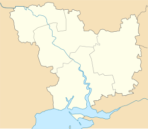
Koblewe ( Ukrainian Коблеве ; Russian Коблево Koblewo ) is a village in the extreme southwest of the Ukrainian Oblast Mykolaiv with about 2300 inhabitants (2004).
The village, founded in 1850, was originally called Troitske ( Троіцьке ) and forms its own district council within the Berezanka district on the border with Odessa Oblast , which also includes the villages of Leninka (Ленінка) and Morske (Морське).
Koblewe lies at Tylihul Estuary to the east and the coast of the Black Sea in the south 30 km southwest of Rajonzentrum Beresanka , 80 km south-west of Oblastzentrum Mykolaiv and 55 km northeast of Odessa . The M 14 / E 58 road runs through the village . There are vineyards around the village and wine and brandy are produced in the village.
Web links
Individual evidence
- ↑ Koblewe on the official website of the Verkhovna Rada , last accessed on April 19, 2015


