Koettlitz glacier
| Koettlitz glacier | ||
|---|---|---|
|
Satellite image of the Koettlitz Glacier (center left) |
||
| location | Victoria Land , East Antarctica | |
| Mountains | Royal Society Range , Transantarctic Mountains | |
| length | 60 km | |
| Coordinates | 78 ° 15 ′ S , 164 ° 15 ′ E | |
|
|
||
| drainage | McMurdo Sound | |
|
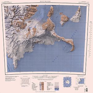
KOETTLITZ GLACIER in the northwest of the map sheet |
||
The Koettlitz Glacier is a 60 km long glacier west of the volcanoes Mount Discovery and Mount Morning in East Antarctic Victoria Land . In the Royal Society Range, it flows northeast from the vicinity of Mount Cock between the Brown Peninsula and the mainland to McMurdo Sound .
The glacier was discovered during the Discovery Expedition (1901-1904) under the direction of the British polar explorer Robert Falcon Scott and named after Reginald Koettlitz (1861-1916), the doctor and botanist on this expedition.
Web links
- Koettlitz Glacier in the Geographic Names Information System of the United States Geological Survey (English)
- Koettlitz Glacier on geographic.org (English)


