Kolvenderbach
| Kolvenderbach | ||
|
|
||
| Data | ||
| location | Liege Province ; Wallonia ; Belgium | |
| River system | Rhine | |
| Drain over | Our → Sauer → Moselle → Rhine → North Sea | |
| source | northeast of the Schürbusch 50 ° 21 '42 " N , 6 ° 17' 25" O |
|
| Source height | approx. 625 m | |
| muzzle | northeast of Sankt Vith -Andler in the Our coordinates: 50 ° 18 ′ 33 ″ N , 6 ° 17 ′ 7 ″ E 50 ° 18 ′ 33 ″ N , 6 ° 17 ′ 7 ″ E |
|
| Mouth height | approx. 440 m | |
| Height difference | approx. 185 m | |
| Bottom slope | approx. 21 ‰ | |
| length | approx. 8.7 km | |
The Kolvenderbach is an approximately 8.7 km long right and northern tributary of the Our in Belgium .
course
The Kolvenderbach rises in a forest area northeast of the Schürbusch . It flows around the Schürbusch in a large arc and then flows past the Köscheberg on the left . Shortly afterwards it is fed by the Köscheborn . Its direction of flow is essentially south-facing. It flows around the Wendelberg from the east and is then reinforced by the Wendelwasser and, after flowing past the Klausbusch , by the Ottenbach . At the Herresbacher Mühle he leaves the forest area. There the Durstborn flows to him . At the Andlermühle it finally flows into the Our about 50 m after the Medemberbach .
biosphere
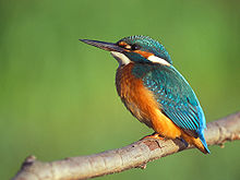
The Kolvederbachtal is part of a nature reserve . In its forests, meadows and floodplains, there is a rich biodiversity of animals and plants typical of this part of the High Ardennes. The clear water of the creek is the ideal environment for trout , the bank of the creek is lined alder and on the surrounding wetlands and pastures grow Bistort , Bärwurz , bristle grasses and various Geißkleearten . Black stork , kingfisher and dipper can be found in the bank area and in the nearby floodplains, and badgers and wild cats in the forests .
Tributaries
- Köscheborn ( right )
- Wendelwasser ( right )
- Ottenbach ( right )
- Durstborn ( left )
Web links
Individual evidence
- ↑ a b Géoportail de la Wallonie , Service public de Wallonie (SPW) ( notes )
