Krötenbach (Näßlichbach)
| Toad stream | ||
|
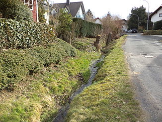
The toad stream in Horbach |
||
| Data | ||
| location |
Spessart
|
|
| River system | Rhine | |
| Drain over | Näßlichbach → Kinzig → Main → Rhine → North Sea | |
| source | south of Waldrode 50 ° 8 ′ 41 ″ N , 9 ° 11 ′ 43 ″ E |
|
| Source height | 300 m above sea level NHN | |
| muzzle | in Horbach in den Näßlichbach Coordinates: 50 ° 8 ′ 21 ″ N , 9 ° 9 ′ 40 ″ E 50 ° 8 ′ 21 ″ N , 9 ° 9 ′ 40 ″ E |
|
| Mouth height | 190 m above sea level NHN | |
| Height difference | 110 m | |
| Bottom slope | 33 ‰ | |
| length | 3.3 km | |
| Catchment area | 2.2 km² | |
The Krötenbach is a right tributary of the Näßlichbach in the Main-Kinzig district in the Hessian Spessart .
geography
course
The Krötenbach rises south of Waldrode on the Junkernberg (326 m). It initially runs in a northerly direction, then bends to the northwest at Waldrode and flows through the toad pond . The Krötenbach runs from there southwest to Horbach , where it flows into the Näßlichbach .
Tributaries
- Acid reason ( right )
Kinzig river system
See also
Web links
Commons : Krötenbach - Collection of images, videos and audio files
Individual evidence
- ↑ a b c Hessenviewer (Geoportal Hessen) of the Hessian State Office for Soil Management and Geoinformation with property mapping ( notes )
- ↑ Water map service of the Hessian Ministry for the Environment, Climate Protection, Agriculture and Consumer Protection ( information )
- ↑ Streams of Freigericht
