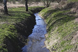
Krümmelbach
| Krümmelbach | ||
|
The Krümmelbach near Wirges |
||
| Data | ||
| Water code | DE : 2589414 | |
| location |
Westerwald
|
|
| River system | Rhine | |
| Drain over | Aubach → Gelbach → Lahn → Rhine → North Sea | |
| source | on the edge of the Silbersee near Wirges 50 ° 28 ′ 29 ″ N , 7 ° 47 ′ 12 ″ E |
|
| Source height | 282 m | |
| muzzle | in Staudt from the right and west-northwest in the Aubach Coordinates: 50 ° 27 ′ 56 " N , 7 ° 49 ′ 31" E 50 ° 27 ′ 56 " N , 7 ° 49 ′ 31" E |
|
| Mouth height | 253 m | |
| Height difference | 29 m | |
| Bottom slope | 8.8 ‰ | |
| length | 3.3 km | |
| Catchment area | 12.6 km² | |
The Krümmelbach is a 3 km long brook and a west-north-west and right tributary of the Aubach in the Westerwald .
geography
course
The Krümmelbach rises at an altitude of about 282 m above sea level. NHN on the edge of the Silbersee near Wirges . It flows in an east-southeast direction through Wirges and finally flows into neighboring Staudt at an altitude of about 253 m above sea level. NHN from the right into the Aubach .
Its approximately 3.3 km long run ends about 29 meters below its source, so it has a mean bottom gradient of about 8.8 ‰.
Tributaries
- Kleiner Krümmelbach ( left ), 0.8 km
- Schwarzbach ( left ), 3.8 km
- Krambach ( left ), 2.3 km
nature and environment
The crumbs Bach is like Schwarzenbach low not dirty up by sound. In earlier samples, however, the value for ammonium - nitrogen (NH 4 -N) was classified as high and the phosphorus load as very high. In crumbs stream can often be brown trout surveys. In addition, a weir with a dam was built near Staudt to prevent flooding, such as in 1978, when major damage occurred. The floodplain between Staudt and Wirges is used as a flood basin.
Web links
Individual evidence
- ↑ ( Page no longer available , search in web archives: Quality report 2000 - Water quality report for flowing waters in Rhineland-Palatinate )
