Krainke
| Krainke | ||
|
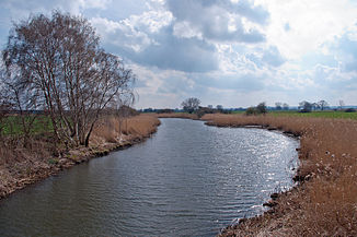
Krainke west of Stapel, viewed upstream |
||
| Data | ||
| Water code | DE : 59366 | |
| location | West Mecklenburg, East Lower Saxony ( Neuhaus Office ) | |
| River system | Elbe | |
| Drain over | Sude → Elbe → North Sea | |
| Junction | west of Woosmer from the Rögnitz 53 ° 12 ′ 7 ″ N , 11 ° 9 ′ 5 ″ E |
|
| Source height | approx. 13.5 m above sea level NN | |
| muzzle | southeast of possession in the Sude coordinates: 53 ° 20 ′ 8 " N , 10 ° 52 ′ 49" E 53 ° 20 ′ 8 " N , 10 ° 52 ′ 49" E |
|
| Mouth height | 7 m above sea level NN | |
| Height difference | approx. 6.5 m | |
| Bottom slope | approx. 0.19 ‰ | |
| length | 34.5 km | |
| Catchment area | 130 km² | |
| Communities | Neuhaus Office | |
The Krainke is a 35 kilometer long branch of the Rögnitz and tributary of the Sude in northern Germany.
It branches off to the left of the Rögnitz in the municipality of Vielank in the west of the Schlonsberge settlement belonging to the Woosmer district and initially flows in a south-westerly direction, crossing the border between Mecklenburg-Western Pomerania and Lower Saxony. In the municipality of Amt Neuhaus , the Krainke makes an elongated curve from Tripkau in a north-westerly direction, there runs parallel to the Elbe and the federal highway 195 through the Lower Saxony Elbe Valley Biosphere Reserve . Numerous drainage ditches flow to the water on their way and the Stixer See and Zeetz See are flowed through. There are also further lake-like expansions. A few meters after the re-crossing the border opens the Krainke southeast of possession in the brews.
In 1990 the Krainke was designated as a nature reserve with the name Krainke from the source to the mouth of the Sude in its entire course, including the 50-meter-wide shoreline, by a resolution of the Schwerin District Assembly .
Web links
Individual evidence
- ^ Map portal Environment Mecklenburg-Western Pomerania : Running waters → Courses of water and routes GWK stations ; Catchment areas → EZG ; Geospatial base data → topographic maps
