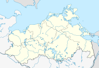
Krainke nature reserve from the source to the mouth of the Sude
Coordinates: 53 ° 19 '34.9 " N , 10 ° 53' 4.3" E
The nature reserve Krainke from the source to confluence with the brews was a 22 hectare wide nature reserve in Mecklenburg-Vorpommern (from 1993 mostly in Lower Saxony ), two kilometers east of the town property . It was placed under protection on May 15, 1990 with the aim of preserving part of the Krainke River with adjacent areas.
The nature reserve was in the Mecklenburg Elbe Valley Nature Park .
Today, the Mecklenburg part is located in the UNESCO - Biosphere Reserve Riverine Landscape Elbe-Mecklenburg-Vorpommern . With the passing of the "Law on the Biosphere Reserve River Landscape of the Elbe Mecklenburg-Western Pomerania" on January 15, 2015, the large protected area was divided into core, maintenance and development zones in order to implement the national criteria for the recognition and review of UNESCO biosphere reserves in Germany (Section 6 BRElbeG MV). At the same time, with Article 7 of the law "Repeal of legal provisions", the national protected area ordinances and resolutions etc. a. to landscape and nature reserves as well as to the nature park "Mecklenburgisches Elbetal", so that these protected area categories no longer exist within the biosphere reserve. The areas of the nature reserve have been given the status of maintenance zone in the Elbe-Mecklenburg-Western Pomerania River Landscape Biosphere Reserve.
The Lower Saxony part has merged into the Lower Saxony Elbe Valley Biosphere Reserve .
literature
- Krainke from source to mouth in the Sude 159 . In: Ministry of Environment Mecklenburg-Western Pomerania (Hrsg.): The nature reserves in Mecklenburg-Western Pomerania . Demmler-Verlag, Schwerin 2003, ISBN 3-910150-52-7 , p. 672 f .


