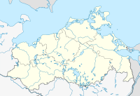
The Großer and Kleiner Serrahn nature reserve
Coordinates: 53 ° 34 '35 " N , 12 ° 10' 8.7" E
The Großer and Kleiner Serrahn nature reserve is a 722 hectare nature reserve in Mecklenburg-Western Pomerania north of the villages of Wendisch Waren and Neu Poserin and east of Sandhof. It serves to protect and preserve a moor landscape that emerged from two silted-up lakes - the Kleiner Serrahn in the northern part of the area and the Großer Serrahn to the south. The area designated on September 24, 1990 is traversed by a network of ditches, which drains the areas westwards in the direction of Lake Goldberg, one kilometer away .
The state of the area is assessed as good because it is a growing bog.
The protected area is located in the Nossentiner-Schwinzer Heide nature park and is part of an FFH and bird protection area under EU law .
With the exception of a path from Wendisch-Waren that leads along a pasture, the protected area is not accessible. A lookout tower at Sandhof provides a glimpse into the areas.
History and water balance
The areas of the protected area are located on the southern edge of an ice age sand . The two lakes go back to dead ice forms , as do the surrounding Goldberger and Damerower lakes . Calcareous groundwater led to the deposition of up to 8 meters powerful deposits of lime mudde and lake marl . The lakes silted up over time. A rampart on the east bank of the Langhagensee lake, two kilometers to the north, indicates that the area was settled in the Slav period. At the southeast end of the Großer Serrahn a water mill was operated in the Middle Ages . The Wiebeking's map from 1786 shows the Great Serrahn nor as lake in extension of today's ring trench. Peripheral dry areas were already subject to meadow and pasture use. At that time, the Kleine Serrahn consisted of two smaller bodies of water. In the years 1853 to 1857 the lake was completely drained when the water level of the Goldberger See dropped by 1.2 meters. Furthermore, the Mildenitz river was expanded as a canal. Further ditches for drainage were created in order to use the dry land as grassland. A wind-driven pumping station supported this process. The drainage was stopped in 1997. The areas of today's protected area have been a restricted military area since 1962.
Since the summer of 2009, nature conservation-appropriate grazing has been taking place in the nature reserve with water buffalo that were bought by the nature park's association.
Flora and fauna
The silting area in the central part has reeds and reeds . Typical species are bulrush , beaked sedge , pond sedge , nightshade and reed . To the south there are swamp forests.
Wet meadows with sedges and rushes can be found in the area of the Kleiner Serrah, which has a spring moor. The northern boundary is formed by an alder forest with meadows of oats and meadow foxtail .
Breeding birds are the reed warbler , crane , common snipe , whinchat and red-backed killer . Several hen harriers use the Großer Serrahn as a winter resting place. The otter lives in the area.
literature
- Big and Small Serrahn 197 . In: Ministry of Environment Mecklenburg-Western Pomerania (Hrsg.): The nature reserves in Mecklenburg-Western Pomerania . Demmler-Verlag, Schwerin 2003, ISBN 3-910150-52-7 , p. 528 f .
cards
- Wiebeking map of Mecklenburg, 1786.
- Economic map of the Dobbertin Forestry Office 1927/1928.
- Official cycling and hiking map of the Nossentiner / Schwinzer Heide nature park, 2010.
Web links
- Map portal environment of the State Office for the Environment, Nature Conservation and Geology Mecklenburg-Western Pomerania ( information ) with geodata
- Photo from the nature reserve
Individual evidence
- ↑ Standard data sheet FFH area Mildenitztal with tributaries and connected lakes (PDF; 60 kB)
- ↑ Standard data sheet for the EU bird sanctuary Nossentiner-Schwinzer Heide
- ↑ Burgwall Sandhof in the KLEKs
- ^ Poseriner mill in the KLEKs
- ↑ Playful, exotic and frugal. - Article of December 4, 2009 in the Schweriner Volkszeitung on grazing with water buffalo.
- ↑ Biotope arch The Great Serrahn (PDF; 27 kB)
- ↑ Biotope arch quarry forest complex in the southwest of the Großer Serrahn (PDF; 18 kB)
- ↑ Biotope arch quarry forest complex in the south of the Großer Serrahn (PDF; 21 kB)
- ↑ Biotope arch quarry forest complex in the southeast of the Großer Serrahn (PDF; 19 kB)
- ↑ Biotope arches wet meadows rich in sedge and rushes, reed stands and reeds (PDF; 27 kB)
- ↑ Erlenbruch biotope arch in the north of the Kleiner Serrahn (PDF; 24 kB)


