Paschensee nature reserve
|
Paschensee nature reserve
|
||
|
West bank of the Paschensee in the NSG (2015) |
||
| location | Neu Poserin and Plau am See , Mecklenburg-Western Pomerania , Germany | |
| surface | 228 hectares | |
| Identifier | NSG N 120 | |
| WDPA ID | 164978 | |
| Natura 2000 ID |
(FFH), DE-2339-402 (SPA) DE-2439-304 (FFH), DE-2339-402 (SPA) |
|
| FFH area | 228 hectares | |
| Bird sanctuary | 228 hectares | |
| Geographical location | 53 ° 35 ' N , 12 ° 14' E | |
|
|
||
| Setup date | 1982 | |
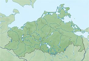
The Paschensee nature reserve is located in the communities of Neu Poserin and Plau am See in the Ludwigslust-Parchim district in Mecklenburg-Western Pomerania . The 228 hectare nature reserve (NSG identification N 120) is located in the Nossentiner / Schwinzer Heide nature park east of the Neu Poseriner village of Wooster Teerofen. With the designation on March 22, 1982, the drainless, mesotrophic limestone Paschensee with adjacent forest areas is to be protected. An area downsizing was made in 1996.
The state of the area is rated as satisfactory. Low annual rainfall in recent years has caused the lake area to shrink and lead to the drying up of the swamp moors on the south and north-east shores with the resulting nutrient input into the lake. The former forest pastures are kept open through maintenance measures with goats and sheep.
The area of the nature reserve is also in the FFH area Paschen-, Langhagen- and Validzsee (identification DE-2439-304) and in the European bird sanctuary Nossentiner / Schwinzer Heide (DE-2339-402). As a result, the area around Lake Paschensee is part of the European Natura 2000 network of protected areas .
There are several ways to enter the area. Bathing and fishing is prohibited.
history
The lake, which is 15 meters deep today, was created as a form of dead ice during the last ice age . It is embedded in a sander landscape that looms over the lake and extends into the underlying moraine of the Frankfurt ice advances.
Human use has been documented in the area since the Slav period. A Slavic castle was on the west bank of the Langhagensee , two kilometers to the west. There was the former Slavic village of Pajow until the Thirty Years War. The Paschensee was called Pajower See at that time. The surrounding areas were cultivated and were free from forests. During the war the village became a desert and pioneer forest settled around the Paschensee. The west bank was still used as forest pasture in the following decades, as indicated by juniper and common oak . The Schmettauschen map from 1794 shows a forest to the south of the lake and a heather area to the west. There were newly afforested areas to the east. Systematic forest management was introduced by the forest management of Dobbertin Monastery at the beginning of the 19th century . Until 1945 the fen areas were used as fields and meadows. In the 1930s, carp and eels were introduced into the lake. The fishing ended in 1985 when the lake was fished.
Flora and fauna
The nutrient-poor, acidic environment leads to an adapted flora and fauna. The lake is largely free of underwater vegetation. Smaller stocks of white water lily , floating pondweed , knotweed and whorled thousand-leaf exist only near the shore . Reeds and common swamp rush grow in the bank area. Schneideried can be found on bare beach sand. Except for the west bank, the lake is surrounded by mesotrophic-acid swamp moors with peat moss , sedges and cotton grass . Sundew occurs. Edges made of alder, birch and pine run around the lake.
The otter lives in the area, continues to bats as Noctule , Natterer , Rauhaut- and Daubenton's bat .
literature
- Paschensee 120 . In: Ministry of Environment Mecklenburg-Western Pomerania (Hrsg.): The nature reserves in Mecklenburg-Western Pomerania . Demmler-Verlag, Schwerin 2003, ISBN 3-910150-52-7 , p. 540 f .
Web links
- NSG regulation
- Area presentation in the state portal MV
- Map portal Umwelt MV with geodata (protected area borders, biotope mapping, etc.)
Individual evidence
- ↑ Heidepflegefonds - Funded Measures 2006 ( Memento of the original from March 12, 2005 in the Internet Archive ) Info: The archive link was inserted automatically and has not yet been checked. Please check the original and archive link according to the instructions and then remove this notice.
- ↑ Standard data sheet FFH area Paschen-, Langhagen- and Validzsee (PDF; 57 kB)
- ↑ Standard data sheet EU bird sanctuary Nossentiner-Schwinzer Heide (PDF; 101 kB)
- ↑ Burgwall Sandhof in the KLEKs
- ↑ Biotope arch moor at the southern tip of the Paschensee (PDF; 20 kB) for more see map portal environment


