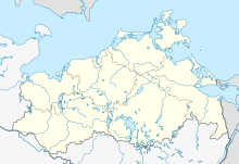
Jellen nature reserve
Coordinates: 53 ° 38 ′ 7 ″ N , 12 ° 11 ′ 30 ″ E
The Jellen nature reserve is a nature reserve in Mecklenburg-Western Pomerania five kilometers southwest of the city of Krakow am See and 3 kilometers northeast of the village of Jellen . It was placed under protection in 1957 as a natural forest cell with an extension in 1961. Currently, an area of 24 hectares is covered with the aim of protecting the development of a 200-year-old pine forest with interspersed juniper groups . The nature reserve is located in the Nossentiner / Schwinzer Heide nature reserve .
The state of the area is satisfactory. Light spots are created by wind throws, which can subsequently result in deciduous tree species immigrating. However, due to the high density of hoofed game, there is hardly any sustainable natural regeneration , so that the populations have the character of a hut forest in places .
The pine forest grows on nutrient-poor sand areas with raw humus , which arose in the Pomeranian stage of the last ice age.
Usage history
A settlement established by the Slavs has been documented as Jellen since 1369. Although the monastery had a claim to the land around Jellen as early as 1227, the meager sandy soil may have prevented expansion as a monastery area for the time being. Jellen was not finally transferred to the Dobbertin Monastery until 1455 and the pine tree expanded spontaneously. At the time of the Thirty Years' War , Jellen was hit by great war ruin in 1633 and in 1640 was completely desolate .
It was not until after 1700 that an independent farm with an administrator was set up in Jellen as Meyerey, also known as the sheep farm. On Wiebeking's map from 1786, the area is still unforested, but is no longer listed as arable land. Eight years later, the Schmettauschen map from 1794 already shows pine trees on which today's tree population is based. The poor, sandy arable land was cleared for afforestation by the monastery office. The field mark around Jellen was now administered by the Schwinz forest farm, which belonged to the Dobbertiner monastery forest office.
The areas were also used as forest pastures for cattle during these times. The common juniper, which is protected against browsing by domestic animals, was able to develop well under the old pine trees, as the remains of today's juniper population attest.
During the GDR era , the pines were used for resin extraction, a six-hectare part of the area was cleared and reforested with pines.
Flora and fauna
The floor is covered with wrought iron , red fescue and resin bedstraw . Are in the area of breeding birds Eurasian Hobby , black woodpecker , stock dove (Columba oenas), red-backed shrike , turncoat , eagles , ravens and many Meis species detected. Can continue bat species as the noctule (Nyctalus noctula) which Pipistrelle (Pipistrellus nathussii) and the brown long-ear observed. They use the abundance of caves in the old pines for breeding or as quarters for rearing the young.
literature
- Volker Beiche / Walter Kintzel: In nature conservation work in Mecklenburg-Western Pomerania. Protected trees in the Parchim district. Güstrow 2009, issue 1, p. 28.
- Mecklenburg-Western Pomerania Ministry of the Environment (publisher): Jellen 40 nature reserve . In: The nature reserves in Mecklenburg-Western Pomerania . Demmler-Verlag, Schwerin 2003, p. 532 f.
- Ralf Koch: Securing natural monuments in the Nossentiner / Schwinzer Heide nature park. Development of a concept, Woosten 2010. (unpublished master's thesis) 153 pp.
swell
Printed sources
- Mecklenburg record book (MUB)
Unprinted sources
-
State Main Archive Schwerin (LHAS)
- LHAS 5.12-4 / 2 Mecklenburg Ministry of Agriculture, Domains and Forests.
cards
- Topographical, economic and military chart of the Duchy of Mecklenburg-Schwerin 1758 Dobbertin monastery office with the Sandpropstei of Count Schmettau.
- Economic map of the Dobbertin Forestry Office 1927/1928.
- Official cycling and hiking map of the Nossentiner / Schwinzer Heide Nature Park 2010.
Web links
- NSG regulation
- Map portal environment of the State Office for the Environment, Nature Conservation and Geology Mecklenburg-Western Pomerania ( information ) with geodata


