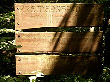
Kremershammer
|
Kremershammer
City of Wuppertal
Coordinates: 51 ° 12 ′ 40 ″ N , 7 ° 6 ′ 33 ″ E
|
||
|---|---|---|
| Height : | 123 m above sea level NN | |
|
Location of Kremershammer in Wuppertal |
||
|
The hammer desert
|
||
The Kremershammer is an abandoned hammer mill in the Bergisch city of Wuppertal . The Hammerwüstung , the Obergraben and the Hammerteich were placed under protection as a ground monument in March 2006 .
Location and description
The Kremershammer was located on the lower reaches of the Burgholzbach near the mouth of the Wupper in the Burgholz State Forest . The Hammerwüstung is located in the Küllenhahn residential area of the Cronenberg district at 123 meters above sea level at the foot of the Burggrafenberg .
State road 74 leads directly past the ground monument . The neighboring third grinding cone on the Wupper has also left. On the other side of the Wupper in the Solingen urban area, connected by the so-called Devil's Bridge, is the neighboring Friedenstal residential area .
history
The Kremershammer was founded in 1607 by a Peter Eschbach from Schwabhausen near Cronenberg. The hammer is marked on the Topographia Ducatus Montani by Erich Philipp Ploennies from 1715, the topographical survey of the Rhineland from 1824 and on the Prussian first photo from 1840.
In the municipality lexicon for the Rhineland province from 1888, a house is given.
Individual evidence
- ^ Royal Statistical Bureau (Prussia) (Ed.): Community encyclopedia for the Rhineland province. Based on the materials from the census of December 1, 1885 and other official sources (= community encyclopedia for the Kingdom of Prussia. Vol. 12, ZDB -ID 1046036-6 ). Publishing house of the Royal Statistical Bureau, Berlin 1888.


