
Burgholz State Forest
The Burgholz state forest is a forest area in the Wuppertal and Solingen urban areas in the Bergisches Land low mountain range in North Rhine-Westphalia ( Germany ). It is known for its nationwide unique arboretum in which forest science studies are carried out.
| Detailed map | Situation map |
|---|---|

|

|
| Basic data | |
| State : | North Rhine-Westphalia |
| Administrative region : | Dusseldorf |
| Cities : | Wuppertal , Solingen |
| State Forest and Wood Agency NRW: | Regional Forestry Office Rhein-Sieg-Erft |
| Forestry District: | Grossgrimberg |
| Sovereign responsibility: | Regional forest office Bergisches Land |
| Geographic location : | 51 ° 13 ′ 0 ″ N , 7 ° 7 ′ 0 ″ E |
| Height : | 120– 304 m above sea level NHN |
| Area : | approx. 540 ha |
| Arboretum area : | approx. 200 ha |
| image | |

|
|
Geography and location
location

The national forest Burg timber is for the most part on the city of Wuppertal on the border of Solingen, which is associated in the southwest a smaller part. In the north, the forest is bounded by the Wuppertal districts and districts of Vohwinkel , Sonnborn and Elberfeld ; in the east and southeast, Cronenberg with the main town and the districts of Küllenhahn , Hahnerberg and Cronenfeld encompasses the area; in the south lies the Cronenberg district of Kohlfurth and to the west the Solingen district Graefrath . The topography ranges from 120 m above sea level. NHN up to 282 m above sea level NHN . The former Von der Heydt'sche private forest and the resulting urban recreation facilities in the north on Kiesberg are also assigned to the forest area.
Waters
The course of the Wupper in north-south direction separates the forest area into a larger eastern and a smaller western part. The river has dug its way through the mountains up to 160 m deep. The western part of the Burgholz is also known as the monastery bush, a name that points to an earlier property of the nearby former Gräfrath monastery .
Numerous brooks and sieves flow from both sides into the Wupper, which flows south here. The streams Burgholzbach , Rutenbecker Bach (also called Rutenbeck ), Glasbach , Kaltenbach and the streams Flockertsholzer Bach and Steinbach coming from the west have dug deep but flattened valleys and are the most water-rich tributaries of the Wupper.
Other tributaries of the Wupper in the forest area are: Kleiner Meersiepen , Großer Meersiepen , Gerretsiefen , Flockertsberger Bach , Weilandsiepen , Fuchskuhler Bach , Herichhauser Bach , Unterholzer Bach , Wahlert , Flächsgessiepen , Ketzberger Bach , Jacobsbergsiefen and Kohlfurther Brückenbach . The Burgholzbach also has several tributaries, including the Vonkelner Bach , Nöllenhammer Bach , Steinsiepen and Langensiepen . At Burgholzbach and Kaltenbach there are several small reservoirs that were created to use water power for hammer mills during the early industrialization period (16th to 19th centuries).
Surveys
The highest individual elevation is the centrally located Burggrafenberg at 282.8 meters . The name is an etymological development of the earlier name Burggrabenberg or Burggrawenberg . Other elevations are the Kiesberg in the north, the Nesselberg in the east, the Jacobsberg in the south and the Flockertsberg in the west.
climate
The prevailing climate is warm and rainy. The annual average temperature is 8.5 to 9 ° C, the annual average amount of precipitation between 1100 and 1200 millimeters with maximum precipitation in July / August and in December / January. The winters are mild with average January temperatures of +1.3 ° C. The growing season , during which the mean temperature is 14.5 to 15 ° C, lasts 155 to 160 days a year. The prevailing wind direction is southwest and west. Hurricane winds can be reached in winter .
Transport links

The national road 74 follows the course of the Wupper in the valley and is next to the river is the second major dividing line in the forest area. For the general public motorable roads do not exist.
The forest area is connected to the local public transport through the surrounding city districts and districts . For visitors who arrive by public transport and want to reach the core area of Rutenbeck / Burgholz, we recommend bus line 613 from Wuppertal Hbf ( Harzstraße exit ). The CE64 (direction Solingen) and CE65 (direction Sudberg) lines lead you to your destination faster, but with a change , change at the Hahnerberg stop to line 633 , the get off stop is Am Burgholz . The southern forest area can be reached with the CE64 line (possible exit stops are Wahlert or Kohlfurther Bridge ). The area of the Klosterbusch can be reached from the Wuppertal-Vohwinkel train station with the lines 621 and 631 , get off at the final stop Dasnöckel Mitte .


The Burgholzbahn through the forest from Elberfeld to Cronenberg, popularly known as the Samba Express , has been shut down and dismantled since 1988. The former Burgholz train station is now home to a restaurant that is popular with hikers. On October 27, 2006, with funds from the Regionale 2006, a cycling and hiking trail was opened on the so-called Sambatrasse , which extends roughly from the Wuppertal Zoo to the Küllenhahn train station in Wuppertal-Cronenberg . Since 2007 the Sambatrasse can be used as a (bike) hiking trail to what was then the final stop at Wuppertal-Cronenberg Bhf .
Under the forest is the approx. 1800 meter long Burgholz tunnel , which opened in 2006 and through which the L 418 runs. It connects the Sonnborner Kreuz with the Wuppertal Südhöhen . Originally, this expressway connection should be carried out above ground for reasons of cost; For reasons of environmental protection, however, the complex tunnel variant was chosen.
history
middle Ages
The Burgholz forest area has a development history that is largely typical of the region. Hardly developed until the 8th century, with the establishment of the county of Berg as a result of settlements and clearing, the forest area was increasingly pushed back. At the end of the Middle Ages , overexploitation took on ever greater proportions. In addition to the growing consumption of wood as building and fuel material, pastures were wrested from the forest, especially for livestock farming. The forest was covered with bushes in large parts, which is why it was referred to as the Bergisch Bush as a landscape form .

The core area of Burgholz belonged to the Counts of Berg , whose headquarters and castle grounds were not far away. The name of the forest area, as well as place names such as Burggrafenberg (formerly Burggrabenberg ), according to other sources, also point to ownership of the former Elberfeld Castle and an old ring wall system on Burggrafenberg , of which only the moat is preserved as a ground monument .
Beginning of forestry
At the end of the 18th century there was a regulated forestry for the first time , which counteracted this development. In the following years, spruce and pine were preferred as useful trees, also because they were the less demanding tree species that were the only ones still suitable for settlement. At this point in time, however, no forest-scientific findings on the advantages of mixed planting were known. The growing demand for construction and firewood quickly led to medium-sized forest management , which was abandoned again by 1840 due to the emergence of hard coal as fuel. From 1820 the transition to high forest management gradually began and European larch and Scots pine were preferred , but also deciduous trees were planted.
By 1860 a was coniferous forest - deciduous forest ratio of 1: 2 is reached, wherein whipped Rotbuche surfaces successively through oak plantations have been replaced. The proportion of spruce was 20%. The first planting of trees on other continents began around 1900 with the settlement of white pine ( Pinus strobus ), American red oak ( Quercus rubra ), Douglas fir ( Pseudotsuga menziesii ) and Japanese larch ( Larix kaempferi ). At the same time, the proportion of spruce decreased due to smoke damage , an early form of forest damage caused by pollutant emissions.
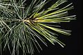
The long needles of the white pine

Douglas firs over 100 years old

War and post-war years
The next major turning point occurred in the war and post-war years of World War II . The lack of fuel again led to excessive deforestation, especially of the Wuppertal forests. New plantings were made with fast-growing and pollution-resistant tree species. Quickly stimulating elements should also be created for the population of the nearby large cities . The then district forester Heinrich Hogrebe took this event as an opportunity to think about increasing the quantity of tree species for the purpose of more efficient management. At Hogrebe's suggestion, the planting of tree species that were not typical of the region began as early as 1958.

In the early 1970s, the forest management district of Burgholz was designated by the state forest administration of North Rhine-Westphalia as a test area for the cultivation and testing of various tree species. From the outset, there should be an ecological interlocking of the foreign wood with native species. This was achieved by planting within the basic stands of native trees. From 1972 three large-scale geographical group plantings were carried out, each grouping together the trees of one continent.
In 1974, a 120 hectare piece of forest called " Piedboef " west of the Wupper in the Solingen city area was purchased and assigned to the Burgholz state forest. This forest was already included in the cultivation planning for foreign tree species in 1975.
Today the arboretum in the Burgholz state forest is the largest recognized German test area for the cultivation of woody plants from foreign countries. At the beginning of the 1990s, the pollutant emissions in connection with other factors also made the Burgholz state forest a problem. Up to 40% of beeches and up to 70% of oaks were affected by the phenomenon of forest dieback. Since then, there has been a slight recovery, even if it is only very slight.
Geology and soil science
Emergence

Geologically, the Burgholz belongs to the Remscheid Saddle (also known as Remscheid-Altenaer Saddle ) in the Rhenish Slate Mountains . The rocks are lagoon - and shelf - marine sediment of a shallow sea from the Lower and Central Devon , which was formed 300 to 400 million years ago. The layers found start in the higher Eifel level and extend into the Givet level . The average age is 380 million years, although the facies must be viewed over a longer period of time and no fixed point in time can be given.
Rock layers
In contrast to the variety of rock layers customary in the Wuppertal area, those of the castle wood are largely homogeneous . The layer structure is of type Brandenberg layer (independent sequence of Lenne - shale ), a layer sequence of the Rhenish Massif, south of the first time at the Brandenberg Iserlohn - Letmathe was explored.
The thickness of the Brandenberg stratum is 750 m. The sequence of layers consists predominantly of a lime-free sequence of gray and reddish slate, interspersed with gray-wacky banks. ( Grauwacke is actually geologically incorrect because it is sandstone . The traditional official name is, however, Grauwacke.) In the northern tip of the Burgholz, the Brandenbergschicht merges into the lower Honselschicht . The rock sequences of the surrounding region differ significantly from that of the castle wood.
Fossils
Although in the Brandberg layer relatively few fossils exist, paleontologists find quite also fossil remains of the most original sprout plants ( Asteroxylon elberfeldense , Hicklingia erecta , Calamophyton primaevum , Hyenia elegans , Aneurophyton anglicum , Protopteridium thomsonii and Duisbergia mirabilis ), sometimes clams (often Archanodon rhenanus , Myophoria oblonga and Modiomorpha waldschmidti ) and brachiopods ( Spirifers and Rhynochelliden ). A shellfish platter ( Placodermi ) also met with interest .
Bottoming out
From the Devonian weathering products and superimposed flow earth from the Diluvium are predominantly single, nutrient-poor to moderate nutrient-poor brown earth with different stone and Grusgehalt formed. The soils are mostly medium to deep with a good water supply.
Wupper deposits
The younger deposits took place in the form of Wupper terraces during the cold ages 400,000 and 15,000 years ago. During the thawing periods, the river carried greatly increased water and thereby deposited gravel on the slopes of the Wuppertal. The older terraces are up to 45 m above the river level, the younger ones are hardly higher than the current river level.
ecology
flora
Native population

The indigenous forest landscape comprises just under 30 tree species, of which only five are recorded in a significant number. Since the end of the Middle Ages, a grove - beech forest ( Fagus ) has predominated , supplemented in the upper layer by oaks ( Quercus ), as well as small proportions of birch ( Betula ), spruce ( Picea ) and European larch ( Larix decidua ). The middle class is mostly made up of beeches.
The European holly ( Ilex aquifolium ), as well as mountain ash ( Sorbus aucuparia ), beech, spruce, sycamore maple ( Acer pseudoplatanus L. ) and birch are found in the lower class .
The accompanying flora largely comprises addition of holly also blackberry ( Rubus fruticosus agg. ), Wood-sorrel ( Oxalis ), node figwort ( Scrophulariaceae ), stinging nettle ( Urtica ) wall lettuce ( Mycelis muralis ), impatiens ( Impatiens ) and various ferns ( Filicinophyta ).
Other forest landscapes and biotopes include high beech forests, birch-hornbeam forests, as well as wet and marsh areas and open heather areas .
The natural forest cells Steinsieperhöh and Meersiepenkopf

As part of the nationwide natural forest cell program , two areas of the Burgholz state forest were designated as natural forest cells. In these natural forest cells with a core area of 12.9 (Meersiepenkopf) or 5.3 hectares (Steinsieperhöh), regional forest landscapes should develop naturally without any human intervention. Parts of the natural forest cells are fenced off to protect them from being bitten by game. It is hoped that this will provide forest science knowledge about the natural regeneration of the forest and near-natural forestry cultivation methods.
The natural forest cells are located in the headwaters of the Steinsiepen , a tributary of the Burgholzbach , and in the upper reaches of the Großer Meersiepen , a tributary of the Wupper. They each have a typical regional stock of a grove beech forest with some sessile oaks and holly undergrowth. The age of the trees is given as 155 to 185 years (2013). These areas have not been subject to cultivation since 1972 and are therefore developing into a “new primeval forest ” through natural succession . The areas are divided into 20 × 20 m squares in which the type, diameter, vitality and sociological status of the trees are examined every ten years.
fauna
Mammals
The higher animal species include the regionally usual range of red , deer and wild boar , foxes and small mammals ( rabbits , badgers , Marder etc.). Because of the gravity of dendrological research the stocks of will shell Wilds kept small in order to game damage limit. Accordingly, the populations in the conventionally managed parts of the forest are somewhat stronger.
Entomofauna

According to a count by the zoological department of the Fuhlrott Museum in Wuppertal, between 81 and 96 species of beetles are found in the traditionally managed parts of the forest, depending on the tree population. In mixed areas of native and foreign tree species, an increased number of 112 species has even been counted. Species such as bark beetles and weevils , which are considered forest pests, face a balanced number of natural enemies such as bark beetles and root beetles . With 100,000 individuals per square meter of floor space, mite species are the most common organisms. The mixed plantings and natural forest management have a measurably positive influence on the diversity of species and their composition.
A total of 423 large butterfly species have been identified in the Burgholz, including threatened and rare species such as butterbur owl ( Hydraecia petasitis ) and plantain bear ( Parasemia plantaginis ).
Common species are sack-bearers (Psychidae), snow-wrench ( Apocheima pilosaria ), large frost-wrench ( Erannis defoliaria ), great maiden ( Archiearis parthenias ), small fox ( Aglais urticae ), peacock butterfly ( Inachis io ), lemon butterfly ( Gonepteryx rhamni ), round winged butterfly ( Orthosia cerasi ), nail patch ( Aglia tau ), Large and Small White ( Pieris brassicae, Pieris rapae ), Aurorafalter ( Anthocharis cardamines ), Holly Blue ( Celastrina argiolus ), dovetail ( Papilio machaon ), large skipper ( Ochlodes sylvanus ) Meadowsweet mother-of-pearl butterfly ( Brenthis ino ).
Avifauna
The bird world is also composed of species typical of the region. Depending on the season, different species can be observed well.
In the winter months there are: blackbird , blue tit , Brambling , Chaffinch , woodpecker , bullfinch , Jay , Siskins , Treecreeper , Greenfinch , crested tit , Grosbeak , Nuthatch , Great Tit , Redwing , Black Woodpecker , Coal Tit , dippers and Goldcrest . The predators are hawk and buzzard .
.jpg)
The migratory birds gradually arrive in spring . In addition to the species that settle here, many migratory bird species breeding further north use the castle wood as a resting place. To watch are: wagtail , grasshopper warbler , willow warbler , garden warbler , redstart , wagtail , spotted flycatcher , House Sparrow , Cuckoo , Blackcap , swifts , martins , nightingale , oriole , Barn Swallow , wood pigeon , robin , song thrush , Star , reed warbler , pied flycatcher , Fieldfare , tawny owl , Long-eared owl , wren and chiffchaff .
In summer, the second brood is already full-fledged in some species. The midsummer singers such as blackcap, wood pigeon and blood panther now dominate . Common buzzards and kestrels circle over the forest. The first migratory birds leave in August. The gray heron fishes on the Wupper .
In autumn, the Burgholz will again be a station for the migratory birds moving south. Skylark , meadow pipit , barn swallow and crane are often observed. Crossbills feed on pine cone seeds.
The Burgholz nature reserve
In 1992, smaller areas around the natural forest cells were placed under nature protection for the first time . These protected areas, which are only a few hectares in size, were greatly expanded in 2005 to an area of more than 600 hectares, so that today most of the Burgholz is designated as the second largest nature reserve in the Bergisches Land .
The aim of being protected is to protect natural mountain forest communities such as the beech forest ( Luzulo luzuloides-Fagetum ), the ash forest ( Carici remotae-Fraxinetum ), the alder forest accompanying the stream ( Stellario nemorum-alnetum glutinosae ), the oak-birch forest ( Betulo rocky sites -Quercetum ). In addition to forest landscapes are more habitat types such as springs, natural streams, riparian wetlands , wetland broke , Hochstaudenfluren , Pestwurzfluren and still waters under protection.
Further protection goals are:
- the maintenance and promotion of forest communities with the species spectra typical of the natural deciduous forest communities in different stand ages and site variations as well as the habitats of rare, endangered and landscape-typical animal and plant species in large contiguous forest ecosystems .
- the preservation of the characteristic forest-bound mammals, birds, reptiles , amphibians and invertebrates fauna of the Bergisch forest areas
- the preservation of the natural spring sieves and stream valleys
In addition, the area is of national heritage , natural history and geological reasons as well as scientific aspects of forestry development and forest ecology protected. The protection takes place not least because of the rare special characteristics and the outstanding beauty of the area, the landscape-bound local recreation and its function as a natural experience and educational area.
Sights and special features
Since the end of the 19th century, the state forest of Burgholz increasingly served the recreation of the citizens of the cities of Gräfrath, Cronenberg and the then large cities of Elberfeld and Barmen ( united in 1929 to form the city of Wuppertal).
The northern recreational forest


In contrast to the parts to the south, the north of the Burgholz state forest has more of the character of a wooded park and was officially run as an urban complex at the beginning of the 20th century. Numerous memorial stones and the naming of a large number of forest paths prove the function as a recreation area. In 1872 a restaurant was built on the Königshöhe . As a result, the former poor district “Am Elend” became more and more of a local recreation area. In 1892 a lookout tower was opened near the top of the Kiesberg with the Von-der-Heydt Tower . Not only can you enjoy a panoramic view of Elberfeld from the observation tower, numerous forest aisles also offer beautiful views of Elberfeld, Rutenbeck, Buchenhofen, Sonnborn and Vohwinkel. This is particularly appreciated by the allotment gardeners in the allotment gardens “In der Hoffnung” and “In der Heiterkeit” , which are located on the hillside near Königshöhe .
A cemetery of honor for the citizens of Elberfeld who died in World War I completes the park-like character of the forest. The starting point for walks in the park was often the Boltenberg stop on the Burgholzbahn , which almost completely circled this part of the Burgholz in a large topographical loop.
The Kiesberg Tunnel , inaugurated in 1970 , is a two-story road tunnel , almost 1000 m long, crosses the recreational forest and connects the Elberfeld city center via the L70 and L418 state roads with the A46 motorway at the Sonnborner Kreuz .
Adjacent residential areas
In the north of the forest, the Elberfeld poor districts, which quickly acquired the name “Elendstal” or “Am Elend” , extended as far as the Von der Heydt'schen private forest and the urban green spaces on the Königshöhe above. There were only mud and wooden huts of poor residents. Johanna Faust began to evangelize the area in 1868 and achieved that a chapel could be built.
In contrast, there was the bourgeois villa district at the Zoological Garden , which also borders the forest area. The zoo district was created in the second half of the 19th century on the "Am Kothen" site. Originally, the area on the western slope of the Kiesberg only housed a few farms and was owned by a few Wuppertal families. In 1879 the stock corporation Zoologischer Garten was founded. She acquired the southern part of the area where the Wuppertal Zoo was inaugurated in 1881. The Zoologischer Garten train station on the Bergisch-Märkische Eisenbahn-Gesellschaft route was laid out and the first road connection to the zoo was built by it.

The Herrmanns & Riemann company planned an upscale urban district north of the zoo. In the 1890s streets and the first villas were gradually laid out. The zoo district is still an upscale residential area today, and many of the villas are listed. In 1924, the now listed stadium at the zoo was built on the banks of the Wupper west of the zoo .
The residential area Boltenberg, located south of Sonnborn on the slope, is also an upscale residential area. Located at the western end of the urban area, its train stop made it a convenient starting point for walks in the forest or in the nearby zoo. The Kurhaus Waldesruh with a view of the forest over the valley of the Wupper was ideal for the less active.


The core area of the Burgholz state forest
The core area of the Burgholz State Forest includes the area north and south of the Burgholzbach , whose valley is also called Nöllenhammertal . It is separated from the northern recreational forest by the Rutenbeck brook , whose brook valley has lost its attractiveness due to the local route of the L418 highway-like road. In the west, the course of the Wupper and the state road L74 delimit the area, on the opposite side of which the part of the Burgholz connects, the monastery bush is called.
The route of the Burgholzbahn runs through the eastern part of the forest. In the subsoil below the route of the Burgholzbahn, the 1,800 m long Burgholz tunnel was completed at the end of 2005 , which closed the gap between two already existing sections of the L418 state road.
The Burgholzbach and its sights
The Burgholzbach impressed with his deep valley, the heartland of the castle wood. It rises at 284 m above sea level. NN near the Neuenhof outdoor pool in the Cronenberg district of Küllenhahn , flows in a westerly direction and empties after 3.335 km at 120 m above sea level. NN in the Wupper. The outdoor pool is supplied with heat from the nearby Wuppertal waste incineration plant so that it can be used all year round. Until the Burgholzbahn was shut down, the swimming pool at the edge of the forest was easily accessible via the Neuenhof stop.
According to the handbook of the natural spatial structure of Germany, the Bachtal forms its own natural spatial unit with the number 338.051 ( Burgholzberge ) and, as part of the natural spatial unit 338.05 (Lichtscheider mountain ridge), belongs to the higher-level natural area 338 ( Bergische plateaus ).
On the site of the waste incineration plant on the edge of the forest there is a quarry which, after the management was abandoned, filled with groundwater and which the local population called "Silbersee" . Other parts of the quarry, which is not open to the public, are filled with the incineration residues from the waste incineration plant. The only large wind turbine in Wuppertal is also located here.
Early use of hydropower


At the Burgholzbach there are reservoirs that held water for the drive of hammer mills and grinding Kotten ( see also Kotten ) from the time of early industrialization. The Nöllenhammer, which also housed the Cronenberg waterworks , consisting of five wells and a pumping station , was still preserved until 2009 . From the Kremershammer, founded in 1607 shortly before the mouth of the Burgholzbach brook into the Wupper, only the foundation walls are preserved. From the Bremershammer , the Plätzershammer , the Evertshammer and the Nöllenkotten , however, there are hardly any traces to be found. A left side stream of the Burgholzbach feeds a forest swimming pool in Cronenberg.
The ring wall system on Burggrafenberg
On the northern slope of the Burgholzbach valley are the remains of a ring wall system , the name of which was the castle moat for the name of the mountain Burggrafenberg (282.8 m), on whose flank it is located. Little is known about the history of the site, which is registered as a ground monument. It is said to have been the ancestral seat of a "Knight of Kronenburg". The complex was probably completely abandoned as early as 1715, as it is not even shown in the detailed regional map series Topographia Ducatus Montani (Topography of the Duchy of Berg) by Erich Philipp Ploennies .

The Glasbach and its sights
The northern stream valley adjacent to the Burgholzbach is traversed by the Glasbach . It rises at 251 m above sea level. NN between the Zimmerplatz and the educational facility of the Paritätisches Bildungswerk , located in the forest , which served the maternal convalescence organization of the German Red Cross until the 1960s . The Glasbach flows west through the Burgholz Arboretum with the focus on European and Asian Minor trees and flows after just under a kilometer at 136 m above sea level. NN opposite the municipal sewage treatment plant Buchenhofen in the Wupper.
A 282 m above sea level separates it from Burgholzbach. NN high ridge with the Burggrafenberg as the highest elevation. On this ridge is adjacent to the remote and now abandoned shooting range and the natural forest Steinsieperhöh. In the immediate vicinity of the shooting range, in today's natural forest cell “Steinsieperhöh”, 30 Eastern European forced laborers (6 women and 24 men) were executed by the local Gestapo and buried in a mass grave during the Third Reich, around the end of February / beginning of March 1945 . A plaque commemorates the crime . The bodies of the victims were exhumed in September 1945 and buried in the Schorfer cemetery in the presence of the local population. The access to the arboretum is at Zimmerplatz , a crossing point of several main paths in the forest, which not only houses seating and a refuge but also information boards. A large number of descriptive boards explain the names, origins and characteristics of the tree species in the arboretum.
The Rutenbeck brook and its sights
Another mountain range separates the Glasbach from the Rutenbeck Bach . This ridge goes east in the Cronenberg district of Küllenhahn into the Wuppertal southern heights . At the edge of the forest are the former Burgholz train station stop of the Burgholzbahn and the old half-timbered Obere Rutenbeck . In the vicinity of the breakpoint there is the imperial oak as a natural monument , which was planted in 1871 to commemorate the founding of the German Empire by students of an Elberfeld grammar school.


In the middle of the forest on the ridge are the buildings of a former municipal children's home " Zur Kaisereiche ", which used to be a forest school . The children's home was closed in 2008; Caritas wants to set up a stationary children's hospice in the buildings , which is to be opened in 2010. The Meersieperkopf natural forest cell is located on the western slope that slopes down towards the Wupper .
The valley of the Rutenbeck brook is dominated by the highway L418, which has been developed like a motorway and has left little of its original natural state. For the portals of the Kiesberg tunnel and the Burgholz tunnel, the stream was laid in a new, artificial bed in sections. The stream itself rises at 281 m above sea level. NN at the half-timbered yard Obere Rutenbeck in the Cronenberg district of Küllenhahn and flows after 2.25 km at the youth farm Rutenbeck , an adventure educational facility of the city of Wuppertal, at 132 m above sea level. NN in the district of the same name in the Wupper.
Along the Wupper
The valley of the Wupper also has sights and historical desolation despite the two-lane state road L74 which dominates today .
In the north the valley widens and offers space in a sweeping Wupperschleife for the municipal sewage treatment plant Buchenhofen , which treats a large part of the Wuppertal wastewater. As early as 1906, a sewage treatment plant for the then independent cities of Elberfeld and Barmen was founded, which over time has developed into one of the most important sewage treatment plants in the Wupperverband since it was taken over by the association in 1930 . After the Second World War it became the Buchenhofen sewage treatment plant , and numerous new mechanical systems such as the sludge incineration plant and the hydropower plant were built. In 2005 the last construction phase was completed and opened in time for the anniversary.
At the confluence of the Burgholzbach and the opposite Flockertsholzer Bach is one of the few bridges in Burgholz over the Wupper. It is referred to by the population as the “Devil's Bridge” based on the high and striking rocky promontory “Devil's Cliff” nearby .
Today's prestressed concrete bridge was built in the 1970s as part of the expansion of the state road, but a hundred years earlier there was a narrow footbridge with the same name. It connected the eastern part of the Burgholz with the Friedenstal , where the third Kotten or Burgholzkotten , a grinding Kotten on the Wupper, was located.
The only residential building that still exists there today was a popular restaurant at the beginning of the 20th century. Other grinding kotten on the Wupper in Burgholz were the Lechmigskotten (built around 1856) and the second Kotten (occupied from 1684).

The Kaltenbach and its sights
Another intersection in Burgholz is the L427 state road, which connects the Cronenberg center via Wahlert with the Kohlfurt settlement on a former ford in the Wupper on a ridge that slopes down to the Wupper. The valley adjoining the ridge south is formed by the Kaltenbach , which rises to 231 m above sea level. NN near the Cronenberger center and after 2.2 km to 110 m above sea level. NN flows into the Wupper. This brook also has numerous reservoirs and supplied the drive energy for six hammer mills, grinding bowls and mills , including the Friedrichshammer , the Kaltenbacher hammer and the Manuelskotten .
Above Kohlfurth, which is well known beyond the region due to a popular motorcycle meeting point on the Solingen side, a viewing pavilion called Adelenblick has been offering a view over the Wupper valley to Solingen since the end of the 19th century .
The Manuelskotten
The Manuelskotten , also known as the Kaltenbacher Kotten , is the only still functional Schleifkotten in the Wuppertal city area. The restored plant has belonged to the city of Wuppertal since 1993 and serves as an industrial museum to demonstrate the old craft of grinding. At the same time, cutter knives are still industrially manufactured in the plant for a Remscheid-based tool company , so that the craft shown is by no means just museum-like.
The route of the Bergische Museumbahn

The route of the Bergisches Trammuseum museum route also runs in the Kaltenbachtal . A 3.2 km long section of the former tram line from Elberfeld to Solingen, running through the forest, was acquired by the museum association and will be used by historic trams on the weekend between Cronenberg-Greuel and Cronenberg-Kohlfurth . The association keeps the extensive collection of vehicles in its halls in Kohlfurth, where the tram once crossed the Wupper on a bridge that is now a listed building.
Towers in the Burgholz State Forest
There are three towers in the Burgholz State Forest or in its immediate vicinity, which differ fundamentally in their historical and current use.

On the gravel mountain in the north of the Burgholz is at 260 m above sea level. NN the 20 m high Von-der-Heydt-Turm , an observation tower with a view of Elberfeld. The tower was built in 1892 with donations from the Wuppertal banker August Freiherr von der Heydt and named after the founder.

The Gräfrath light tower is in close proximity to the highest natural elevation in the city of Solingen . The tower, which is now provided with a glass dome, is the former water tower of Gräfrath, built in 1904 , which was badly damaged in the war and decommissioned in 1983. Since 1993 the tower has been privately owned by the lighting designer Johannes Dinnebier , who replaced the water container with the glass dome and set up a light laboratory in it. From the tower, which is not open to the public, one has a panoramic view over the valley of the Wupper to large parts of the castle wood. The telecommunications and television tower Rigi-Kulm is located in the Küllenhahn district of Cronenberg . Its shape, height and the red and white paint on the antennas qualify it as a clearly visible landmark in the entire area. At the beginning of the 20th century there was an observation tower on the Königshöhe.
tourism
Hiking trails


Numerous marked hiking trails run through the Burgholz State Forest . Apart from the four arboretum trails, all hiking trails in the forest have been marked by the Sauerland Mountain Association (SGV) since the 1930s .
Arboretum trails
The forest administration has set up four hiking trails that describe the individual tree species in the arboretum with signs along the way. For more information on the trails: see subsection Themed trails in the Arboretum chapter
Main walking routes of the SGV
Two main hiking trails of the Sauerland Mountain Association cross the Burgholz State Forest:
The SGV main hiking route X7 (153 km), Residenzenweg , from Arnsberg to Düsseldorf-Gerresheim runs through the forest in an east-west direction and passes the following sights:
- Telecommunication tower Rigi-Kulm, Königshöhe, recreational forest near Boltenberg, Meersiepenkopf natural forest cell, Rutenbeck youth farm
The SGV main hiking route X29 (133 km), Bergischer Weg , from Essen to Uckerath ( Siebengebirge ) runs through the forest in a north-south direction and passes the following sights:
- Wuppertal Zoo, Königshöhe, Imperial Oak, Burgholz station, Exotenwald, Nöllenhammer, Cronenberg forest swimming pool
District routes of the SGV
The district hiking trail 6 (SGV district Bergisches Land, 125 km), called Wupperweg , crosses the core area of the Burgholz and then follows the Wupper. He passes the following sights:
- Telecommunications tower Rigi-Kulm, Obere Rutenbeck, Imperial Oak, Meersieperkopf natural forest cell, Exotenwald, Nöllenhammer, Kremershammer, Devil's Bridge, Friedenstal, Kohlfurth
Local routes of the SGV
The local departments of Wuppertal and Solingen of the SGV maintain hiking trails at the local level.
The Wuppertaler Rundweg (hiking trail around Wuppertal, 106 km) and the Solinger Klingenpfad (hiking trail around Solingen, 75 km) also cross the forest. The blade path remains in the Solingen part of the Burgholz, the monastery bush, the Wuppertal circular route runs through the entire core area and the monastery bush.
Other local hiking trails are:
Circular hiking trails from the starting point Kaisereiche
| Circular / hiking trail | Waymarks | Route and sights | Path length |
| Circular hiking trail | A1 | Imperial oak, Meersieperkopf natural forest cell, Buchenhofen sewage treatment plant, exotic forest, Imperial oak | 3.6 km |
| Circular hiking trail | A2 | Imperial Oak, Burgholz Station, Zimmerplatz, Nöllenhammer, Burggraben Ringwall, Burggrafenberg, Zimmerplatz, Obere Ruthenbeck, Imperial Oak | 7 km |
| Circular hiking trail | A3 | Imperial Oak, Burgholz Train Station, Obere Rutenbeck, Königshöhe, Boltenberg Recreational Forest, Rutenbecker Bachtal, Imperial Oak | 6.2 km |
Wolfgang-Kolbe -weg
| Circular / hiking trail | Waymarks | Route and sights | Path length |
| Circular hiking trail | Beetle | Zimmerplatz, Nöllenhammer, Burggraben Ringwall, Burggrafenberg, Zimmerplatz | 7 km |
Circular hiking trails from the starting point in Gräfrather Lichturm
| Circular / hiking trail | Waymarks | Route and sights | Path length |
| Circular hiking trail | A2 | Gräfrath light tower, Buchenhofen sewage treatment plant, Steinbachtal, Gräfrath light tower | 6.7 km |
| Circular hiking trail | A3 | Graefrath light tower, Flockertsholzer Bachtal, Unterholzer Bachtal, Untenzumholz, Graefrath light tower | 5.8 km |
Kleingartenweg
| Circular / hiking trail | Waymarks | Route and sights | Path length |
| Circular hiking trail | K | Allotment garden in the hope , allotment garden in the serenity | 5.5 km |
Access routes to the Wuppertal circular route
| Circular / hiking trail | Waymarks | Route and sights | Path length |
| trail | W. | Viehhof, Obere Rutenbeck, Burgholz station | 3.8 km |
| trail | W. | Cronenfeld, Nöllenhammer | 2.1 km |
Target hiking trails
| Circular / hiking trail | Waymarks | Route and sights | Path length |
| trail | rectangle | Cronenfeld, Burgholzbachtal, Nöllenhammer, Langensiepener Bachtal, ring wall system Burggraben, Zimmerplatz, Küllenhahn | 7.7 km |
| trail | Δ | Sonnborn, Boltenberg Recreational Forest, Königshöhe, Von-der-Heydt Tower, Viehhof | 5.3 km |
Burgholz Arboretum
History of foreign cultivation

The Arboretum Burgholz has a long tradition of planting non-native tree species in the Burgholz forest. Already from 1820 non-regional trees like the European larch (Larix decidua) and the Scots pine (Pinus sylvestris) were cultivated. However, this was not done for reasons of science , but served the rapid production of timber yields.
Around 1900, xenophytes from other continents were planted for the first time . Mention should be made of the Douglas fir (Pseudotsuga menziesii) and the white pine (Pinus strobus) from America , the Japanese larch (Larix kaempferi) from East Asia and the red oak (Quercus rubra) from eastern North America . The reasons for the settlements were the poor growth of the spruce stands and the difficult rejuvenation of the beech stands .
Under the impact of overexploitation as a result of war and post-war period began around 1955 under the forester forestry office man Heinrich Hogrebe , since 1988 honorary member of the German Dendrological Society , the targeted cultivation of exotic conifers . The acreage grew rapidly, so that the castle wood soon became a recognized focus of foreign country cultivation in North Rhine-Westphalia.
With the active support of an employee qualified in cultivation of foreign countries, Hogrebe experimented more and more with foreign tree species, the saplings and seedlings of which had to be laboriously procured and later grown in the greenhouse. Attempts at cultivation, which were initially interpreted as a failure, were partly secretly improved by replanting due to his inadequate experience at the time, although over time it turned out that the majority of these areas also developed well on their own.
Since the native population comprised only 30 species, the forest was not productive enough as a commercial forest and also not optimally positioned as a recreational forest , after initial resistance at the lower levels of the forest administration in the State Ministry of Food, Agriculture and Forestry, the decision was finally made in 1970 to carry out experiments with North American To begin coping. Species were selected that promised an equal or higher yield compared to native trees.
At the suggestion of the State Forester Gottfried Pöppinghaus from the Higher Forest Authority of the Rhineland, the Ministerialrat Fritz Rost (Silviculture Advisor of the State Ministry of Food, Agriculture and Forests) and the Chief Forester Genßler, the nucleus of a federal arboretum should be created. The Wuppertal City Council made a corresponding recommendation to the state government. However, the process initially silted up in the mills of bureaucracy . In 1972 a new attempt was made, which was more successful: A decision by the State Ministry for Food, Agriculture and Forests to create large-scale cultivation of foreign countries followed.
On May 1, 1973, the forestry officer Herbert Dautzenberg took over the forest operation. Under his leadership, the existing foreign country cultivation areas were thinned and numerous new plantings were made.
Research priorities
From 1972 Burgholz Forest (of the total 25%) were more than 250 hectares of forest science framework non-native tree species with a focus on environmental planted. Another focus was on dendrological research with a focus on forestry aspects.

The main research areas were:
- the cultivability and cultivation worth of different tree species
- finding ecologically and economically superior tree species
- Findings about the growth of trees from foreign climatic zones , which could be of great importance in the future in view of possible climate changes
- Increase the diversity of the forest and beautify the landscape
- Exploring additional harvesting options for Christmas , decorative and traditional plants
Both foreign individual species within regional forest landscapes and complete, closed foreign forest landscapes are cultivated. In forestry own greenhouses with a total area of two hectares seedlings bred, the proliferation of Xenophyten is promoted and scientifically examined from various perspectives. The focus is on a. in the rearing of threatened tree or shrub species and the establishment of an immissions- resistant tree population.
In the history of the arboretum, there were only major failures of a tree species that is native to the southern hemisphere at the turn of the year 1978/79: Two representatives of the species of the false beeches ( Nothofagus ) fell victim to a temperature drop of 35 degrees Celsius.
Administration and scientific support
As a state-owned forest, the Arboretum Burgholz is looked after by the State Office for Forest and Wood NRW (www.wald-und-holz.nrw.de). The state forest has been managed since May 2012 by the Rhein-Sieg-Erft regional forest office based in Bonn, Großgrimberg forestry district. The scientific support is carried out in cooperation with the Arnsberg Forest Teaching and Experimental Forestry Office. The regional forest office Bergisches Land, based in Gummersbach, is responsible as a so-called “public concern”. Interested laypeople can request information from the Waldpädagogisches Zentrum (WPZ) Burgholz in Wuppertal-Cronenberg.
The arboretum from a nature conservation perspective


Like many such projects, the arboretum was initially controversial from a nature conservation perspective . The arboretum is far from offering the kind of ecology found in natural areas typical of the region. It was feared that in addition to the flora, which was already very different, the soil fauna and the insect population would also change atypically strongly and disadvantageously.
According to initial studies, these fears have not come true. The fauna, especially the insect population, inevitably changed, but quickly assumed a natural balance. The native species adopted the new forest landscapes for the most part without the natural structure shifting asymmetrically towards certain species . Compared to the usual monocultures of conventional forest management, the species relationship between phytophagous species and predators in the exotic forest landscapes is even very natural and well balanced.
Nevertheless, these fears led to the fact that in 1995 the new minister for the environment, regional planning and agriculture, Bärbel Höhn , issued instructions in the new red-green North Rhine-Westphalian state government to stop cultivation abroad and to clear the existing areas and fill them with local beeches plant.
With scientific support from the head of the Natural Science and City History Museum in Wuppertal, the entomologist Wolfgang Kolbe , who had written numerous publications on the forest area and the ecology of foreign land cultivation, the district forester Herbert Dautzenberg managed to dispense with this plan. However, there was a ban on further cultivation and thinning of foreign stocks, which still exists today. By converting the state forest into a nature reserve, this ban was consolidated by the nature reserve ordinance.
From today's perspective, however, the advantages clearly outweigh the advantages, especially the scientific findings relating to climate change. After the dry year 2018 , the first half of 2019 was too dry for the native tree species, so that the native populations are weakened and also damaged more than ever before by the infestation by bark beetles and in some cases their substance is even endangered. Some of the foreign tree species, on the other hand, proved to be very resistant under these conditions, showed no damage and could play an important role in a changed climate for future forestry and in plant-based CO 2 reduction, should indigenous species no longer be cultivable in the foreseeable future be. Due to the existing ban on cultivation and maintenance in the arboretum, these findings cannot be further deepened by planting additional areas with different site conditions.
The exotic forest in the arboretum
On May 26, 1999, the so-called exotic forest in the Arboretum Burgholz was opened by the State Minister Bärbel Höhn . The three large cultivation areas with species from three continents were made accessible to the public through hiking trails. Many of the approx. 100 foreign tree species are presented using signs.
North American woody plants
The focus for North American trees is near the forester's house in the southern area of the Burgholz. The following types can be found here (excerpt):
| Tree species | Scientific name | origin | image |
| Colorado fir | Abies concolor | Southwestern USA , Northern Mexico |

|
| Purple fir | Abies amabilis | Northwest USA ( British Columbia to Oregon ) |
|
| Big sea fir | Abies excelsior | Northwest USA, Southwest Canada ( Pacific Coast ) |
|
| Rock Mountain Fir | Abies lasiocarpa | Alaska , Oregon, Utah and New Mexico ( high mountain areas ) |

|
| Magnificent fir | Abies magnifica | Western USA (high mountain ranges from Oregon to California ) |
|
| Silver fir , Pacific silver fir | Abies procera | Mountainous regions of Northwest America |

|
| Chilean araucaria , Andean fir | Araucaria araucana | Chile , Argentina |

|
| Yellow birch | Betula alleghaniensis | Eastern North America, mostly Canada |
|
| California incense cedar | Calocedrus decurrens | Southwestern USA (Oregon, Nevada , California mountain ranges ) |
|
| Lawson's cypress | Chamaecyparis lawsoniana | Western USA (narrow strip near the Pacific coast in the coastal mountains of Oregon and California) |
|
| Tulip tree | Liriodendron tulipifera | Northeastern USA ( Great Lakes , Appalachians , prairies to the Atlantic ) |
|
| Sitka spruce | Picea sitchensis | Northwest USA, Southwest Canada (Southwest Alaska, British Columbia, Washington , Oregon, Northern California) |
|
| American red spruce | Picea rubens | Northern USA (Great Lakes, Smoky Mountains to Appalachians) |
|
| Yellow pine | Pinus ponderosa | Northwest USA (Washington to California, Oregon to Nebraska ) |
|
| White Pine , Strobe, Silky Pine | Pinus strobus | Northeastern USA, Southeastern Canada ( Newfoundland to the Appalachians) |
|
| Jeffrey pine | Pinus jeffreyi |

|
|
| Douglas fir | Pseudotsuga menziesii | Northwest USA, Southwest Canada (British Columbia to California) |

|
| Coastal quoie | Sequoia sempervirens | Western USA (Pacific coast from Oregon to Southern California) |

|
| Redwoodtree | Sequoiadendron giganteum | Western USA (California Sierra Nevada ) |

|
| Bald cypress , two-row bald cypress , swampy wood | Taxodium distichum | Southeastern USA, Mexico to Guatemala |
.jpg)
|
| Giant tree of life | Thuja plicata | Western USA, Canada (Southern Alaska to Southern California, Pacific Coast to Rocky Mountains ) |

|
| Western hemlock | Tsuga heterophylla | Northwest USA, Southwest Canada (Oregon, Washington, British Columbia, Alaska) |
|
| Mountain hemlock | Tsuga mertensiana | Mountain ranges of western North America |

|
Asian trees
The focus for Asian trees is near the forester's house in the southern area of the Burgholz. The following types can be found here (excerpt):
| Tree species | Scientific name | origin | image |
| Momi fir | Abie's company |
|
|
| Nicotine | Abies homolepis | Japan (mountain ranges of central Honshū and Shikoku ) |
|
| Sakhalin fir | Abies sachalinensis |
|
|
| Veitchs fir | Abies veitchii | Japan ( Honshū , Shikoku) |

|
| Japanese birch | Betula japonica | Northern Japan ( Honshū , Hokkaidō and Kurils ) | |
| Maximowiczs birch | Betula maximowicziana | Japan and South Kuril Islands |

|
| Katsura tree , cake tree | Cercidiphyllum japonicum | Japan, China (mountainous areas of Sichuan Province ) |

|
| Hinoki cypress | Chamaecyparis obtusa | Japan |
|
| Japanese crescent fir | Cryptomeria japonica | Japan (due to centuries of planting as a useful wood all over Japan, it is no longer possible to determine the exact origin) |
|
| ginkgo | Ginkgo biloba | East Asia (China, Japan, Korea ) |
|
| Ancient sequoia , Chinese redwood, water larch | Metasequoia glyptostroboides | Central China (Sichuan, Hubei ) |

|
| Japanese tree of life | Thuja standishii | Japan |

|
| Hiba tree of life | Thujopsis dolabrata | Japan |
|
| Japanese zelkove | Zelkova serrata | Japan |
|
European and Asian minor trees
The area of European and Asia Minor trees is located near the former Burgholz train station. The following types can be found here (excerpt):
| Tree species | Scientific name | origin | image |
| Greek fir | Abies cephalonica | Greece |
|
| Cilician fir | Abies cilicica | Asia Minor ( Taurus Mountains , Lebanon Mountains ) |

|
| Troy fir | Abies equi-trojani | Ida Mountains in the Turkish province of Çanakkale |

|
| Nordmann fir | Abies nordmanniana | Western Caucasus (mountain ranges) |

|
| Common boxwood | Buxus sempervirens | Mediterranean area (native to Germany since the Middle Ages) |

|
| Sweet chestnut | Castanea sativa | Northern Mediterranean ( Portugal to Turkey ) |
_1.jpg)
|
| Cedar of Lebanon | Cedrus libani | Lebanon , Syria , Turkey (Mediterranean Coast, Black Sea ) |

|
| Atlas cedar | Cedrus atlantica | North African Atlas and Rif Mountains |

|
| Tree hazel , Turkish hazel | Corylus colurna | Extensive distribution from China to Hungary |

|
| Oriental beech | Fagus orientalis | Mountains of Southeast Europe, Northern Asia Minor, Northern Persia and the Caucasus |

|
| walnut | Juglans regia | Iran , Asia Minor, Greece. |

|
| European hop beech | Ostrya carpinifolia | Southern Europe and Asia Minor |

|
| Serbian spruce , omorika spruce | Picea omorika | Serbian Tara Mountains |
|
| Macedonian (Rumelian) pine | Pinus peuce | Macedonia , Serbia , Bulgaria , Albania |

|
| Zerr oak | Quercus cerris | Mediterranean area, Asia Minor |

|
Themed trails
In 1999, the Landesbetrieb Wald und Holz NRW set up four hiking trails - so-called themed trails - which describe the individual tree species in the arboretum with signs along the way. Three of the four hiking trails ( impressions from Europe , impressions from North America and impressions from Asia ) are circular routes through the individual arboretum areas for European, North American and Asian trees. Good starting points for a walk are the “Zimmerplatz” in the northern part of the arboretum in the Küllenhahn district and the Burgholz Forest Pedagogical Center in the Cronenberg district. The room space can be reached by car via the Kaisereiche car park in the street “Zur Kaisereiche”, the WPZ Burgholz is located on Friedensstrasse.


The fourth path, called Forests of the World , also begins at the forester's house and leads through the Burgholzbachtal past Zimmerplatz to the Imperial Oak. It offers an introductory look at the diversity of vegetation in the Burgholz. In detail he shows:
- Mixed stand of sequoia, California frankincense cedar and Douglas fir
- Mixed stand of West American hemlock, Douglas fir, giant arborvitae, sequoia and Lawson's cypress
- Consists of noble fir and individual sequoia trees
- Mixed stand of Douglas fir, noble fir, large coastal fir, Colorado fir, California incense cedar, Jeffrey pine and yellow pine
- Mixed stock of noble fir, rock mountain fir and purple fir
- Mixed stock of California incense cedar, Douglas fir, Colorado fir and West American hemlock
- Bald cypress in the stream area
- Consists of sequoia and noble fir
- Culture from Sitka spruce and Engelmann spruce, further along the way culture from spruce from Istebna
- Mixed stand of coastal sequoia (redwood) and Leyland cypress
- Mixed stand of large coastal fir and purple fir, Chinese redwood along the stream and mountain hemlock, Nikko fir and Veitchs fir on the opposite slope
- Pure stand of linden-leaved birch, native to Japan
- Paper birch and Japanese birch, native to Japan
- Nordmann's fir and Nikko fir
- Consists of Chinese redwood, Douglas fir and sequoia
- Mixed stand of rock mountain fir and noble fir
- Pure stand of twist pine
- West American white pine
- Pure stand of noble cypress
- American red spruce
- Consists of giant arborvitae and Japanese crescent fir on the northern edge
- Mixed stand of Douglas fir and large coastal fir
- Mixed stand of coastal sequoia (redwood) and mountain hemlock
- Mixed stand of giant arborvitae, Lawson's cypress, Serbian spruce, sequoia, large coastal fir and Chinese redwood
- Mixed stand of sequoia, noble fir, large coastal fir and Douglas fir
- Mixed stand of sequoia and mountain hemlock
literature
- Kolbe, Wolfgang / Uwe Lünsmann (Ed.): Burgholz Monograph - Annual Reports of the Natural Science Association in Wuppertal No. 53.Wuppertal 2000
- Burgholz Arboretum. (Information brochure). Edited by Ministry for the Environment, Regional Planning and Agriculture NRW. State Forestry Office Bergisch Gladbach-Königsforst, Bergisch Gladbach 1998.
- Herbert Dautzenberg, Klaus Offenberg, Ute Nolden-Seemann, Alfred Becker, Uta Schulte et al .: Burgholz. From the experimental area to the arboretum. Issue 11 of the publication series of the state forest administration of North Rhine-Westphalia. Published by the Ministry for the Environment, Nature Conservation, Agriculture and Consumer Protection NRW / State Forestry Office Bergisch Gladbach-Königsforst, Düsseldorf 2000 ( online version as PDF file ( memento from March 15, 2007 in the Internet Archive ))
- Wolfgang Kolbe (Hrsg.): The Bergische Wald - Habitat for plants, animals and people, presented using the example of the Burgholz state forest in Wuppertal and Solingen. Observing and getting to know nature, Bergisches Land, Volume 7. Born-Verlag, Wuppertal 1991, ISBN 3-87093-044-6
- Roland R. Theimer, K. Bathen (Hrsg.): Staatsforst Burgholz - Study to record and analyze the cultivation of native and foreign tree species. , 1995
- Heinrich Hogrebe : Foreign tree species in the state forest ranger's office in Burgholz. German Forest Association (Ed.), Düsseldorf 1966
See also
Web links
- "Burgholz" nature reserve in the specialist information system of the State Office for Nature, Environment and Consumer Protection in North Rhine-Westphalia
- Forest Education Center & Arboretum Burgholz e. V.
Individual evidence
- ^ "Burgholz" nature reserve in the specialist information system of the State Office for Nature, Environment and Consumer Protection in North Rhine-Westphalia , accessed on February 20, 2017.
- ↑ Handbook of the natural spatial structure of Germany: Sheet 108/109: Düsseldorf / Erkelenz (Karlheinz Paffen, Adolf Schüttler, Heinrich Müller-Miny) 1963; 55 p. And digital version of the corresponding map (PDF; 7.4 MB)
- ↑ WZ-Newline from January 16, 2009
- ↑ Friedenstal and Teufelsbrücke
- ↑ Lechmigskotten
- ↑ Second Kotten
- ↑ Historic Center ( page no longer available , search in web archives ) Info: The link was automatically marked as defective. Please check the link according to the instructions and then remove this notice.
- ↑ BMB Wuppertal