
Kreuzberg (Bavarian Prealps)
| Kreuzberg | ||
|---|---|---|
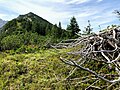
 The east side of the Kreuzberg seen from the Kloo-Ascheralm |
||
| height | 1715.6 m | |
| location |
Bavaria , Germany Tyrol , Austria |
|
| Mountains | Bavarian Prealps | |
| Dominance | 0.92 km → Hinteres Sonnwendjoch | |
| Notch height | 144 m ↓ Scharte to the Sonnwendjoch | |
| Coordinates | 47 ° 36 '45 " N , 11 ° 55' 59" E | |
|
||

The Kreuzberg is a 1715.6 m high mountain in the Bavarian Prealps on the border between Tyrol and Bavaria . It is the summit of a spur from the Hinterer Sonnwendjoch massif northwards to Bavaria. A 1567 m high secondary summit to the north of the main summit bears the name Kreuzbergspitzl .
On the German side, Kreuzberg separates areas of the communities Schliersee in the west and Bayrischzell in the east. On the east side of the mountain at 1305 m , below the rocky summit wall, lies the Kreuzbergalm , from which one overlooks the Kloo-Ascher valley (also known as Kloaschau valley ) running to the east . North of the mountain, the 1143 m high Elendsattel pass offers a transition from the Kloo-Ascher valley to the Valepp valley , the region south of the Spitzingsee .

Border stone Tyrol-Bavaria on the Kreuzbergalm and east face of the Kreuzberg

View from the Kreuzbergalm into the Kloo-Ascher Valley and the Großer Traithen
On the Kreutbergspitzl with a view of the Kreuzberg


