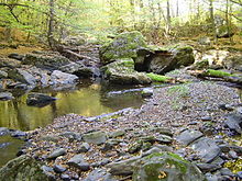
Krupinská planina
Coordinates: 48 ° 15 ' N , 19 ° 10' E

The Krupinská planina (German for "carp plateau") is a geomorphological unit in Slovakia. It is named after the city of Krupina .
Location, boundary and subdivision
The Krupinská planina is located in the south of Slovakia and forms the southernmost part of the Slovak Central Uplands .
The plateau is limited
- in the north-west of the Schemnitz Mountains ,
- to the north from the Pliešovská kotlina basin and the Javorie Mountains
- in the east of the Ostrôžky Mountains ,
- in the southeast of the Juhoslovenská kotlina basin ,
- in the southwest of the Danube hill country .
The Krupinská planina is geomorphologically divided into:
- Modrokamenské úbočie
- Dačolomská planina
- Bzovická pahorkatina
- Závozská vrchovina
character
The highlands are of volcanic origin. It is characterized by quite deeply cut creek and river valleys and gradually rises from southwest to northeast. The highest mountains reach approx. 800 m. The highlands are drained to the south by the rivers Štiavnica , Krupinica and Ipeľ .
The region is predominantly forested; deciduous forests dominate, which are mainly formed by oaks and beeches. There are also extensive pastures.
The north-east of the Krupinská planina has a share of the military area and military training area Lešť .
Attractions
The scenic region is suitable for hiking and cycling tourism. Popular hiking destinations are the castles of Bzovík , Modrý Kameň and Čabraď .
In the vicinity of the highlands there are thermal baths Dolná Strehová and Dudince .
Some places in the highlands and in the vicinity
- Krupina
- Dudince
- Veľký Krtíš
- Modry Kameň

