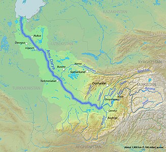
Kunduz (Amudarja)
|
Kunduz Kunduz, Surchab, Bamiyan River |
||
|
Course of the Kunduz in the catchment area of the Amudarja |
||
| Data | ||
| location | Baglan , Bamiyan , Kunduz ( Afghanistan ) | |
| River system | Amu Darya | |
| Drain over | Amu Darya → Aral Sea (temporarily) | |
| Headwaters |
Koh-e Baba 34 ° 40 '2 " N , 67 ° 38' 20" O |
|
| Source height | approx. 4200 m | |
| muzzle |
Amu Darya Coordinates: 37 ° 0 '15 " N , 68 ° 15' 54" E 37 ° 0 '15 " N , 68 ° 15' 54" E |
|
| Mouth height | 318 m | |
| Height difference | approx. 3882 m | |
| Bottom slope | approx. 9.2 ‰ | |
| length | 420 km | |
| Catchment area | 37,100 km² | |
| Discharge at the Pol-e Chomri A Eo gauge: 17,405 km² |
MQ 1950/1968 Mq 1950/1968 |
63.6 m³ / s 3.7 l / (s km²) |
| Discharge at the Char Dara A Eo gauge: 24,820 km² |
MQ 1964/1978 Mq 1964/1978 |
53.4 m³ / s 2.2 l / (s km²) |
| Discharge at the Kulukh Tepa A Eo gauge : 37,100 km² Location: 5 km above the mouth |
MQ 1965/1978 Mq 1965/1978 |
106 m³ / s 2.9 l / (s km²) |
| Right tributaries | Andarab , Khanabad | |
| Big cities | Baglan , Kunduz | |
| Medium-sized cities | Bamiyan , Pol-e Chomri | |
| Small towns | Aliabad | |
| Communities | Doshi | |
The Kunduz (also Kunduz , in the upper reaches also Surchab ) is a left tributary of the Amudarja in the north of Afghanistan .
The Kunduz rises in the Koh-e Baba ridge about 20 km southwest of the city of Bamiyan . It flows through the Bamiyan Valley as the "Bamiyan River" in a north-easterly direction and separates the Koh-e-Baba in the south from the western part of the Hindu Kush in the north. After about 50 km the Kunduz turns north and cuts through the Hindu Kush in a deep valley. At Pol-e Khomri he finally reaches the Amu Darya plain. It flows further in a northerly direction, flows through the cities of Baglan and Kunduz , then turns to the northwest and finally flows into the Amu Darya on the border with Tajikistan . The Kunduz has a length of 420 km. Its catchment area covers 37,100 km². The Kunduz is mainly fed by the snowmelt . The water of the Kunduz is used for irrigation . In Pol-e Chomri there is a hydropower plant on the Kunduz.
Hydrometry
Average monthly discharge of the Kunduz (in m³ / s) at the Char Dara gauge (near the city of Kunduz)
measured from 1964 to 1978

