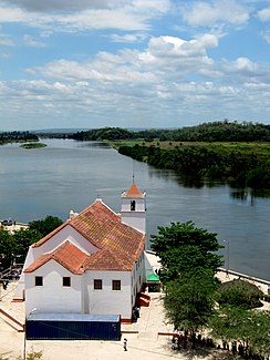
Cuanza
|
Cuanza Kwanza |
||
|
Course of the Cuanza River with its tributaries |
||
| Data | ||
| location |
|
|
| River system | Cuanza | |
| source | in the highlands of Bié 13 ° 49 ′ 35 ″ S , 17 ° 19 ′ 31 ″ E |
|
| Source height | approx. 1450 m | |
| muzzle |
Atlantic Ocean Coordinates: 9 ° 20 ′ 49 ″ S , 13 ° 9 ′ 15 ″ E 9 ° 20 ′ 49 ″ S , 13 ° 9 ′ 15 ″ E |
|
| Mouth height | 0 m | |
| Height difference | approx. 1450 m | |
| Bottom slope | approx. 1.5 ‰ | |
| length | 960 km | |
| Catchment area | 157,000 km² | |
| Discharge at the Cambambe gauge (601908) A Eo : 121,470 km² Location: 120 km above the mouth |
MNQ MQ Mq MHQ |
210 m³ / s 788 m³ / s 6.5 l / (s km²) 1750 m³ / s |
| Left tributaries | Kukema, Cunhinga, Ngango, Cutato | |
| Right tributaries | Cuiva, Luando , Cuige, Lucala | |
| Reservoirs flowed through | Capanda dam , dam Lauca , cambambe hydroelectric power station | |
The Cuanza or Kwanza is a 965 km long stream in Angola , Africa .
course
It rises near Mumbue at an altitude of about 1450 m in the highlands of Bié in central Angola and flows into the Atlantic Ocean : From its source , the water of the Cuanza flows first in a northerly direction through the province of Bie , then in a north-westerly direction as a border river between the provinces Bie and Malange , later Cuanza Sul and Malange , and then - in a westerly direction - Cuanza Sul and Bengo , before flowing through the province of Cuanza Norte . The river then flows into the Atlantic at Barra do Cuanza around 50 km south of the capital of Angola, Luanda .
In the lower reaches of the Cuanza is navigable for around 250 km. Tributaries of the Cuanza are the Cutato , Luando and Lucala . The provinces of Cuanza Sul (south) and Cuanza Norte (north) owe their names to the river.
Hydrometry
The discharge would be measured at the Cambambe station at 83% of the catchment area and about 120 km above the mouth in m³ / s (read from the diagram).

The runoff peak is delayed by one month from the precipitation peak. This is due to the fact that the water level is below the Cambambe Dam, and thus the discharge is regulated.
Power plants and reservoirs
Looking downstream, the Cuanza is dammed by the following hydropower plants:
| power plant | operator | Max. Power (MW) | Reservoir | Surface (km²) | Volume (million m³) | photo |
|---|---|---|---|---|---|---|
| Capanda | ENE | 520 | Capanda | 164 | 4,800 |

|
| Laúca | ENE | 2,070 | Laúca | 188 | 5,482 |

|
| Cambambe | ENE | 180 |

|

