
Lasszinswiesen

The Laßzinswiesen , also Lasszinswiesen on maps or similar , are located north of the Spandau Forest in the municipality of Schönwalde-Glien in the Brandenburg district of Havelland and were an exclave of West Berlin on the territory of the former GDR until 1988 . Nearby, but already in Berlin , is the Laßzinssee . The enclave was only around 50 meters from the main Berlin area. However, a patrol route of the border troops also ran through this corridor. The Laßzinswiesen exclave had an area of 13,494 ha and belonged to the Spandau district from 1920 to 1988 , whereby until 1920 the larger sub-area of 11.012 ha was an enclave of the former rural community Gatow and a smaller sub-area of 2,482 ha an enclave of the former rural community Cladow ( later Kladow) was. The main areas of the communities mentioned were about ten kilometers further south, so the respective enclaves were thus much further apart until 1920 than the later enclave in relation to Berlin.
History before and in divided Germany
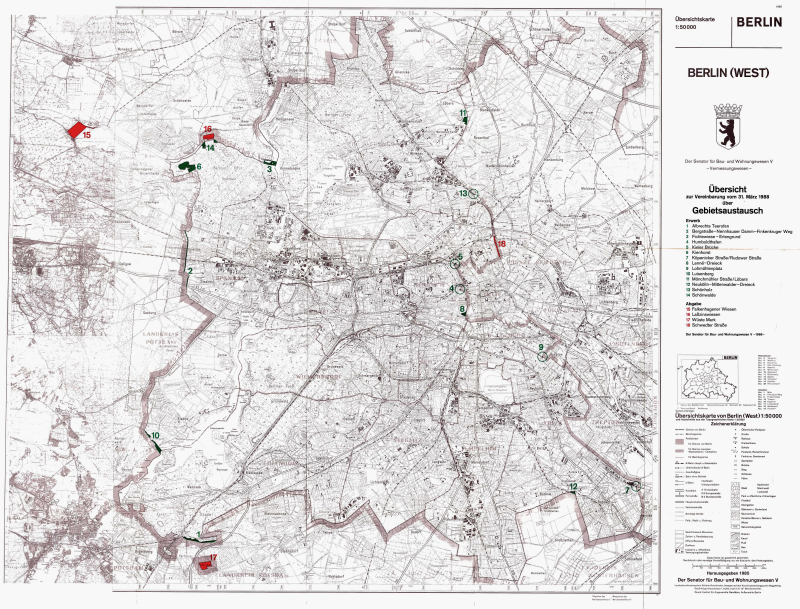
In the past, when property tax was paid for an area, this was assigned to the municipality in which the owners were resident. With the formation of Greater Berlin in 1920, numerous exclaves were created on Brandenburg territory, which administratively belonged to Berlin, but were outside the contiguous urban area. They were preserved even after the end of World War II . As a result of the division of Germany in 1949, the situation became even more complicated, because now the areas were not just within a different municipality, but a different state. Since 1961, the Laßzinswiesen were separated from the other parts of West Berlin by the Berlin Wall .
After the Four Power Agreement in 1971, East and West tried to correct borders. Twice - in 1972 and again in 1988 - territorial exchanges were carried out between West Berlin and the GDR. In the latter case, the Laßzinswiesen then fell to the GDR and, accordingly, belong to Brandenburg today.
Web links
Individual evidence
Coordinates: 52 ° 36 ′ 1.6 ″ N , 13 ° 9 ′ 30.3 ″ E