La Stretta
| La Stretta | |||
|---|---|---|---|
|
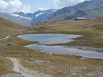
La Stretta, taken from the west |
|||
| Compass direction | west | east | |
| Pass height | 2465 m above sea level M. | ||
| region | Canton of Graubünden | region Lombardy | |
| Watershed | Ova da la Val da Fain ( Ova da Bernina → Flaz → Inn → Danube ) | Spöl ( Inn → Danube ) | |
| Valley locations | Bernina Suot | Alpe Vago | |
| expansion | trail | ||
| Mountains | Livigno Alps | ||
| profile | |||
| Ø pitch | 5.2% (420 m / 8.03 km) | 26.3% (366 m / 1.39 km) | |
| map | |||
|
|
|||
| Coordinates , ( CH ) | 46 ° 27 '42 " N , 10 ° 3' 8" O ( 800 730 / 148 921 ) | ||
La Stretta (feminine to the past participle, Latin strictus , German 'narrow, narrow' , Rhaeto-Romanic stret ) is an Alpine pass between the Swiss canton of Graubünden and the Italian region of Lombardy . With a peak height of 2465 m above sea level. M. it connects the Val da Fain in the west with the Valle della Forcola in the east. The pass is located between Monte Breva in the north and Piz dals Lejs in the south. The top of the pass is very attractive with its little lakes.
Location and surroundings
The La Stretta pass belongs to the Piz Languard group, a subgroup of the Livigno Alps . The pass is located on the border between Switzerland and Italy. La Stretta is bordered in the west by the Val da Fain , a side valley of the Val Bernina , and in the east by the Valle della Forcola , a side valley of the Valle di Livigno . The pass connects the Monte Breva ( 3104 m ) in the north with the Piz dals Lejs ( 3044 m ) in the south. The west side is very flat and wide, while the east side to 800 m horizontally 357 Hm loses.
There is a building and several lakes on the pass. Valley locations are Pontresina and Livigno , frequent starting points are Bernina Suot and the Forcola di Livigno .
Routes to the pass
By Bernina Suot
- Starting point: Bernina Suot ( 2045 m )
- Via: Val da Fain, Alp la Stretta
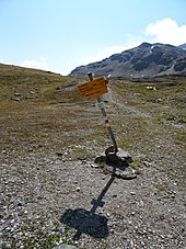
- Difficulty: B than trail white-red-white marks
- Time required: 3 hours
From Alpe Vago
- Starting point: Alpe Vago ( 1981 m )
- Via: Baitel del Gras degli Agnelli
- Difficulty: B , marked as a hiking trail
- Time required: 2 hours
From Forcola di Livigno
- Starting point: Forcola di Livigno ( 2315 m )
- Difficulty: B , marked as a hiking trail
- Time required: 1 hour
gallery
West side of the pass, view through Val da Fain to Piz Tschüffer , Piz Pischa , Piz Sagliaint , Piz Languard , Piz Prüna and Piz Chatscheders
East side of the pass, view of the Valle della Forcola. The Forcola di Livigno is on the far right.
Web links
- www.hikr.org Various tour reports
literature
- Bernard Condrau, Walter Candinas: club guide, Bündner Alps . Middle Engadine and Poschiavo. 2nd Edition. tape X . Verlag des SAC, 1984, ISBN 3-85902-039-0 , p. 155 .
- National map of Switzerland, sheet 1258 La Stretta, 1: 25,000, Federal Office of Topography, 2015 edition.
Individual evidence
- ↑ Andrea Schorta: How the mountain got its name . Small Rhaetian name book with two and a half thousand geographical names of Graubünden. Terra Grischuna Verlag, Chur and Bottmingen / Basel 1988, ISBN 3-7298-1047-2 , p. 137 .


