Lake Abita
|
Lake Abita Abita Lake |
||
|---|---|---|
| Geographical location | Cook County in Minnesota (USA) | |
| Drain | → Brule River | |
| Location close to the shore | Grand Marais | |
| Data | ||
| Coordinates | 47 ° 55 '23 " N , 90 ° 27' 21" W | |
|
|
||
| Altitude above sea level | 625 m | |
| surface | 42 ha | |
| length | 900 m | |
| width | 700 m | |
| Maximum depth | 4.3 m | |
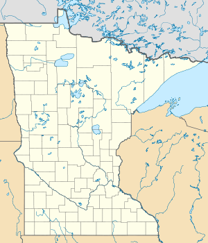
Lake Abita (also Abita Lake ) is a lake in West Cook , Minnesota , which is the highest lake in this state with a lake level of 625 m .
Surname
Abita comes from the Ojibwe language and means "half".
topography
Lake Abita is located to the north of the Duluth Complex in the Misquah Hills . The gabbro of this region forms several ranges of hills trending from east to west, which are broken by isolated so-called red rocks , some of which are among the highest peaks in the state. Lake Abita sits on the southern flank of one of these mountains, Brule Mountain , the summit of which rises 154 m to the north above the surrounding terrain. To the south the highlands are only a few meters below the summit and the water level of the lake is only nine meters lower. The lake is thus the highest lake in Minnesota. The difference in altitude to the deepest lake in this state, the Upper Lake , is 440 m. Its shoreline is at a height of 183 m and thus forms the lowest point in Minnesota. The highest and lowest lakes in the state are only 19 km away from each other.
Lake Abita belongs to the catchment area of the Brule River , in whose southern arm the lake between Lake Brule and the confluence of the northern arm drains.
ecology
Lake Abita is a shallow lake that reaches a maximum water depth of 4.3 m. This makes the lake particularly suitable for smaller fish. In a study in 1990, Catostomus commersonii accounted for the largest proportion of fish caught, an average of 58.3 fish of this species were caught per net examined, and an average of one perch was counted per net. Glass eyeglasses were not found, despite the fact that the state fisheries authority had previously spawned this species in the lake for three years. The Minnesota Department of Nature and Recreation concluded that the lake was of little value to sport fishermen.
geology
In the late 19th century, geological surveys conducted in Minnesota found that the area around Lake Abita was predominantly red and gray feldspar , partly as diopside , magnetite, and hornblende . Quartz, apatite and pyrite have also been found in the area around the lake.
supporting documents
- ↑ a b c Abita Lake in the Geographic Names Information System of the United States Geological Survey
- ^ A b Warren Upham: Minnesota Geographic Names, Their Origin and Significance . In: Collections of the Minnesota Historical Society , Volume 17 1920, p. 145.
- ↑ BWCA Glossary ( English ) Retrieved August 20, 2010.
- ↑ Christopher Webber Hall: Geography and Geology of Minnesota , Volume 1. The HW Wilson Company, Minneapolis 1903, p. 7.
- ^ Karl Ver Steeg: The Influence of Geologic Structure on the Drainage Pattern in Northeastern Minnesota . In: The University of Chicago Press (Ed.): The Journal of Geology . 55, August, pp. 353-361.
- ^ Newton Horace Winchell: The Geology of Minnesota, Vol. I of the Final Report. Plate LXXXIII, The Rove Lake Plate. Pp. 1872-1901.
- ^ NH Winchell: Annual Report, for the Year 1881 . Geological and Natural History Survey of Minnesota, St. Paul 1882, p. 74.
- ↑ The Geography of Minnesota ( English ) Retrieved on August 20 of 2010.
- ^ Public Water Access, Cook County West. Retrieved August 20, 2010 (PDF, English; 4.5 MB)
- ^ NH Winchell: The History of Geological Surveys in Minnesota . Pioneer Press, St. Paul 1880, pp. 76, 78.
