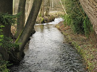
Long again Bach
| Long again Bach | ||
|
Lang again brook near Lußsee |
||
| Data | ||
| Water code | DE : 164526 | |
| location | Munich and the district of Dachau , Bavaria , Germany | |
| River system | Danube | |
| Drain over | Gröbenbach → Amper → Isar → Danube → Black Sea | |
| source | in Aubing near Altostraße (original upper course) 48 ° 9 ′ 56 ″ N , 11 ° 24 ′ 57 ″ E |
|
| muzzle | between the Bergkirchen districts of Eschenried and Gröbenried in the Gröbenbach Coordinates: 48 ° 13 '7 " N , 11 ° 25' 32" E 48 ° 13 '7 " N , 11 ° 25' 32" E
|
|
The Langwieder Bach is a flowing body of water in Munich and belongs to the Isar river system .
The stream rises in the west of the city in the Aubing district and runs through the Aubing and Langwied districts to the north, past Langwieder See , Lußsee and Birkensee to the east .The tributaries of the Langwieder Bach are the Lohwiesengraben , the Quellsack and the Emmeringer Bach .
By extending the A99 motorway, the Langwieder Bach was interrupted in its upper reaches; the upper course has since been draining through a newly created connection directly into the source sack, which then flows back into the Langwieder Bach. The Lohwiesengraben flows directly below the interruption and is therefore mistakenly viewed as the upper reaches of the Langwieder Bach on various maps (e.g. on Google Maps).
Behind the city limits of Munich, the brook forms the border between the communities Bergkirchen and Karlsfeld and flows into the Gröbenbach about 1.7 km north of Munich between the Bergkirchen districts of Eschenried and Gröbenried .
Web links
Individual evidence
- ↑ Information board about the relocation. Retrieved January 11, 2020 .
