Laxbach (Neckar)
|
Laxbach Lachsbach sometimes named after one of the upper reaches Ulfenbach or Finkenbach |
||
|
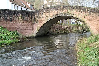
The Laxbach in Hirschhorn |
||
| Data | ||
| Water code | DE : 23896 | |
| location |
Odenwald
|
|
| River system | Rhine | |
| Drain over | Neckar → Rhine → North Sea | |
| origin | Confluence of the right Ulfenbach and the left Finkenbach 49 ° 26 ′ 51 ″ N , 8 ° 53 ′ 40 ″ E |
|
| Source height | approx. 120 m above sea level NHN confluence Ulfenbach / Finkenbach |
|
| muzzle | at Hirschhorn in the Neckar Coordinates: 49 ° 26 '33 " N , 8 ° 53' 57" E 49 ° 26 '33 " N , 8 ° 53' 57" E |
|
| Mouth height | approx. 116.4 m above sea level NHN | |
| Height difference | approx. 3.6 m | |
| Bottom slope | approx. 5 ‰ | |
| length | 727 m from Zsfls. Ulfenbach / Finkenbach |
|
| Catchment area | 170.017 km² with Ulfenbach and Finkenbach |
|
| Discharge A Eo : 170.29 km² at the mouth |
MQ Mq |
2,888.7 m³ / s 17 l / (s km²) |
| Small towns | Staghorn | |
|
The Laxbach flows into the Neckar |
||
The Laxbach , also known as the Lachsbach , is the short, shared lower course of two long Odenwald brooks, which flows into the Neckar from the right and north at Hirschhorn in the Bergstrasse district of Hesse .
geography
course
The Laxbach arises in the Hirschhorn area from the confluence of the right Ulfenbach and the left Finkenbach and flows into the Neckar after just over 700 m. Sections of the Ulfenbach lower course are sometimes given his name or, conversely, his own course with that of one of the upper courses.
Catchment area
The catchment area covers 170.0 km² and , in terms of natural space , lies in the Odenwald , largely in its sub-area Sandstone-Odenwald , last and especially with the last sub - catchment area below the confluence of the upper reaches in the lower Odenwald-Neckar area .
Tributaries
- Ulfenbach , right and north-north-western upper reaches, 29.3 km and 95.8 km².
- Finkenbach , left and northern upper reaches, 21.6 km and 73.9 km².
See also
Individual evidence
LUBW
Official online waterway map with a suitable section and the layers used here: Course and catchment area of the Laxbach
General introduction without default settings and layers: State Institute for the Environment Baden-Württemberg (LUBW) ( notes )
- ↑ a b c Height according to the contour line image on the background layer topographic map .
- ↑ a b Length according to the waterway network layer ( AWGN ) .
- ↑ Catchment area after the layer aggregated areas 05 .
- ↑ Catchment area according to the basic catchment area layer (AWGN) .
Other evidence
- ↑ Water map service of the Hessian Ministry for the Environment, Climate Protection, Agriculture and Consumer Protection ( information )
- ↑ Otto Klausing: Geographical land survey: The natural space units on sheet 151 Darmstadt. Federal Institute for Regional Studies, Bad Godesberg 1967. → Online map (PDF; 4.3 MB)
- ↑ Josef Schmithüsen : Geographical land survey: The natural space units on sheet 161 Karlsruhe. Federal Institute for Regional Studies, Bad Godesberg 1952. → Online map (PDF; 5.1 MB)
literature
- Topographic map 1: 25,000 Baden-Württemberg, as a single sheet
- for the Laxbach run: No. 6519 Eberbach
- for the catchment area: No. 6318 Lindenfels, No. 6319 Erbach, No. 6418 Weinheim, No. 6419 Beerfelden, No. 6519 Eberbach

