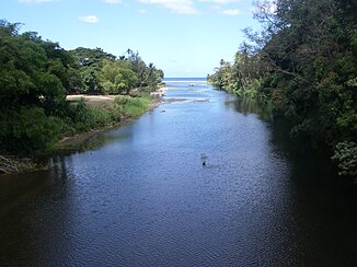
Layou River
| Layou River | ||
| Data | ||
| location | Dominica | |
| River system | Layou River | |
| source | in the Northern Forest Reserve 15 ° 27 ′ 15 ″ N , 61 ° 20 ′ 28 ″ W. |
|
| muzzle | at Layou south of Saint Joseph in the Caribbean Sea Coordinates: 15 ° 23 ′ 37 " N , 61 ° 25 ′ 32" W 15 ° 23 ′ 37 " N , 61 ° 25 ′ 32" W
|
|
| length | 26 km | |
| Navigable | No | |
The Layou River or Rio Layou is a river in Dominica , an island state in the eastern Caribbean . It rises in the interior of the country, flows westward through the Parish Saint Joseph and flows into the Caribbean Sea roughly in the middle of the west coast of the island near the town of St. Joseph . The Layou River is the most important and longest river in Dominica. It is about 15 km long, very rich in water, but not navigable .
geography
Due to its length, the Layou River has a large drainage basin and is also adjacent to numerous other large river systems in Dominica. In addition, it has well-known tributaries with important waterfalls. The sources of the Layou River on the one hand have their source north on Mosquito Mountain and in the center of the island, on the edge of the Central Forest Reserve . Numerous tributaries, including the Laurent River and Pagayer River , on the other hand, flow down south of the Morne Trois Pitons . The northern and eastern borders of the catchment area simultaneously form the borders between the parishes of Saint Joseph and Saint Andrew and Saint David , respectively .
As already mentioned, the Layou River rises on the eastern slope of Mosquito Mountain and receives further source streams from the southern slope of Mang Peak . These streams flow south first, turn east, and then turn south again in the plains of Bassin Will and Bells . Further tributaries come here from the east, including the Rivière d'Or (r). The major tributaries from the Morne Trois Pitons flow to Bells: Laurent River with its swarm of spring streams, as well as the Pagayer River. There the river turns west and flows curvy through the lowlands. After about four kilometers it is fed by the Rivière Bway from the right and north, whose source streams in turn arise in Mosquito Mountain. After about 3 km, the river at D Leau Matthieu receives its inflow through the Matthieu River , where Lake Matthieu existed due to a large landslide between 1997 and 2011 . There the river turns more strongly to the southwest again. He maintains this course despite numerous corners. At Ancaster Park Estate it receives an inflow from the left and south through the Ravine Dublanc . The other tributaries in the lower reaches are not named. the river forms several small dividing courses and after a few kilometers flows into the Caribbean Sea at Layou .
Individual evidence
- ↑ dm.geoview.info and [1] .
