Lebanon (Missouri)
| Lebanon | |
|---|---|
|
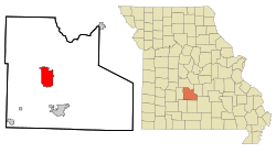
Location in Missouri
|
|
| Basic data | |
| Foundation : | 1877 |
| State : | United States |
| State : | Missouri |
| County : | Laclede County |
| Coordinates : | 37 ° 41 ′ N , 92 ° 40 ′ W |
| Time zone : | Central ( UTC − 6 / −5 ) |
| Residents : | 12,155 (as of: 2000) |
| Population density : | 344.3 inhabitants per km 2 |
| Area : | 35.4 km 2 (approx. 14 mi 2 ) of which 35.3 km 2 (approx. 14 mi 2 ) is land |
| Height : | 384 m |
| Postal code : | 65536 |
| Area code : | +1 417 |
| FIPS : | 29-41168 |
| GNIS ID : | 0720871 |
| Website : | www.lebanonmissouri.org |
| Mayor : | Stanley "Bud" Allen |
Lebanon is the county seat of Laclede County in the US state of Missouri in the United States of America and has 12,155 inhabitants with a population density of 344.3 inhabitants / km² (as of 2000). Lebanon is the birth town of architect Antoine Predock , NASA astronaut Michael Scott Hopkins, and playwright Lanford Wilson .
geography
The location is south of the geographic center of Missouri on Interstate 44 , which is part of the better known Route 66 , about 90 km northeast of Springfield , about 250 km northwest of Kansas City, and has a total area of 35.4 square kilometers, of which 0 , 1 km² of water.
history
In 1849, when Laclede County was formed, Lebanon was elected the district capital, but was then named Wyota , after the Indians who used to live here, and was only later renamed after the town of the same name, Lebanon in Tennessee . The first settler in this area is said to have been Jesse Ballew as early as 1820 . During the American Civil War , the city was occupied several times by both Union and Confederate troops.
