Lepelle-Nkumpi (Municipality)
| Lepelle-Nkumpi Lepelle-Nkumpi Local Municipality |
||
|---|---|---|
 |
||
| Symbols | ||
|
||
|
Motto "Motho ke Motho ka Batho" |
||
| Basic data | ||
| Country | South Africa | |
| province | Limpopo | |
| District | Capricorn | |
| Seat | Lebowakgomo | |
| surface | 3463 km² | |
| Residents | 230,350 (October 2011) | |
| density | 67 inhabitants per km² | |
| key | LIM355 | |
| ISO 3166-2 | ZA-LP | |
| Website | www.lepelle-nkumpi.gov.za (English) | |
| politics | ||
| mayor | Matshipsana Meriam | |
Coordinates: 24 ° 12 ′ S , 29 ° 42 ′ E
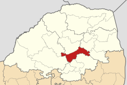
Lepelle-Nkumpi ( English Lepelle-Nkumpi Local Municipality ) is a local municipality in the Capricorn district of Limpopo Province in South Africa . The seat of the municipal administration is in Lebowakgomo . Mayor is Matshipsana Meriam.
Its name is derived from the two rivers Lepelle (Olifants until 2005) and Nkumpi .
places
In Lebowakgomo is the Lebowakgomo Old Parliament and next door is the Provincial Legislature of Limpopo.
Nature reserves and tourism
- Bewaarkloof Nature Reserve
- Lekgalameetse Nature Reserve
- Wolkberg (Serala) Wilderness Area
Not far from the village of Ga-Mathabatha there is the Asbestos Museum and the Makgatho Air Museum . In the village of Lapalesehle there is the possibility of water sports activities. In the west of the municipality is the Zebediela Citrus Estate , one of the oldest preserved plantations in the country and equipped with tourist attractions. This includes a small railway line from Mookgophong (formerly Naboomspruit) to Zebediela; however, it is shut down. The highest point in the area of the local parish is Mount Iron Crown (2128 m). The area of the local parish has a high tourist potential for the Limpopo province.
population
In 2011 the community had 230,350 inhabitants in 59,682 households on an area of 3,463 km². Of these, 99.6% belonged to the black population group.
The first language was Sepedi in 86.1% , isiNdebele in 4.6% , Xitsonga in 3.7%, and English and isiZulu in 0.9% each .
Web links
- The community site (English)
Individual evidence
- ↑ a b Local Government Handbook. South Africa: Lepelle-Nkumpi Local Municipality (LIM355) . at www.municipalities.co.za (English).
- ^ Department of Arts and Culture: Place Names . at www.salanguages.com (English).
- ^ Lepelle-Nkumpi Local Municipality: Tourism Plan . online at www.lepelle-nkumpi.gov.za (English, PDF), PDF document p. 7–19.
- ↑ 2011 census: Lepele-Nkumpi . accessed on July 14, 2020.
- ↑ Statistics South Africa : Lepele-Nkumpi . at www.statssa.gov.za (English).
