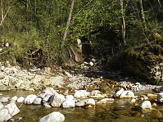
Lettenbach (Klausbach)
| Lettenbach | ||
|
The Lettenbach flows into the Klausbach |
||
| Data | ||
| location | Salzkammergut mountains | |
| River system | Danube | |
| Drain over | Klausbach → Salzach → Inn → Danube → Black Sea | |
| source |
Millstone 47 ° 45 ′ 19 ″ N , 13 ° 7 ′ 6 ″ E |
|
| Source height | 906 m | |
| muzzle |
Glasenbachklamm in Klausbach Coordinates: 47 ° 46 '2 " N , 13 ° 6' 19" E 47 ° 46 '2 " N , 13 ° 6' 19" E |
|
| Mouth height | 485 m | |
| Height difference | 421 m | |
| Bottom slope | 23% | |
| length | 1.8 km | |
The Lettenbach is a left tributary of the Klausbach in the municipality of Elsbethen , a southern suburb of the city of Salzburg .
geography
The source of the Lettenbach am Mühlstein is at an altitude of 906 m and from there it flows north to its confluence with the Klausbach , which flows through the Glasenbachklamm . On its mostly wooded path to Glasenbachklamm, it flows through the hamlet of Gfalls, which is part of the Elsbethen cadastral community of Gfalls.
General
The Lettenbach is the largest tributary of the Klausbach in the Glasenbachklamm, all other tributaries mostly consist of smaller rivulets . At its mouth, the hiking trail that leads through the Glasenbachklamm leads over a wooden bridge, which was renovated in May 2008. Also at the mouth on the right side of the Lettenbach there is a wooden bench and a small fountain.
