Leyberg (Westerwald)
| Leyberg | |
|---|---|
|
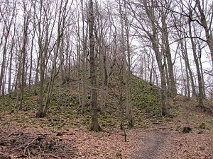
The summit of the Leyberg |
|
| height | 359.2 m above sea level NHN |
| location | Bad Honnef |
| Mountains | Westerwald |
| Coordinates | 50 ° 37 '58 " N , 7 ° 15' 58" E |
The Leyberg (formerly also Leiberg ) is 359.2 m above sea level. NHN high mountain at the northern end of the Rheinwesterwälder volcanic ridge , which connects to the Siebengebirge to the south . It is located in the south of the urban area of Bad Honnef .
The neighboring mountains are the Zickelburg ( 188 m ) in the west and the Hardt ( 278 m ) in the southwest . Its rocky, conical basalt summit allows a panoramic view of the Rhine Valley, the northern and eastern Siebengebirge as well as towards Bonn and is one of the most spectacular in the region. The ascent takes place over more or less natural rock stairs for the last 80 meters - not suitable for people with disabilities. The mountain can be reached via the rest area at 271 m at the former "Barbarahütte", which is located on the southern slope of the mountain. The Rheinsteig passes it at a short distance, with a yellow-marked detour leading to the summit.
The type of rock occurring on the Leyberg is olivine basalt . This was formerly dismantled in a small quarry, whereby the route of the braking line on the north side of the summit - an extension of the Leybergbahn path named after it - can still be seen today as a narrow aisle.
Individual evidence
- ↑ a b Information according to the digital terrain model and digital topographic map 1: 25,000, 1: 50,000 and 1: 100,000 (available in the TIM-online map service )
- ^ Geological State Office North Rhine-Westphalia (ed.); Gangolf Knapp, Klaus Vieten: Geological map of North Rhine-Westphalia 1: 25,000. Explanations for sheet 5309 Königswinter . 3rd, revised edition, Krefeld 1995, p. 33.
- ^ G11 Leyberg , Tourism Siebengebirge GmbH

