Liamone
| Liamone | ||
|
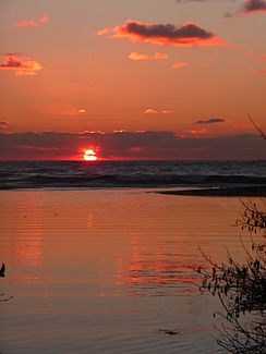
Estuary at sunset |
||
| Data | ||
| Water code | FR : Y81-0400 | |
| location | France , Corsica | |
| River system | Liamone | |
| source | in the municipality of Letia, 42 ° 15 ′ 1 ″ N , 8 ° 55 ′ 38 ″ E |
|
| Source height | approx. 1865 m | |
| muzzle | on the municipal boundary of Casaglione and Coggia in the Mediterranean Coordinates: 42 ° 4 ′ 41 ″ N , 8 ° 43 ′ 1 ″ E 42 ° 4 ′ 41 ″ N , 8 ° 43 ′ 1 ″ E |
|
| Mouth height | 0 m | |
| Height difference | approx. 1865 m | |
| Bottom slope | approx. 45 ‰ | |
| length | 41 km | |
| Catchment area | 367 km² | |
| Left tributaries | Guagno , Cruzini | |
The Liamone is a river in France that runs in the Corse-du-Sud department on the island of Corsica . It rises in Regional Park Corsica , on the south edge of the Capu au Tozzu (2007 m) in the municipality of Letia flows in a southwest direction away larger settlements and opens after 41 kilometers at the municipal boundary of Casaglione and Coggia in the Gulf of Sagone in the Mediterranean . In its estuary section, it flows through the Liamone plain (French: Plaine du Liamone) named after it, which merges into the sea as Liamone Beach (French: Plage du Liamone), at the mouth of the river it is often formed by shifting sand a freshwater lagoon .
Places on the river
history
The river gave its name to the historical French department of the same name, which existed from 1793–1811 and which included all of southern Corsica.
Attractions
- Capigliolo tower on the estuary
Web links
Remarks
- ↑ Source geoportail.fr (1: 32,000)
- ↑ mouth geoportail.fr (1: 32,000)
- ↑ a b c The information on the river length is based on the information about the Liamone at SANDRE (French), accessed on April 11, 2012, rounded to full kilometers.
