Letia
| Letia | ||
|---|---|---|
|
|
||
| region | Corsica | |
| Department | Corse-du-Sud | |
| Arrondissement | Ajaccio | |
| Canton | Sevi-Sorru-Cinarca | |
| Community association | Spelunca Liamone | |
| Coordinates | 42 ° 11 ′ N , 8 ° 51 ′ E | |
| height | 232–2,098 m | |
| surface | 36.44 km 2 | |
| Residents | 121 (January 1, 2017) | |
| Population density | 3 inhabitants / km 2 | |
| Post Code | 20160 | |
| INSEE code | 2A141 | |
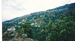
 Letia with the Saint-Martin church |
||
Letia is a municipality in the French department of Corse-du-Sud on the Mediterranean island of Corsica . It belongs to the canton of Sevi-Sorru-Cinarca in the Arrondissement of Ajaccio . The residents call themselves Létiais .
geography
The parish is formed by the two parish villages Saint-Martin and Saint-Roch . The river Liamone has its source in Letia . Neighboring communities are Cristinacce , Albertacce and Corte in the north, Soccia in the east, Poggiolo in the southeast, Murzo in the south, Vico in the southwest and Renno in the west.
Population development
| year | 1962 | 1968 | 1975 | 1982 | 1990 | 1999 | 2008 | 2012 |
|---|---|---|---|---|---|---|---|---|
| Residents | 312 | 285 | 252 | 204 | 122 | 96 | 110 | 110 |
Web links
Commons : Letia - collection of images, videos and audio files
