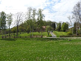
Lichtenberg (crouching)
|
Lichtenberg
community Kauern
Coordinates: 50 ° 49 ′ 50 ″ N , 12 ° 8 ′ 31 ″ E
|
||
|---|---|---|
| Height : | 180 m above sea level NN | |
| Residents : | 27 (2000) | |
| Incorporation : | July 1, 1950 | |
| Postal code : | 07554 | |
| Area code : | 036602 | |
|
Location of Lichtenberg in Thuringia |
||
|
In the town
|
||
Lichtenberg is a former municipality in Thuringia that was largely excavated in the 1950s as part of the bismuth opencast mine of the same name. The remaining part of the village is now a district of Kauern in the district of Greiz .
location
The part of Lichtenberg that is preserved today is located south of Kauern, southwest of the mining area and today's rehabilitation area of Wismut AG .
history
Lichtenberg was first mentioned in a document on June 14, 1165, according to other sources in 1306. Until 1920 Lichtenberg belonged to the Principality of Reuss Younger Line and from 1920 to the State of Thuringia. On April 1, 1939, Lichtenberg was united with the neighboring village of Loitzsch to form the municipality of Lichtenberg. The resulting community of Lichtenberg was incorporated into Kauern on July 1, 1950. From 1949 a geological exploration of the area took place; extensive uranium deposits were found under Lichtenberg. Several depths were created around the place; In March 1952, a first main shaft was sunk to a depth of 180 meters on the southern outskirts of Lichtenberg. Parts of the hallway were cordoned off and the first courtyards cleared; from then on the landscape was shaped by mining. The last of the 254 residents had to leave the place by 1954. Most of the residents found a new home in Ronneburg , Wünschendorf , Seelingstädt and Lengefeld . The last building to be demolished in 1965 was the former sheep farm.
Only two properties remained from the place, which now form the new place Lichtenberg with the rest of the former village of Loitzsch.
Population development
In 1861 112 people lived in the village, in 1891 there were 101 inhabitants in 19 houses with 22 households. In 1904 there were 86 and in 1926 95 people. In 1938 there were 100 residents, 6 farmers, 6 houses and 1 inn and finally in 1948 after the merger with Loitzsch, 26 households with 254 residents. In 2000, today's (remaining) town of Lichtenberg had 27 residents in eight houses with 10 households, 18 of whom lived in the former district of Loitzsch.
literature
- Annerose Kirchner: Disappeared without a trace: Villages in Thuringia, victims of uranium mining, Verlag Ch.Link, 2010
Individual evidence
- ^ Wolfgang Kahl : First mention of Thuringian towns and villages. A manual. Rockstuhl Verlag, Bad Langensalza, 2010, ISBN 978-3-86777-202-0 , p. 164
- ↑ a b c Disappeared Villages - Lichtenberg at www.bergbauverein-ronneburg.de Source Herrmann Müller OTZ in 2001. Retrieved on May 28, 2012


