Linderbach (Lohr)
| Linderbach | ||
|
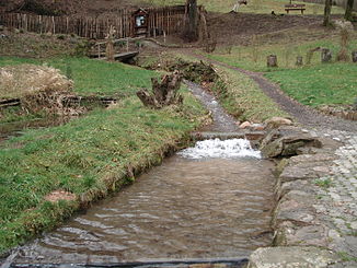
The Linderbach in the Frammersbach herb garden |
||
| Data | ||
| location |
Spessart
|
|
| River system | Rhine | |
| Drain over | Lohr → Main → Rhine → North Sea | |
| source | in the Ruhbrunnen in Frammersbach 50 ° 3 ′ 46 ″ N , 9 ° 29 ′ 22 ″ E |
|
| Source height | 259 m above sea level NHN | |
| muzzle | in Frammersbach in the Lohr coordinates: 50 ° 3 ′ 21 ″ N , 9 ° 29 ′ 3 ″ E 50 ° 3 ′ 21 ″ N , 9 ° 29 ′ 3 ″ E |
|
| Mouth height | 212 m above sea level NHN | |
| Height difference | 47 m | |
| Bottom slope | 52 ‰ | |
| length | 900 m | |
| Catchment area | approx. 1.9 km² | |
|
The Linderbach (pipe on the right) flows into the Lohr |
||
The Linderbach or Lindenbach is a left tributary of the Lohr in the Main-Spessart district in the Bavarian Spessart .
geography
course
The Linderbach rises from the Ruhbrunnen in Frammersbach . The source is in the so-called herb garden at the southeast foot of the Mützelsberg (339 m). The Linderbach runs in a south-westerly direction through Frammersbach. In the industrial park it is completely piped and flows into the Lohr behind a hardware store .
The water of the Linderbach has water quality class III. Since the piping cannot discharge some floods, consideration is being given to exposing the stream in the mouth area. In April 2011, was packing the Ruhbrunnens of 30 l / s.


