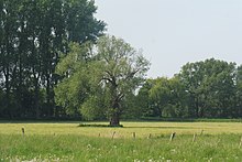
Lip Low VI - Mantinghausen
Coordinates: 51 ° 41 ′ 54 " N , 8 ° 29 ′ 47" E
The Lip Niederung VI - Mantinghausen nature reserve is located in the area of the town of Salzkotten in the Paderborn district in North Rhine-Westphalia .
The area extends south of Mantinghausen , a district of Salzkotten, and west of Holsen, part of the Salzkotten district of Schwelle , along the Lippe . The state road L 815 runs to the north and the L 549 to the south-east.
meaning
The approximately 99 ha area, which consists of three parts, was placed under nature protection in 1992 under the key number PB-036 .
See also
Web links
Commons : Lip Niederung VI - Mantinghausen - Collection of images, videos and audio files
- Nature reserve "Lip Niederung VI - Mantinghausen (PB-036)" in the specialist information system of the State Office for Nature, Environment and Consumer Protection in North Rhine-Westphalia
- World Database on Protected Areas - Lip Niederung VI - Mantinghausen (English)


