List of architectural monuments in Dömitz
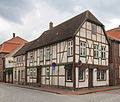
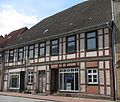
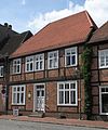
The list of architectural monuments in Dömitz lists all of the architectural monuments of the city of Dömitz (Ludwigslust-Parchim district) and its districts (status: November 2009).
Doemitz
| ID | location | designation | description | image |
|---|---|---|---|---|
|
|
Am Heldenhain (on the B 191) (map) |
Monument to the fallen 1914/18 |
 |
|
|
|
Am Wall 1 (map) |
Residential building | ||
|
|
Am Wall 6 (map) |
Residential building | ||
|
|
Am Wall 9 (map) |
Residential building | 1-sch. Plastered building by the Frede family; built around 1870 |
 |
|
|
Am Wall 10 (map) |
House, stable | 1-sch. Plastered building by the Frede family; built around 1870 |
 |
|
|
Am Wall 13 (map) |
Residential building | 2-tier Half-timbered construction | |
|
|
At the bleaching room 4 (card) |
Residential building | ||
|
|
At the bleaching room 5 (card) |
Residential building | ||
|
|
At the pale 6 (card) |
Residential building | ||
|
|
At the pale 7 (card) |
Residential building | ||
|
|
At the fortress 1 (map) |
former Wallmeisterhaus | ||
|
|
At the fortress 2/4 (map) |
Residential building | ||
|
|
Station with reception building (map) |
Goods handling building, 2 sheds and storage with hand crane (Am Hafen 1) | 3-tier System from around 1880/90 with two lateral. Clinker clinker wings, significant fire damage to the reception building in 2011 and 2012. |
 |
|
|
B 191 | milestone |
 |
|
|
|
Elbstraße 1/3 (map) |
Residential building | ||
|
|
Elbstrasse 2 (map) |
Residential building | 2-tier Half-timbered building with hipped roof | |
|
|
Elbstrasse 4 (map) |
Residential and commercial building | 2-tier Half-timbered building with crooked hip | |
|
|
Elbstrasse 6 (map) |
Residential building | ||
|
|
Elbstrasse 7 (map) |
Residential building |
 |
|
|
|
Elbstraße 8 (map) |
Residential building | ||
|
|
Elbstraße 12 (map) |
former hotel | ||
|
|
Elbstraße 13 (map) |
Residential building |
 |
|
|
|
Elbstraße 18 (map) |
Residential building | ||
|
|
Elbstrasse 19 (map) |
Residential building | ||
|
|
Elbstraße 20 (map) |
Residential building | 1-sch. Build with a detailed door | |
|
|
Elbstrasse 21 (map) |
Residential building | 1-sch. Construction with a mascaron , i.e. a grimacing face, as a half-sculpture | |
|
|
Elbstrasse 26 (map) |
House with door and garden pavilion | ||
|
|
Elbstrasse 28 (map) |
House and garden pavilion | ||
|
|
Elbstraße 30 (map) |
Residential building | 1-sch. Construction with a mascaron , i.e. a grimacing face, as a half-sculpture | |
|
|
(Map) | Fortress with Fritz Reuter memorial | 1559–1565: Extension of the castle to a pentagonal fortress according to plans by Francesco a Bornau, fortress gate in the style of the Dutch late Renaissance from 1565; inner gate from 1790; 3-tier Commandant's house and east tower made of brick from 14./15. Century; Buildings in the courtyard are newer structures; since 1750 also madhouse and prison, Fritz Reuter was imprisoned here from 1838 to 1840; Renovations from 1861/65; today museum of local history. |
 |
|
|
Friedrich-Franz-Strasse 3 (map) |
post Office | ||
|
|
Friedrich-Franz-Strasse 6 (map) |
Residential building | ||
|
|
Fritz-Reuter Strasse 20 (map) |
Residential building | 2-tier Brick building from the Wilhelminian era with mezzanine floor , 3-storey. Gable risalit and hipped roof | |
|
|
Fritz-Reuter Strasse 27 (map) |
Residential building | ||
|
|
Fritz-Reuter Strasse 29 (map) |
Residential building | ||
|
|
Fritz-Reuter Strasse 30 (map) |
Residential building | 2-tier Half-timbered building with hipped roof | |
|
|
Goethestrasse 4 (map) |
Residential building | ||
|
|
Goethestrasse 8 (map) |
Residential building | 2-tier Half-timbered gable construction with a gable roof | |
|
|
Goethestrasse 10 (map) |
Residential building | ||
|
|
Goethestrasse 15 (map) |
Residential and commercial building | 2-tier baroque plastered building with utlucht | |
|
|
Goethestrasse 21 (map) |
Official building | ||
|
|
Goethestrasse 25 (map) |
Memorial plaque for Anna Wolffenstein | ||
|
|
Kalisser Deich 2 (map) |
Petition | ||
|
|
Barracks east of the old town, Jewish memorial stone | |||
|
|
(Map) | church | Neo-Gothic hall church from 1872 made of brick according to plans by Oppermann from Schwerin; 50 meter high tower West octagonal, acute spire and four flanking turrets; a bell from 1664, interior from around 1872/73. |
 |
|
|
Ludwigsluster Strasse 2 (map) |
villa | ||
|
|
Marienstraße 1 (map) |
Residential building | ||
|
|
Marienstraße 2 (map) |
Residential building | ||
|
|
Marienstraße 5 (map) |
barn | ||
|
|
Marienstraße 10 (map) |
Residential building | ||
|
|
Marienstraße 13 (map) |
Residential building | ||
|
|
Marienstraße 19 (map) |
Residential building | ||
|
|
Pestalozzistraße 12 (map) |
Villa / residential building | ||
|
|
Promenade 5 (map) |
Culture house | 2-tier Former Köhn'sches society house from 1898 with hall and arcade entrance | |
|
|
Rathausplatz 1 (map) |
Town hall with fire station, town hall tower | 2-tier, 9-axis half-timbered building from 1820 with mansard roof, renovated around 2012 |
 |
|
|
Rathausplatz 2 (map) |
Residential building | 2-tier Half-timbered building with crooked hip |
 |
|
|
Rathausplatz 4 (map) |
Residential building |
 |
|
|
|
Rathausstrasse 21 | Steps sandstone reliefs 16th century | ||
|
|
Schusterstrasse 1 (map) |
Residential building | ||
|
|
Schusterstrasse 27 (map) |
Residential building | 2-tier classical brick building | |
|
|
Schweriner Strasse / Ludwigsluster Strasse (map) |
lock | Formerly from 1572 a chamber lock made of brick and sandstone ( stone lock ); 1722 conversion to a preserved lock structure, 1821/22 renovation; 1831–1837 construction of the large lock; 1956 installation of a pumping station ; Renovation in 2001, dismantling of the pumping station and installation of new stem gate pairs . |
 |
|
|
Schweriner Strasse 6 (map) |
Residential building | ||
|
|
Schweriner Strasse 11 (map) |
Residential building | ||
|
|
Schweriner Strasse 19 (map) |
Residential building | ||
|
|
Slueterplatz 1 (map) |
Residential and commercial building | ||
|
|
Slüterplatz 2 (map) |
Department store | 3-tier Clinker brick building with hipped roof from 1926 for Karstadt , renovated in 2009 as a department store Dömitz , closed in 2014 |
 |
|
|
Slueterplatz 4 (map) |
Residential and commercial building | ||
|
|
Slueterplatz 6 (map) |
Stairwell | ||
|
|
Slueterplatz 7 (map) |
Residential building | ||
|
|
Slueterplatz 8 (map) |
Rectory | ||
|
|
Slueterplatz 9 (map) |
Rectory and farm building | ||
|
|
Slüterplatz 10 (map) |
Square facade | ||
|
|
Torstrasse 1 (map) |
Residential house with storage |
 |
|
|
|
Torstrasse 2 (map) |
Residential building |
 |
|
|
|
Torstrasse 3 (map) |
Residential building | ||
|
|
Torstrasse 4 (map) |
Residential and commercial building | ||
|
|
Torstrasse 12 (map) |
Residential building | ||
|
|
Torstrasse 15 (map) |
Residential building |
 |
|
|
|
Torstrasse 21 (map) |
Residential building |
 |
|
|
|
Torstrasse 23 (map) |
Storage | ||
|
|
Torstrasse 27 (map) |
Inn |
 |
|
|
|
Torstrasse 29 (map) |
Residential house with storage |
 |
|
|
|
Torstrasse 31 (map) |
Residential building | ||
|
|
Torstrasse | former gatehouse and wall | ||
|
|
Wallstrasse 2 (map) |
Residential and commercial building | ||
|
|
Wallstrasse 7 (map) |
Residential building | ||
|
|
Wallstrasse 19 (map) |
Residential building | ||
|
|
Wallstrasse 21 (map) |
Residential building | 2-tier clinker brick construction | |
|
|
Waterway 6 (map) |
Residential building |
 |
|
|
|
Waterway 8 (map) |
Residential building | ||
|
|
Waterway 10 (map) |
Residential building | ||
|
|
Werderstrasse 4a (map) |
old gym | ||
|
|
Werderstrasse 13 (map) |
Residential and commercial building | ||
|
|
Werderstrasse 14 (map) |
villa | ||
|
|
Werderstrasse 15 (map) |
villa | ||
|
|
Werderstrasse 17 (map) |
villa | ||
|
|
Werderstrasse 18 (map) |
Residential building | ||
|
|
Werderstrasse 419 (map) |
villa | 2-tier Plastered building with gable | |
|
|
Werderstrasse 20 (map) |
villa | ||
|
|
Werderstrasse 21 (map) |
Residential building | ||
|
|
Werderstrasse 22 (map) |
former water and electricity company / WH | 1-sch. brick-built building from 1903 with a large, central stepped gable; today the fire station of the volunteer fire brigade |
 |
|
|
Werderstrasse 23/25 (map) |
villa | ||
|
|
Werderstrasse 27 (map) |
villa |
Groß Schmölen
| ID | location | designation | description | image |
|---|---|---|---|---|
|
|
Am Brink 6 (map) |
barn |
 |
|
|
|
Am Brink 10 (map) |
Hall house | ||
|
|
Mittelstrasse 3 (map) |
Residential building | ||
|
|
Mittelstrasse 4a (map) |
barn | ||
|
|
Mittelstrasse 13 (map) |
Residential building | ||
|
|
Mittelstrasse 16 (map) |
Residential building | ||
|
|
Mittelstrasse 18 (map) |
Residential building |
Heidhof
| ID | location | designation | description | image |
|---|---|---|---|---|
|
|
Cemetery (map) |
Soldier grave of H. Raschke |
 |
|
|
|
Hasenheide 7 (map) |
Hall house | ||
|
|
Hasenheide 12 (map) |
Hall house | ||
|
|
Rüterberger Str. 12 (map) |
Courtyard entrance door |
Klein Schmölen
| ID | location | designation | description | image |
|---|---|---|---|---|
|
|
Dünenstrasse 11 (map) |
Hall house |
 |
|
|
|
Lenzener Strasse 1 (map) |
Residential building | ||
|
|
Lenzener Strasse 4 (map) |
Residential building | ||
|
|
Lenzener Strasse 11 (map) |
Residential building |
Polz
| ID | location | designation | description | image |
|---|---|---|---|---|
|
|
Friedensstrasse 7 (map) |
Hall house | ||
|
|
Friedensstrasse 8 (map) |
Hall house | ||
|
|
Cemetery (map) |
Monument to the fallen 1914/18 - 1939/45 |
 |
|
|
|
In Katen 2 (card) |
Hall house | ||
|
|
In Katen 3 (card) |
Hall house | ||
|
|
In Katen 4 (card) |
Hall house | ||
|
|
In Katen 8 (card) |
Hall house |
Rueterberg
| ID | location | designation | description | image |
|---|---|---|---|---|
|
|
Ringstrasse 1 (map) |
Hall house, stable building and coach house | ||
|
|
Cemetery (map) |
Soldiers graves | ||
|
|
Friedhofsstrasse 7 (map) |
Farmhouse | ||
|
|
(Map) | Border memorial |
 |
|
|
|
Friedhofsstrasse 8 (map) |
former border watchtower |
 |
Former architectural monuments
Doemitz
| ID | location | designation | description | image |
|---|---|---|---|---|
|
|
Wallstrasse 17 | former district court | Demolished in August 2014 after the listed building was lifted |
 |
Web links
Commons : Baudenkmal in Dömitz - collection of pictures, videos and audio files