List of architectural monuments in Goldberg (Mecklenburg)
The list of architectural monuments in Goldberg (Mecklenburg) lists all of the architectural monuments of the city of Goldberg (Ludwigslust-Parchim district) and its districts (as of August 17, 2009).
Architectural monuments according to districts
Goldberg
| ID | location | designation | description | image |
|---|---|---|---|---|
|
|
Amtsstrasse 11 (map) |
Residential house with back building | ||
|
|
Amtsstrasse 13 (map) |
Residential house with back building | ||
|
|
Amtsstrasse 16 (map) |
Office building with garden | 2-tier Brick building with gable roof and 3-tier. Tower with hipped roof from the end of the 18th century; Building stands on the foundation walls of the former castle from 1316 of the princes of Werle ; formerly a ducal office, today a vocational school |
 |
|
|
Amtsstrasse 16 (map) |
House with stable and barn | ||
|
|
Austraße 3 (map) |
Residential building | ||
|
|
Austraße 4 (map) |
Residential building | ||
|
|
Austraße 5 (map) |
Residential building | ||
|
|
Austraße 10 (map) |
Residential building | ||
|
|
Austraße 12 (map) |
Residential building | ||
|
|
Bahnhofstrasse 7 (map) |
Villa Elisabeth |
 |
|
|
|
Bahnhofstrasse 10 (map) |
Steam locomotives | ||
|
|
Werderstrasse (map) |
Windmill | One of the largest Dutch windmills in Mecklenburg. |
 |
|
|
Werderstrasse 60 (map) |
Residential building | ||
|
|
Guestrower Strasse (map) |
Cemetery, enclosure, chapel | ||
|
|
graveyard | Memorial stone Karl Bichel | ||
|
|
Güstrower Strasse 11 | Residential building | ||
|
|
Güstrower Strasse 13 | Residential building | ||
|
|
Güstrower Strasse 15 (map) |
Residential building | ||
|
|
Jungfernstrasse 5 (map) |
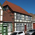
Residential building | 2-tier Half-timbered building with a half- hip roof |
 |
|
|
Jungfernstrasse 6 (map) |
Residential building | ||
|
|
Jungfernstrasse 7 (map) |
Residential building | 1-sch. Half-timbered building with crooked hip roof and 2-tiered. Gable |
 |
|
|
Jungfernstrasse 10 (map) |
Residential building |
 |
|
|
|
Jungfernstrasse 18 (map) |
Residential building | ||
|
|
Jungfernstrasse 19 (map) |
Residential building | 1-sch. Half-timbered building with a half-hipped roof and gable. |
 |
|
|
Jungfernstrasse 21 (map) |
Residential building | 2-tier Half-timbered building with hipped roof. |
 |
|
|
Jungfernstrasse 25 (map) |
Residential building | 2-tier Half-timbered building with a half-hip roof. |
 |
|
|
Jungfernstrasse 26 (map) |
Residential house with back building | ||
|
|
Jungfernstrasse 27 (map) |
Residential building | 2-tier Half-timbered building with a half-hip roof. |
 |
|
|
Jungfernstrasse 28 (map) |
Residential building | ||
|
|
Jungfernstrasse 30 (map) |
Residential building | ||
|
|
Jungfernstrasse 32 (map) |
Parsonage (cath.) | ||
|
|
Jungfernstrasse 34 (map) |
Church (cath.) | ||
|
|
Jungfernstrasse 38 (map) |
Residential and commercial building | ||
|
|
Kampstrasse 2 (map) |
Villa Hedwig | 2-tier Plastered building from around 1900 with 3-tier. octagonal turret and gable roof. |
 |
|
|
Kampstrasse 4 (map) |
Villa Anna | 2-tier Plastered building with hipped roof and central gable projection. |
 |
|
|
Kampstrasse 14 (map) |
Residential building | 1-sch. Half-timbered building with a half-hip roof. |
 |
|
|
Kirchenstrasse (map) |
church | Gothic , single-nave brick church with buttresses and gable roof from 1290; Choir on field stone base; retracted west tower made of granite and brick with a tent roof from the 15th century; after the town fire in 1643 rebuilt using old stones in 1650; extensive restoration 1840–1844; Pulpit altar from 1844, organ from 1880. |
 |
|
|
Kirchenstrasse 4 (map) |
Residential building | ||
|
|
Kirchenstrasse 5 (map) |
Residential building | ||
|
|
Kirchenstrasse 5 (map) |
Residential building | ||
|
|
Kirchenstrasse12 (map) |
Residential building | ||
|
|
Kirchenstrasse 14 (map) |
Residential building | ||
|
|
Kirchenstrasse 19 (map) |
Residential building | ||
|
|
Kirchenstrasse 21 (map) |
Residential house with stable and bakery | ||
|
|
Kirchenstrasse 22 (map) |
Residential building | ||
|
|
Kirchenstrasse 23 (map) |
Rectory | ||
|
|
Kirchenstrasse 26 (map) |
Residential house and store | ||
|
|
Kirchenstrasse27 (map) |
Residential building | ||
|
|
Kirchenstrasse28 (map) |
Residential building | ||
|
|
Kirchenstrasse36 (map) |
Residential building | ||
|
|
Kirchenstrasse45 (map) |
Residential building | ||
|
|
Lange Straße (opposite the post office) | War memorial 1870/71 | Figure after Christian Daniel Rauch |
 |
|
|
Lange Strasse 26 (map) |
Fire tower | ||
|
|
Lange Strasse 28 (map) |
Residential building | ||
|
|
Lange Strasse 35 (map) |
Residential building | ||
|
|
Lange Strasse 39 (map) |
Residential building | ||
|
|
Lange Strasse 43 (map) |
Secret Annex | ||
|
|
Lange Strasse 46 (map) |
Residential building | ||
|
|
Lange Strasse 47 (map) |
Residential building | ||
|
|
Lange Strasse 50 (map) |
Residential building | ||
|
|
Lange Strasse 57 (map) |
Residential building | ||
|
|
Lange Strasse 67 (map) |
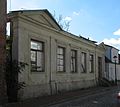
town hall | 2-tier Classicist plastered building from 1828 with a mansard roof and bat dormers , facade accentuated by a central niche and triangular gable above, neo-Gothic turret from 1853. |
 |
|
|
Lange Strasse 71 (map) |
Residential building | 2-tier Half-timbered building with a half-hip roof. |
 |
|
|
Lange Strasse 75a (map) |
Residential and commercial building | ||
|
|
Lange Strasse 81 (map) |
Residential and commercial building with a rear building | 2-tier Gable-independent half-timbered building with a crooked roof. |
 |
|
|
Lange Strasse 86 (map) |
Residential building | ||
|
|
Lange Strasse 93 (map) |
Residential building | ||
|
|
Lange Strasse 94 (map) |
Residential and commercial building with storage | ||
|
|
Lange Strasse 97 (map) |
Residential building | 2-tier Half-timbered building with a half-hip roof. |
 |
|
|
Lange Strasse 98 (map) |
Residential and commercial building | ||
|
|
Lange Strasse 100 (map) |
Residential building | ||
|
|
Lange Strasse 101 (map) |
Residential building | 2-tier clinker brick building from the Wilhelminian era with two gables |
 |
|
|
Lange Strasse 102 (map) |
Hotel "City of Hamburg" | ||
|
|
Lange Strasse 103 / 103a (map) |
Residential building (hotel), rear building and garden | 2 and 3-tier Plaster construction. |
 |
|
|
Lange Strasse 107 (map) |
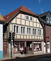
Residential and commercial building | 2-tier Half-timbered building with hipped roof and gable. |
 |
|
|
Lange Strasse 114 (map) |
Residential and commercial building | ||
|
|
Lange Strasse 115 (map) |
post Office | 2-tier Clinker brick building from the Wilhelminian era with pronounced, sloping corner formation. |
 |
|
|
Lange Strasse 116 (map) |
Residential and commercial building | former home of John Brinckman |
 |
|
|
Lange Strasse 118 (map) |
Residential and commercial building | ||
|
|
Lübzer Strasse 33 (map) |
Residential building | ||
|
|
B 192 towards Dobbertin | milestone |
 |
|
|
|
Mittelstrasse 1 (map) |
Residential building |
 |
|
|
|
Mühlenstrasse 16 (map) |
Residential building | ||
|
|
Müllerweg 2 (map) |
Watermill, formerly (local history museum) |
 |
|
|
|
Parkstrasse | Gym | ||
|
|
Schützenplatz 2 (map) |
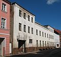
School (2 buildings) | 2-tier elongated plastered building with central gable projections, mezzanine floor and hipped roof; now John Brinckman Elementary School |
 |
|
|
Schützenplatz 3 (map) |
Residential building | ||
|
|
Schützenplatz 4 (map) |
Residential and commercial building | ||
|
|
Schützenplatz 5 (map) |
Residential building | ||
|
|
Schützenplatz 6 (map) |
Residential building | ||
|
|
Schützenplatz 7 (map) |
Residential building | ||
|
|
Schützenplatz 8 (map) |
Residential building | ||
|
|
City Park (map) |
War memorial 1914/18 | 1924 by Wilhelm Wandschneider |
 |
|
|
Werderstrasse 1 (map) |
Residential building | ||
|
|
Werderstrasse | pump |
Diestelow
| ID | location | designation | description | image |
|---|---|---|---|---|
|
|
Memorial stone 1870/71 with peace oak | |||
|
|
Manor park | The almost ten hectare landscape park, which was created in 1850, was placed under protection in 1938. |
Grambov
| ID | location | designation | description | image |
|---|---|---|---|---|
|
|
Am Park 23 (map) |
Manor house with park | The single-storey half-timbered building with a crooked hip roof was built around 1700. Today it is a plastered building with a two-story central projectile and a veranda. The almost three hectare park was created as a manor park before 1866. |
Medow
| ID | location | designation | description | image |
|---|---|---|---|---|
|
|
Am Hof 1 (map) |
manor | The single-storey half-timbered building with a half-hipped roof, erected in the 18th century, was heavily modified at the beginning of the 20th century. As today's plastered building on the front and back with two-story central projections and a veranda. |
 |
|
|
Memorial stone for collectivization |
Sehlsdorf
| ID | location | designation | description | image |
|---|---|---|---|---|
|
|
Am Kulturhaus 26 (map) |
manor | 1-sch. Half-timbered building from 1895 with a crooked hip and a 2-tier. forward arched central projection , built by the Dobbertin monastery office . |
 |
|
|
At the Kulturhaus (map) |
Pigsty | Elongated 1-tier Brick building with high hipped roof and dormers . |
Woosten
| ID | location | designation | description | image |
|---|---|---|---|---|
|
|
(Map) | church | A brick building on a field stone base and a recessed choir with a blind gable from the 14th century. The half-timbered tower above the west gable was built in 1618. |
 |
|
|
Churchyard | War memorial for the victims of both wars | The inscription on the flat side of the large field stone reads: In memory of the victims of both world wars, for us living as a warning . |
 |
Web links
Commons : Baudenkmal in Goldberg (Mecklenburg) - Collection of pictures, videos and audio files