List of ground monuments in Aachen
In the list of ground monuments in Aachen , all ground monuments in the area of the North Rhine-Westphalian city of Aachen are listed. The basis is the list of monuments as of March 19, 2013.
Monuments
![]() Map with all coordinates: OSM | WikiMap
Map with all coordinates: OSM | WikiMap
| location | description | image |
|---|---|---|
| Adalbertstrasse, Beeckstrasse, Adalbertsberg, Harscampstrasse, Kaiserplatz , Aachen city center ( location ) |
Medieval district with city walls, St. Adalbert's monastery immunity | |
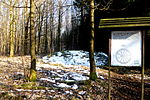
| Am Blauen Stein, Aachen- Soers ( location ) |
Landwehr, Aachener Landgraben , Paulinenwäldchen | |
| At the Schanz, Aachen city center |
Parts of the medieval outer city fortifications | |
| At the Schanz, Aachen city center |
Early modern fountain | |
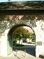
| Benediktusplatz o.Nr .; St. Kornelius / Abteigarten 2,4,6, Aachen- Kornelimünster ( location ) |
Monastery former Benedictine abbey | |
|
Brander Forst , Aachen- Brand ( cannot be localized ) |
Roman slag dump | cannot be properly localized or overgrown |
| Breiniger Strasse, Aachen-Kornelimünster ( location ) |
Varnenum - remains of a Roman temple precinct | |
| Buchkremerstraße 2/4, Aachen-Stadtmitte ( location ) |
Kaiserquelle, Bücheltherme, medieval buildings ( archaeological window in Aachen ) | |
| Buchweg, Aachen- Laurensberg ( location ) |
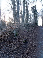
Landwehr, Inwendiger Aachener Buschgraben, Vaalserquartier | |
| Butterweiden, Aachen- Vetschau ( location ) |
Roman ruins | No longer clearly recognizable or overgrown |
| Dreiländerweg, Aachen-Laurensberg ( location ) |
Landwehr, Aachener Landgraben, three-country point | |
| Eberburgweg, Aachen-Ronheide ( location ) |
Landwehr, Aachener Landgraben, Ronheide | |
| Eisenhütte, Aachen- Walheim ( location ) |
Bunker the former West Wallanlage group shelter rule type 101b | |
| Elleterweg, Aachener Wald , near Waldstadion Aachen-Süd ( location ) |
Landwehr, Aachener Landgraben, Elleterberg / Augustinerweg | |
| Entenpfuhl, Aachen Forest Aachen-South ( location ) |
Bronze Age group of burial mounds in the Aachen city forest | |
| Eupener Straße, Aachener Wald, near Köpfchen Aachen-Süd ( location ) |
Landwehr, Aachener Landgraben, An den Zyklopensteinen | |
| Eupener Straße, near Alt-Linzenshäuschen Aachen-Süd ( location ) |
Landwehr, Inwendiger Aachener Buschgraben, Hirtzpley / Schillerhöhe | |
| Finkenhag, Aachen- Orsbach ( location ) |
Landwehr, Aachener Landgraben, Orsbach | |
| Gemmenicher Weg, Aachen-Laurensberg ( location ) |
Landwehr, Inwendiger Aachener Buschgraben, Friedrichswald | |
| Grindelweg, near Alt-Linzenshäuschen Aachen-Ronheide ( location ) |
Landwehr, Inwendiger Aachener Buschgraben, Ronheide / Steinebrück | |
| Großkölnstraße, Aachen city center ( not to be localized ) |
Early modern fountain | integrated within closed development and not visible |
| Hander Weg, Aachen-Laurensberg ( location ) |
Landwehr, Aachener Landgraben, Laurensberg-Hand | |
| Hergenrather Weg, Aachen-Bildchen ( location ) |
Landwehr, Aachener Landgraben, picture | |
| Heyder Feldweg 50, Aachen- Horbach ( location ) |
Castle deserted house Heyden | |
| Kahlgrachtstrasse, Aachen- Verlautenheide ( location ) |
Landwehr Aachener Landgraben, horse church yard Verlautenheide | |
| Kapuzinergraben 26, Aachen city center ( location ) |
Remains of the 1st city wall, Staufer, so-called Barbarossa wall | within closed development and not visible |
| Karlsgraben 50, 52, 54, Aachen-Stadtmitte ( location ) |
Remains of the first city wall, so-called Barbarossa wall | Integrated within closed development (underground car park) and not visible |
|
Katschhof , market, courtyard, Aachen city center ( location ) |
Katschhof, cathedral , town hall (church, Palatinate, settlement) | |
| Klausberg, Aachen Forest Aachen-South ( location ) |
Bronze Age group of burial mounds in the Aachen city forest | |
| Klausbergweg, Aachener Wald Aachen-Süd ( location ) |
Landwehr, Aachener Landgraben, Klausberg | |
|
Klauser Wald , Aachen-Kornelimünster ( location ) |
Section wall Klauserwald (Landwehr) | |
| Kleinheider Weg, Aachen-Verlautenheide ( location ) |
Aachener Landgraben (Verlautenheide, Pfaffenmütz) | |
| Kleinheider Weg, Aachen-Verlautenheide ( not to be localized ) |
Roman unfortified settlement Haaren-Verlautenheide | not to be localized or overgrown |
| Kleinmarschierstrasse 11–27, Aachen city center ( location ) |
Medieval fountain system | integrated within closed development and not visible |
| Kleinmarschierstrasse 47–49, Aachen city center ( location ) |
Parts of the medieval city wall (Barbarossa Wall), older wall remains and anthropogenically filled layers of earth in front of the masonry | integrated within closed development and not visible |
| Königstraße 25, Aachen-Stadtmitte ( location ) |
Modern fountain | integrated within closed development and not visible |
| Laurensberger Strasse, Aachen-Laurensberg ( location ) |
Landwehr, Aachener Landgraben, Horbach | |
|
Lousberg , Aachen-Soers ( location ) |
Neolithic mine on the Lousberg | |
| Lütticher Straße, Aachener Wald Aachen-Ronheide ( location ) |
Landwehr "Inwendiger Aachener Buschgraben", Ronheide | |
| Markt 1–3, Aachen city center ( location ) |
Roman and medieval settlement remains ( archaeological window in Aachen ) | |
| Neukellerweg, Aachen-Laurensberg ( location ) |
Landwehr, Inwendiger Aachener Buschgraben, Laurensberg, Beeck / Reinartzkehl | |
| Pannekogweg 43, Aachen-Walheim ( location ) |
Roman villa rustica on the west side of the Friesenrather Hof | integrated within closed development and not visible |
| Philippionsweg, Aachen Forest Aachen-Hanbruch ( location ) |
Inner Aachen bush ditch, on the wall | |
| Ronheider Berg, Aachener Wald Aachen-Ronheide ( not to be localized ) |
Tumulus, Ronheide / Lütticher Strasse | not to be localized or overgrown |
| Rosstrasse 61, Aachen city center ( location ) |
Modern fountain | integrated within closed development and not visible |
| Schneebergweg, Aachen-Laurensberg ( location ) |
Former Melaten leper station | |
| Sebastianusweg, Aachen- Eilendorf ( location ) |
Westwall, section Aachen, Sebastianusweg | |
| Steinkaulplatz, Aachen-Kornelimünster ( location ) |
High medieval outflow channel Höllenloch / Höllenbachkanal | |
| Süsterfeldstraße, Aachen-Stadtmitte ( not to be localized ) |
Roman baths and settlement remains | not to be localized or integrated within closed development and not visible |
| Templergraben 88–90, Aachen city center ( location ) |
High medieval moat with counter wall, backfill layers and structural remains ( archaeological window in Aachen ) | |
| Unterer Backertsweg, Aachener Wald Aachen- Preuswald ( location ) |
Burial mound, Aachen city forest, Preuswald | not visible and overgrown |
| Unterer Backertsweg, Aachen Forest Aachen-Preuswald ( location ) |
Preuswald tumulus | not visible and overgrown |
| Ursulinerstraße 7-9, Aachen city center ( location ) |
Roman wall of a portico of the 2nd / 3rd centuries Century ( archaeological window in Aachen ) | |
| Vossenweg, Aachen Forest Aachen-Laurensberg ( location ) |
Landwehr, Aachener Landgraben, Heldsruh, Preuswald |
See also
Web links
Individual evidence
- ↑ Mention of villa rustica on the pages of the history association Hahn und Friesenrath eV


