List of ground monuments in Happurg
The ground monuments of the Central Franconian community of Happurg are compiled on this page . This table is a partial list of the list of ground monuments in Bavaria . The basis is the Bavarian Monument List , which was first drawn up on the basis of the Bavarian Monument Protection Act of October 1, 1973 and has since been managed by the Bavarian State Office for Monument Preservation . The following information does not replace the legally binding information from the monument protection authority.
As of October 12, 2018, 41 ground monuments from Happurg are registered in the Bavarian list of monuments.
Notes on the information in the table
- Name, designation column : Designation of the listed property
- District column : District in which the listed property is located
- Coordinates column : Geographical location
- Monument number column : Official monument number of the Bavarian State Office for Monument Preservation
- Column -time job : Special data so far known or derivable partly date of first mention of the property
- Monument scope column , comment : More detailed explanations about the monument status, the scope of the property and its special features
Except for the picture column , all columns can be sorted.
List of ground monuments
| Name, description | District | Coordinates | Monument number | Time position | Monument scope, remark | image |
|---|---|---|---|---|---|---|
| Medieval castle stable | Happurg | 49 ° 29 '31.97 " N , 11 ° 28' 38.36" O | D-5-6534-0013 | Burgstall Hacburg | ||
| Cave station of the Paleolithic and the Urnfield Period | Happurg | 49 ° 29 '4.27 " N , 11 ° 29" 32.14 " E | D-5-6534-0014 | Hollow rock (E 2) |
 more pictures |
|
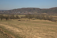
| Medieval tower hill | Happurg | 49 ° 29 '52.36 " N , 11 ° 27' 35.17" O | D-5-6534-0015 | Hundsdruck tower hill , a few meters above the valley floor of the Pegnitz valley |
 more pictures |
|
| Ring wall before - and prehistoric times, hilltop settlement of the bronze , urn fields, Hallstatt , Latène and Roman imperial times as well as the early Middle Ages | Happurg | 49 ° 29 ′ 33 " N , 11 ° 29 ′ 11.04" E | D-5-6534-0018 | Houbirg , the 4.5 kilometer long ring wall covers an area of around 1100 × 800 meters (88 hectares) |
 more pictures |
|
| Hallstatt period settlement | Förrenbach | 49 ° 28 '42.26 " N , 11 ° 29' 36.07" O | D-5-6534-0019 | Right on the bank of the Happurger Bach | ||
| Settlement of the Urnfield Period | Happurg | 49 ° 28 ′ 52.5 " N , 11 ° 28 ′ 32.92" E | D-5-6534-0021 | |||
| Prehistoric settlement | Happurg | 49 ° 28 ′ 45.26 " N , 11 ° 28 ′ 27.57" E | D-5-6534-0024 | |||
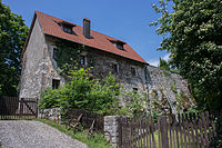
| Medieval and early modern findings in the area of the Reicheneck castle ruins | Kainsbach | 49 ° 28 '30.85 " N , 11 ° 29" 7.37 " E | D-5-6534-0025 | Reicheneck Castle , hilltop castle above the reservoir |
 more pictures |
|
| Burial mound of prehistoric times | Kainsbach | 49 ° 28 '30.85 " N , 11 ° 29" 7.37 " E | D-5-6534-0026 | |||
| Burial mound of prehistoric times | Kainsbach | 49 ° 26 '13.97 " N , 11 ° 28' 44.1" E | D-5-6534-0027 | On the “Landerbühl” south of Schupf | ||
| Settlement of the Urnfield Period | Kainsbach | 49 ° 27 '58.96 " N , 11 ° 28' 45.03" O | D-5-6534-0029 | In the Kainsbach valley | ||
| Settlement of the Neolithic and the Hallstatt Period | Kainsbach | 49 ° 28 ′ 13.62 " N , 11 ° 28 ′ 19.62" E | D-5-6534-0030 | |||
| Prehistoric settlement | Kainsbach | 49 ° 27 '40.31 " N , 11 ° 29" 0.55 " E | D-5-6534-0033 | In the Kainsbach valley | ||
| Prehistoric settlement | Kainsbach | 49 ° 27 '46.85 " N , 11 ° 28' 59.34" E | D-5-6534-0034 | In the Kainsbach valley | ||
| Prehistoric settlement | Kainsbach | 49 ° 27 '43.11 " N , 11 ° 28" 52.08 " E | D-5-6534-0035 | In the Kainsbach valley | ||
| Prehistoric settlement | Kainsbach | 49 ° 27 '48.95 " N , 11 ° 28" 51.29 " E | D-5-6534-0036 | In the Kainsbach valley | ||
| Prehistoric settlement | Kainsbach | 49 ° 27 '51.61 " N , 11 ° 28' 49.13" E | D-5-6534-0037 | In the Kainsbach valley | ||
| Prehistoric settlement | Kainsbach | 49 ° 27 '58.88 " N , 11 ° 28' 45.96" O | D-5-6534-0038 | In the Kainsbach valley | ||
| Prehistoric settlement | Kainsbach | 49 ° 28 ′ 1.52 " N , 11 ° 28 ′ 44.21" E | D-5-6534-0039 | On the southern edge of Kainsbach | ||
| Prehistoric settlement | Kainsbach | 49 ° 28 ′ 8.68 " N , 11 ° 28 ′ 54.72" E | D-5-6534-0040 | In Kainsbach | ||
| Prehistoric settlement | Kainsbach | 49 ° 28 ′ 34.11 " N , 11 ° 28 ′ 31.38" E | D-5-6534-0042 | In the Kainsbach valley | ||
| Open-air station from the late Paleolithic and settlement of prehistoric times | Kainsbach | 49 ° 28 '30.08 " N , 11 ° 28' 33.38" O | D-5-6534-0044 | In the Kainsbach valley | ||
| Prehistoric settlement | Förrenbach | 49 ° 28 ′ 37.94 " N , 11 ° 28 ′ 26.05" E | D-5-6534-0046 | |||
| Prehistoric settlement | Kainsbach | 49 ° 28 '40.66 " N , 11 ° 28' 35.28" O | D-5-6534-0047 | |||
| Burial mound of prehistoric times | Happurg | 49 ° 27 '48.17 " N , 11 ° 28' 4.94" E | D-5-6534-0131 | |||
| Early modern findings in the area of the former von Tucher manor | Happurg | 49 ° 29 ′ 27.24 " N , 11 ° 28 ′ 17.5" E | D-5-6534-0136 | In Happurg | ||
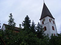
| Medieval and early modern findings in the area of the Evangelical Lutheran parish church of St. Maria and St. Georg | Happurg | 49 ° 29 ′ 32.14 " N , 11 ° 28 ′ 19.24" E | D-5-6534-0166 | Church of St. Mary and St. George |
 more pictures |
|
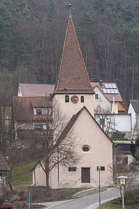
| Medieval and early modern findings in the area of the Evangelical Lutheran parish church of St. Stephan | Kainsbach | 49 ° 28 ′ 7.86 " N , 11 ° 28 ′ 57.77" E | D-5-6534-0171 | St. Stephen Church |
 more pictures |
|
| Mesolithic pitch | Förrenbach | 49 ° 28 ′ 30.46 " N , 11 ° 30 ′ 17.6" E | D-5-6535-0008 | In Förrenbach in the area of the street Am Bühl | ||
| Mesolithic open-air station and late Neolithic settlement | Thalheim | 49 ° 28 '30.51 " N , 11 ° 32' 36.68" O | D-5-6535-0009 | |||
| Hallstatt period settlement | Thalheim / Pommelsbrunn | 49 ° 27 '58.57 " N , 11 ° 33" 12.2 " E | D-5-6535-0045 | Ground monument crossing the municipal boundary to Pommelsbrunn | ||
| Burial mounds from the early Hallstatt period | Thalheim / Pommelsbrunn | 49 ° 27 '54.72 " N , 11 ° 33' 10.38" E | D-5-6535-0046 | Ground monument crossing the municipal boundary to Pommelsbrunn | ||
| Medieval castle stable | Förrenbach | 49 ° 28 '12.4 " N , 11 ° 30' 46.84" E | D-5-6535-0074 | Burgstall on the Vogelfels , on the mountain summit of the same name, partially overbuilt by a mountain hut | ||
| Prehistoric settlement | Polland | 49 ° 26 '48.27 " N , 11 ° 31' 59.05" E | D-5-6535-0078 | On the Hummersberg near Gotzenberg | ||
| Rock roof with finds from the Meso- and Neolithic, the Metal Age as well as the Middle Ages and the Modern Age | Förrenbach | 49 ° 28 '50.01 " N , 11 ° 30' 30.62" E | D-5-6535-0083 | |||
| Late medieval predecessor of the Evangelical Lutheran parish church of St. John the Baptist | Förrenbach | 49 ° 28 '32.77 " N , 11 ° 30' 3.89" E | D-5-6535-0119 | Church of St. John |
 more pictures |
|
| Late medieval and early modern findings in the area of the Evangelical Lutheran branch church St. Peter and Paul | Thalheim | 49 ° 27 '33.84 " N , 11 ° 32' 33.18" E | D-5-6535-0123 | Church of St. Peter and Paul |
 more pictures |
|
| Late medieval and early modern predecessor buildings of Thalheim Castle | Thalheim | 49 ° 27 '34.99 " N , 11 ° 32' 34.94" O | D-5-6535-0124 | Thalheim Castle |
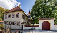 more pictures |
|
| Settlement of the metal ages | Förrenbach | 49 ° 28 ′ 28.59 " N , 11 ° 30 ′ 28.4" E | D-5-6535-0134 | East of Förrenbach | ||
| Prehistoric settlement | Polland | 49 ° 27 '8.96 " N , 11 ° 33' 9.55" E | D-5-6535-0135 | On the "Rohrberg" | ||
| Burial place of prehistoric times with burial mound | 49 ° 28 ′ 56.08 " N , 11 ° 26 ′ 55.26" E | D-5-6534-0059 |
See also
Web links
- List of monuments for Pommelsbrunn (PDF) at the Bavarian State Office for Monument Preservation
- Bavarian Monument Atlas (cartographic representation of the Bavarian architectural and ground monuments by the BLfD , requires JavaScript)
Remarks
- ↑ This list may not correspond to the current status of the official list of monuments. The latter can be viewed on the Internet as a PDF using the link given under web links and is also mapped in the Bavarian Monument Atlas . Even these representations, although they are updated daily by the Bavarian State Office for Monument Preservation , do not always and everywhere reflect the current status. Therefore, the presence or absence of an object in this list or in the Bavarian Monument Atlas does not guarantee that it is currently a registered monument or not. The Bavarian List of Monuments is also an information directory. The monument property - and thus the legal protection - is defined in Art. 1 of the Bavarian Monument Protection Act (BayDSchG) and does not depend on the mapping in the Monument Atlas and the entry in the Bavarian Monument List. Objects that are not listed in the Bavarian Monument List can also be monuments if they meet the criteria according to Art. 1 BayDSchG. Early involvement of the Bavarian State Office for Monument Preservation according to Art. 6 BayDSchG is therefore necessary in all projects.
