List of ground monuments in Pommelsbrunn
The ground monuments of the Central Franconian community of Pommelsbrunn are compiled on this page . This table is a partial list of the list of ground monuments in Bavaria . The basis is the Bavarian Monument List , which was first drawn up on the basis of the Bavarian Monument Protection Act of October 1, 1973 and has since been managed by the Bavarian State Office for Monument Preservation . The following information does not replace the legally binding information from the monument protection authority.
As of October 16, 2018, 78 ground monuments from Pommelsbrunn have been entered in the Bavarian list of monuments.
Notes on the information in the table
- Name, designation column : Designation of the listed property
- District column : District in which the listed property is located
- Coordinates column : Geographical location
- Monument number column : Official monument number of the Bavarian State Office for Monument Preservation
- Column -time job : Special data so far known or derivable partly date of first mention of the property
- Monument scope column , comment : More detailed explanations about the monument status, the scope of the property and its special features
Except for the picture column , all columns can be sorted.
List of ground monuments
| Name, description | District | Coordinates | Monument number | Time position | Monument scope, remark | image |
|---|---|---|---|---|---|---|
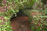
| Cave in the "Burned Mountain" (A 156) with prehistoric finds | Hubmersberg / Etzelwang | 49 ° 31 '51.87 " N , 11 ° 32' 47.02" E | D-3-6435-0061 | Cave in Burned Mountain (A 156). Soil monument crossing the municipal boundary to Etzelwang. | ||
| Burial mound of prehistoric times | Eschenbach | 49 ° 32 '22.76 " N , 11 ° 29' 30.12" O | D-5-6434-0099 | On the "Langen Bühl", north of Eschenbach | ||
| Body graves from the urnfield era | Eschenbach | 49 ° 32 '9.16 " N , 11 ° 29' 33.07" O | D-5-6434-0100 | North of Eschenbach | ||
| Cave station of prehistoric times | Eschenbach / Vorra | 49 ° 32 '50.97 " N , 11 ° 29' 1.44" E | D-5-6434-0101 | Brunnerschacht (A 129) in the forest area "Fichtig". Ground monument crossing the municipal boundary to Vorra. | ||
| Section fortification of the late Hallstatt and early La Tène periods | Hohenstadt | 49 ° 30 '59.16 " N , 11 ° 28" 59.98 " E | D-5-6434-0105 | Section fortification Hohenstädter Fels . Possibly Hallstatt time high sacrifice place. | ||
| Free-field station of the Mesolithic and settlement of prehistoric times | Hohenstadt | 49 ° 30 '56.58 " N , 11 ° 29' 45.57" O | D-5-6434-0106 | |||
| Settlement of the early La Tène period | Hohenstadt | 49 ° 30 '12.92 " N , 11 ° 29" 19.91 " E | D-5-6434-0107 | At the Pommelsbrunn tennis court | ||
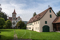
| Medieval moated castle , early modern moated castle | Eschenbach | 49 ° 31 '45.48 " N , 11 ° 29' 23.85" O | D-5-6434-0169 | Eschenbach Castle , successor to a moated castle |
 more pictures |
|
| Medieval and early modern findings in the area of the Evangelical Lutheran parish church of St. Paul and its fortified churchyard | Eschenbach | 49 ° 31 '44.7 " N , 11 ° 29' 30.26" E | D-5-6434-0170 | St. Paul Church | ||
| Medieval predecessor buildings of the Evangelical Lutheran parish church of St. Wenceslaus and Wolfgang | Hohenstadt | 49 ° 30 '41.12 " N , 11 ° 28" 58.41 " E | D-5-6434-0173 | Church of St. Wenceslaus and Wolfgang | ||
| Castle stable of the Middle Ages | 49 ° 32 '22.81 " N , 11 ° 28' 53.58" E | D-5-6434-0248 | ||||
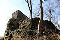
| Medieval and early modern findings in the area of the Lichtenstein castle ruins | Pommelsbrunn | 49 ° 30 '28.72 " N , 11 ° 29' 58.03" O | D-5-6435-0009 | Lichtenstein castle ruins |
 more pictures |
|
| Section reinforcement of prehistoric times | Hohenstadt | 49 ° 31 '12.31 " N , 11 ° 30' 10.77" E | D-5-6435-0010 | Section fortification Windburg | ||
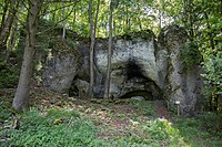
| Cave station from the Hallstatt and early La Tène periods as well as the late Middle Ages | Hubmersberg | 49 ° 32 '10.98 " N , 11 ° 31' 34.24" E | D-5-6435-0011 | Osterloch in Hegendorf (A 2) |
 more pictures |
|
| Sacrifice place of the Urnfield and Hallstatt times | Hubmersberg | 49 ° 32 '56.43 " N , 11 ° 30' 41.16" O | D-5-6435-0012 | Siegelstein near Fischbrunn | ||
| Cave station of prehistoric times and the Middle Ages | Hubmersberg | 49 ° 31 '13.69 " N , 11 ° 32' 6.5" E | D-5-6435-0013 | Fisherman's Cave (A 3) |
 more pictures |
|
| Lime kilns of the Middle Ages and modern times | Hubmersberg | 49 ° 32 '31.05 " N , 11 ° 31' 30.66" O | D-5-6435-0014 | On the Hirtenberg, north of Hegendorf | ||
| Body graves of the late Neolithic and settlement of the Latène period | Hartmannshof | 49 ° 30 '0.18 " N , 11 ° 32' 8.15" E | D-5-6435-0020 | North of the Hartmannshofer sports field | ||
| Cave station of prehistoric times | Hartmannshof | 49 ° 30 '13.9 " N , 11 ° 32' 37.54" E | D-5-6435-0023 | Steinberg-Höhlenruine (cave ruins of Hunas) (A 236) |
 more pictures |
|
| Late Neolithic settlement | Hubmersberg | 49 ° 31 '10.39 " N , 11 ° 32' 3.3" E | D-5-6435-0029 | South of Heuchling | ||
| Medieval castle stable | Hubmersberg | 49 ° 31 '26.07 " N , 11 ° 32' 14.39" E | D-5-6435-0122 | Probably from the Middle Ages | Purkstal tower hill |
 more pictures |
| Medieval and early modern findings in the area of the Evangelical Lutheran parish church of St. Lorenz and its fortified churchyard | Pommelsbrunn | 49 ° 30 '12.21 " N , 11 ° 30' 44.84" E | D-5-6435-0128 | St. Lorenz Church | ||
| Medieval castle stable | Pommelsbrunn | 49 ° 29 '44.66 " N , 11 ° 30' 59.21" E | D-5-6535-0011 | Burgstall old house |
 more pictures |
|
| Hill settlement of the Schnurkeramik , the Urnfield, Hallstatt and early Latène times as well as ramparts of prehistoric times | Arzlohe | 49 ° 28 '51.95 " N , 11 ° 31' 51.31" O | D-5-6535-0012 | Hochberg ramparts | ||
| Early modern lime kilns | Arzlohe | 49 ° 28 '46.26 " N , 11 ° 32' 22.59" E | D-5-6535-0013 | East of Mittelburg | ||
| Lime kiln of the late Middle Ages | Arzlohe | 49 ° 28 '32.92 " N , 11 ° 31' 46.09" E | D-5-6535-0014 | West of Mittelburg | ||
| High medieval desert | Arzlohe | 49 ° 29 '11.55 " N , 11 ° 32' 39.59" O | D-5-6535-0015 | |||
| Mesolithic open-air station and settlement from the late Neolithic and Latène periods | Arzlohe | 49 ° 28 '46.63 " N , 11 ° 32' 3.02" O | D-5-6535-0016 | |||
| Settlement of the early La Tène period | Arzlohe | 49 ° 28 '52.09 " N , 11 ° 32' 23.84" O | D-5-6535-0017 | |||
| Mesolithic open-air station, settlement and graves from the early La Tène period | Arzlohe | 49 ° 28 ′ 45.05 " N , 11 ° 34 ′ 56.37" E | D-5-6535-0018 | |||
| Mesolithic outdoor station, Neolithic and early Latène settlement | Arzlohe | 49 ° 28 '54.88 " N , 11 ° 32' 29.91" O | D-5-6535-0019 | |||
| Settlement of the Urnfield Period | Arzlohe | 49 ° 29 '8.41 " N , 11 ° 33' 51.27" E | D-5-6535-0020 | |||
| Burial mound of prehistoric times | Arzlohe | 49 ° 29 '3.51 " N , 11 ° 32' 40.75" O | D-5-6535-0021 | Early La Tène | At the foot of the Kühberg near Waizenfeld | |
| Mesolithic outdoor station and Neolithic settlement | Arzlohe | 49 ° 28 '35.2 " N , 11 ° 31' 38.8" E | D-5-6535-0022 | |||
| Lime kilns of the late Middle Ages | Arzlohe / Birgland | 49 ° 28 '36.99 " N , 11 ° 35' 20.54" E | D-5-6535-0023 | Ground monument that crosses the municipal boundary to Birgland | ||
| Settlement of the late Hallstatt and early La Tène periods | Arzlohe | 49 ° 28 ′ 49.06 " N , 11 ° 32 ′ 32.58" E | D-5-6535-0024 | |||
| Free-field station of the Mesolithic | Arzlohe | 49 ° 28 '38.24 " N , 11 ° 32' 41.13" O | D-5-6535-0026 | |||
| Mesolithic open-air station, Neolithic and Late Latène settlement | Arzlohe | 49 ° 29 '15.72 " N , 11 ° 32' 44.27" E | D-5-6535-0027 | |||
| Settlement of the Neolithic and the Bronze Age | Arzlohe | 49 ° 29 ′ 10.86 " N , 11 ° 34 ′ 28.2" E | D-5-6535-0028 | At the "Vogelherd" | ||
| Free-field station of the Mesolithic | Arzlohe | 49 ° 29 '21.88 " N , 11 ° 32" 42.08 " E | D-5-6535-0030 | |||
| Bronze Age burial mounds, settlement and moat from prehistoric times | Arzlohe | 49 ° 29 '5.35 " N , 11 ° 34' 26.65" O | D-5-6535-0033 | |||
| Hallstatt period settlement | Arzlohe | 49 ° 29 '6.21 " N , 11 ° 33' 37.03" O | D-5-6535-0034 | |||
| Bronze Age settlement | Arzlohe | 49 ° 29 '15.27 " N , 11 ° 33' 43.46" O | D-5-6535-0035 | |||
| Bronze Age settlement | Arzlohe | 49 ° 29 '17.82 " N , 11 ° 33' 24.92" E | D-5-6535-0036 | |||
| Settlement of the Late Bronze and Urnfield Ages | Hartmannshof | 49 ° 29 '25.81 " N , 11 ° 33' 12.81" E | D-5-6535-0037 | |||
| Hallstatt burial mound | Arzlohe | 49 ° 29 '24.88 " N , 11 ° 33' 31.89" O | D-5-6535-0038 | |||
| Burial mound of prehistoric times | Heldmannsberg | 49 ° 27 '49.05 " N , 11 ° 33' 3.62" E | D-5-6535-0041 | |||
| Burial mound of prehistoric times | Heldmannsberg | 49 ° 28 '25.47 " N , 11 ° 33' 39.97" E | D-5-6535-0042 | |||
| Burial mound of prehistoric times | Heldmannsberg | 49 ° 28 '20.67 " N , 11 ° 33' 56.98" E | D-5-6535-0043 | |||
| Free-field station of the Mesolithic | Heldmannsberg | 49 ° 27 '37.34 " N , 11 ° 34' 14.79" E | D-5-6535-0044 | |||
| Hallstatt period settlement | Heldmannsberg | 49 ° 27 '58.57 " N , 11 ° 33" 12.2 " E | D-5-6535-0045 | Ground monument crossing the municipal boundary to Happurg | ||
| Burial mounds from the early Hallstatt period | Heldmannsberg | 49 ° 27 '54.72 " N , 11 ° 33' 10.38" E | D-5-6535-0046 | Ground monument crossing the municipal boundary to Happurg | ||
| Neolithic settlement | Heldmannsberg | 49 ° 28 '27.53 " N , 11 ° 35' 33.33" E | D-5-6535-0047 | |||
| Mesolithic outdoor station | Heldmannsberg | 49 ° 28 '24.23 " N , 11 ° 33' 33.45" E | D-5-6535-0049 | |||
| Mesolithic outdoor station | Heldmannsberg | 49 ° 28 '26.27 " N , 11 ° 33' 44.02" E | D-5-6535-0050 | |||
| Mesolithic open air station and Neolithic settlement | Heldmannsberg | 49 ° 28 '16.72 " N , 11 ° 33' 28.35" E | D-5-6535-0051 | |||
| Mesolithic outdoor station | Heldmannsberg | 49 ° 27 '46.54 " N , 11 ° 33' 40.31" O | D-5-6535-0052 | |||
| Mesolithic outdoor station, settlement of the Urnfield and Hallstatt period | Hartmannshof | 49 ° 29 '35.86 " N , 11 ° 33' 21.42" E | D-5-6535-0059 | In the "Breitfeld" | ||
| Settlement of the Urnfield and Hallstatt Period | Hartmannshof | 49 ° 29 '41.49 " N , 11 ° 33' 4.88" E | D-5-6535-0060 | In the local area of Hartmannshof | ||
| Settlement of the Urnfield and Latène times, smelting site of the late Middle Ages | Hartmannshof | 49 ° 29 ′ 47.16 ″ N , 11 ° 33 ′ 9 ″ E | D-5-6535-0061 | In the local area of Hartmannshof | ||
| Settlement of the early and late La Tène period | Hartmannshof | 49 ° 29 '43.3 " N , 11 ° 32' 56.82" E | D-5-6535-0047 | In the local area of Hartmannshof | ||
| Open-air station from the Mesolithic, settlement of the Neolithic, the Urnfield, Hallstatt and Latène Ages as well as the Roman Imperial Era, smelting site of the early Middle Ages | Hartmannshof | 49 ° 29 '43.16 " N , 11 ° 32' 49.23" O | D-5-6535-0066 | In the local area of Hartmannshof | ||
| Free-field station of the Mesolithic | Hartmannshof | 49 ° 29 '40.01 " N , 11 ° 33' 37.17" O | D-5-6535-0067 | |||
| Free-field station of the Mesolithic | Hartmannshof | 49 ° 29 '32.41 " N , 11 ° 33' 37.33" E | D-5-6535-0068 | |||
| Mesolithic outdoor station, Neolithic and Urnfield settlements | Hartmannshof | 49 ° 29 '30.46 " N , 11 ° 33' 15.66" E | D-5-6535-0069 | |||
| Burial mound of prehistoric times | Pommelsbrunn | 49 ° 29 ′ 31.93 " N , 11 ° 30 ′ 24.45" E | D-5-6535-0072 | On the "Eichelberg" | ||
| Late Latene settlement | Heldmannsberg | 49 ° 27 '35.19 " N , 11 ° 34' 51.16" E | D-5-6535-0073 | |||
| Neolithic settlement | Heldmannsberg | 49 ° 27 '17.21 " N , 11 ° 34' 18.15" E | D-5-6535-0082 | |||
| Prehistoric settlement | Arzlohe | 49 ° 29 '28.6 " N , 11 ° 33' 46.03" E | D-5-6535-0084 | |||
| Prehistoric settlement | Arzlohe | 49 ° 29 '11.56 " N , 11 ° 32' 51.31" O | D-5-6535-0085 | |||
| Prehistoric settlement | Arzlohe | 49 ° 28 '48.66 " N , 11 ° 34' 45.13" O | D-5-6535-0086 | |||
| Bronze Age hilltop settlement | Heldmannsberg | 49 ° 27 '22.82 " N , 11 ° 33' 40.5" E | D-5-6535-0089 | On the “Zant” at Claramühle | ||
| Prehistoric settlement | Arzlohe | 49 ° 29 '5.44 " N , 11 ° 32' 58.49" O | D-5-6535-0090 | |||
| Prehistoric settlement | Arzlohe | 49 ° 28 '50.1 " N , 11 ° 33' 4.02" E | D-5-6535-0091 | In the "Gunzenbühl" | ||
| Medieval and early modern findings in the area of the St. Rochus and St. Leonhard chapel ruins | Arzlohe | 49 ° 29 '0.79 " N , 11 ° 30' 51.4" E | D-5-6535-0098 | Chapel ruins St. Rochus and St. Leonhard | ||
| Medieval and early modern findings in the area of the Catholic parish church Mariae Himmelfahrt | Heldmannsberg | 49 ° 27 '49.99 " N , 11 ° 33' 44.23" O | D-5-6535-0102 | Church of the Assumption of Mary |
 more pictures |
|
| Cave station of prehistoric times | Heldmannsberg | 49 ° 27 '35.56 " N , 11 ° 34" 10.21 " E | D-5-6535-0103 | Spurzlgrub Cave (E 33) | ||
| Medieval castle stable | Hartmannshof | 49 ° 29 '43.89 " N , 11 ° 32' 54.32" E | D-5-6535-0133 | Burgstall Hartmannshof , in the area of Fleckstraße |
See also
Web links
- List of monuments for Pommelsbrunn (PDF) at the Bavarian State Office for Monument Preservation
- Bavarian Monument Atlas (cartographic representation of the Bavarian architectural and ground monuments by the BLfD , requires JavaScript)
Individual evidence
- ^ John P. Zeitler: Pommelsbrunn-Hohenstadt: The Hohenstädter Fels - A Hallstattzeiltlicher Höhenopferplatz . In: Alfried Wieczorek (Hrsg.): Excursions to archeology, history and culture in Germany. Volume 52: Nuremberg and Nürnberger Land - excursion destinations between Pegnitz and Franconian Alb . Konrad Theiss Verlag, Stuttgart 2010, ISBN 978-3-8062-2368-2 , pp. 206-207.
- ↑ Robert Giersch, Andreas Schlunk, Berthold Frhr. von Haller: Castles and mansions in the Nuremberg countryside . Published by Altnürnberger Landschaft eV, Lauf an der Pegnitz 2006, ISBN 978-3-00-020677-1 , p. 61
- ↑ Werner Sörgel: Sunken Cultures - Hartmannshof - Archeology of a small region in the Franconian Alb . Pp. 130-134
Remarks
- ↑ This list may not correspond to the current status of the official list of monuments. The latter can be viewed on the Internet as a PDF using the link given under web links and is also mapped in the Bavarian Monument Atlas . Even these representations, although they are updated daily by the Bavarian State Office for Monument Preservation , do not always and everywhere reflect the current status. Therefore, the presence or absence of an object in this list or in the Bavarian Monument Atlas does not guarantee that it is currently a registered monument or not. The Bavarian List of Monuments is also an information directory. The monument property - and thus the legal protection - is defined in Art. 1 of the Bavarian Monument Protection Act (BayDSchG) and does not depend on the mapping in the Monument Atlas and the entry in the Bavarian Monument List. Objects that are not listed in the Bavarian Monument List can also be monuments if they meet the criteria according to Art. 1 BayDSchG. Early involvement of the Bavarian State Office for Monument Preservation according to Art. 6 BayDSchG is therefore necessary in all projects.


