List of cultural monuments in Rosbach vor der Höhe
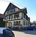
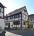
The following list contains the cultural monuments identified in the monument topography in the area of the city of Rosbach vor der Höhe , Wetteraukreis , Hesse .
- Note: The order of the monuments in this list is based first on the districts and then on the address, alternatively it can also be sorted according to the name, the number assigned by the State Office for Monument Preservation or the construction time.
The basis is the publication of the Hessian list of monuments, which was created for the first time on the basis of the Monument Protection Act of September 5, 1986 and has been continuously updated since then.
Nieder-Rosbach
| image | designation | location | description | construction time | Object no. |
|---|---|---|---|---|---|
 |
Erbsengasse 10, corridor location : 1, parcel: 790/1 |
6796 |
|||
 |
Frankenstraße 1 Location hallway: 1, parcel: 784/1 |
6798 |
|||
 |
Frankenstraße 2 Location hallway: 1, parcel: 720/1 |
6800 |
|||
 |
Frankenstraße 8 Location hall: 1, parcel: 716 |
6802 |
|||
 |
Frankenstraße 17 Location hall: 1, parcel: 636/1 |
6804 |
|||
 |
Parish hall, former parish barn | Frankenstraße 19 Location floor: 1, parcel: 638/1 |
6806 |
||
 |
Frankenstraße 20 Location floor: 1, parcel: 657 |
6808 |
|||
 |
Frankenstraße 21 Location hall: 1, parcel: 642 |
6810 |
|||
 |
Frankenstraße 23 Location hall: 1, parcel: 643 |
6812 |
|||
| Nieder-Rosbach | Overall system |
6794 |
|||
 |
Ev. Parish church | Haingraben 10 position hall 1, hall unit: 640/1 |
6822 |
||
 |
Former Moated castle | Haingraben 17 Corridor location : 1, parcel: 615/10 |
6814 |
||
| Schulstraße 17 Location hallway: 1, parcel: 816/1 |
6816 |
||||
 |
Schulstraße 18 Location floor: 1, parcel: 635 |
6818 |
|||
 |
Village community center, originally a school | Schulstraße 20 Location hall: 1, parcel: 632/3 |
6820 |
Ober-Rosbach
| image | designation | location | description | construction time | Object no. |
|---|---|---|---|---|---|
 more pictures |
Rosbach vd Höhe station | Am Bahnhof 6 Location Village: 5, plot: 266/3 |
6904 |
||
 more pictures |
Kapersburg Limes Fort | External location |
6906 |
||
| Baidergasse one location Village: 1, plot: 627/2 |
6830 |
||||
 more pictures |
Baidergasse 2 Location hall: 1, parcel: 782 |
6832 |
|||
 more pictures |
Baidergasse 4 Location hall: 1, parcel: 780 |
6834 |
|||
 |
Baidergasse 11 Location hall: 1, parcel: 639 |
6836 |
|||
 more pictures |
Beinhardshof | Outside (Beinhardshof) Location hallway: 31, parcel: 5/3 |
6908 |
||
 more pictures |
Former Solms-Rödelheim'sches forest office | Beinhardshof location hall: 31, parcel: 11/1 |
6910 |
||
  more pictures |
graveyard | Bergstraße o. No. Location floor: 1, parcel: 241/3 |
Two memorials are under protection in the cemetery: the memorial for those who fell in the Franco-German War 1870/71, an obelisk with a wreath of honor and the 1926 memorial for those who fell in Ober-Rosbach in the form of a square open hall retracted pyramid roof. | 1895 |
6838 |
 |
Friedberger Straße 1 Location floor: 1, parcel: 556 |
6840 |
|||
 more pictures |
Friedberger Straße 3 Location floor: 1, parcel: 557 |
6842 |
|||
 |
Friedberger Straße 7 Location hall: 1, parcel: 584/3 |
6844 |
|||
 |
Former Gasthof 'Der Goldene Stern', today 'Zur Linde' | Friedberger Strasse 9 location |
6846 |
||
 |
Friedberger Straße 23 Location hallway: 1, parcel: 389 |
6848 |
|||
 |
Friedberger Straße 32 Location floor: 1, parcel: 327/1 |
6850 |
|||
 |
Friedberger Straße 34 Location hall: 1, parcel: 326 |
6852 |
|||
 |
Hall construction | Fuhrenstrasse 2 position hall 1, hall piece: 320 and 321 |
6854 |
||
| Ober-Rosbach | Entire facility in Ober-Rosbach |
6826 |
|||
 more pictures |
Hintergasse 1 Location Village: 1 parcel: 558 |
6856 |
|||
 |
Hintergasse 2 position hall 1, hall piece: 582 |
6858 |
|||
| Behind Gasse 3 position hallway: 1, plot 551 |
6860 |
||||
| Hintergasse 6 position hallway: 1, plot 580 |
6862 |
||||
 more pictures |
Market fountain | Homburger Straße o. No. Location floor: 1, parcel: 1336 |
1833 |
6864 |
|
 more pictures |
Former manorial estate and late Gothic defense tower | Homburger Straße 1a / 3 Location floor: 1, parcel: 621/5, 623/5, 623/4 |
6866 |
||
  more pictures |
Former Town hall and 'summer house' | Homburger Straße 2 Location hall: 1, parcel: 554 |
6868 |
||
 |
Homburger Straße 4/6 Location hallway: 1, parcel: 548/1 |
6870 |
|||
 |
Homburger Straße 7 Location hall: 1, parcel: 626 |
6872 |
|||
 |
Homburger Straße 9 Location hallway: 1, parcel: 783 |
6874 |
|||
 |
Homburger Straße 11 Location hall: 1, parcel: 784 |
6876 |
|||
 |
Homburger Straße 13 Location hall: 1, parcel: 786 |
6878 |
|||
 more pictures |
Customs House | Homburger Straße 17 Location floor: 1, parcel: 1716 |
6880 |
||
 more pictures |
Former Rectories | Kirchstraße 1 Location hall: 1, parcel: 610/2 |
6882 |
||
| Ev. Parish church | Kirchstraße 3 Location hall: 1, parcel: 614/2 |
6884 |
|||
 |
Kaplanshaus' | Kirchstraße 14 Location hall: 1, parcel: 652 |
6886 |
||
| Kirchstraße 21 Location hall: 1, parcel: 674/1 |
6888 |
||||
 more pictures |
Neuer Weg 2, corridor location : 1, parcel: 368 |
6890 |
|||
| Nieder-Rosbacher-Straße 2 Location floor: 1, parcel: 536/1 |
6892 |
||||
| Site fortification | Fortification location |
6827 |
|||
 more pictures |
Crossroad one location Village: 1 parcel: 725 |
6894 |
|||
 |
Crossroads 3 Location Corridor: 1, parcel: 726 |
6896 |
|||
 more pictures |
Steinstraße 2 Location hallway: 1, parcel: 785 |
6898 |
|||
 |
Steinstraße 3 Location hall: 1, parcel: 750/1 |
6900 |
|||
 more pictures |
Jewish Cemetery | Taunusstraße location floor: 15, parcel: 527/7 |
The former Jewish cemetery has not been preserved. It is designed as a fenced in green area. A memorial stone reminds of the cemetery. |
6902 |
Rodheim before the height
| image | designation | location | description | construction time | Object no. |
|---|---|---|---|---|---|
 |
Gate construction | Amtsgasse 13 Location hall: 1, parcel: 544/2 |
6917 |
||
 more pictures |
Enclosure of the cemetery from 1902 | Outside hallway: 10, parcel: 27 |
7001 |
||
 |
Borngasse 9/11 Location floor: 1, parcel: 385 and 380 |
6921 |
|||
 |
Half-timbered house | Borngasse 13 Location floor: 1, parcel: 392 |
6923 |
||
 more pictures |
Burggasse 3 Location hallway: 1, parcel: 429 |
6925 |
|||
| Rodheim | Overall system |
6914 |
|||
 |
Main Street 3 Location Corridor: 1, parcel: 557 |
6927 |
|||
 more pictures |
Hauptstraße 6 Location hallway: 1, parcel: 570 |
6929 |
|||
 more pictures |
Hauptstraße 4, location hall: 1, parcel: 569 |
6931 |
|||
 |
Hauptstraße 8 Location hall: 1, parcel: 488 |
6933 |
|||
| Hauptstrasse 10 position hall 1, hall piece: 489 |
6935 |
||||
 more pictures |
Town hall and former Faselstall | Hauptstraße 12/14 Location hall: 1, parcel: 490 |
6937 |
||
 |
Former Lutheran, today Protestant parish church | Hauptstraße 16 Location hall: 1, parcel: 491 |
6939 |
||
 more pictures |
Medieval choir tower | Hauptstrasse 27 position hall 1, hall unit: 500/2 |
6941 |
||
 |
Hauptstraße 31 Location hallway: 1, parcel: 518 |
6943 |
|||
 |
Hauptstraße 42 Location hall: 1, parcel: 414 |
The house is a four-sided farmstead, the oldest parts of which date from around 1700. A half-timbered house is probably hidden under the plaster. |
6945 |
||
 |
Rodheim station | Hauptstraße 80 Location hall: 9, parcel: 275/6 |
6947 |
||
 |
Holzhäuser Straße 15 Location hall: 1, parcel: 661 |
6949 |
|||
 |
Junkergasse 2 Location hallway: 1, parcel: 348 |
6951 |
|||
 |
school | Junkerngasse 5 position hall 1, hall unit: 525/1 |
The late classicist school building, built by the district architect Süffert, was the local school from its inauguration on November 30, 1864 until 1999 and a day-care center since 2001. |
6953 |
|
 |
'Junkernhof' | Junkergasse 12-16 Location floor: 1, parcel: 342/1, 341/2, 341/3 and 338 |
6955 |
||
| Kirchgasse 1 Location hallway: 1, parcel: 503/1 |
6957 |
||||
 |
Rectory | Königstraße 1 Location hallway: 1, parcel: 582 |
6959 |
||
| Königstraße 2 Location hallway: 1, parcel: 555 |
6961 |
||||
 |
Königstraße 7 Location hallway: 1, parcel: 612/2 |
6963 |
|||
| Königstraße 15 Location hall: 1, parcel: 617 |
6965 |
||||
 |
Former inn 'Hanauer Hof' | Königstraße 19 Location hall: 1, parcel: 622/6 |
6967 |
||
 |
Königstraße 20 Location floor: 1, parcel: 544/3 |
The half-timbered house from 1679 was part of the Stolberger Hof. The county of Stolberg-Königstein was half involved in Rodheim until 1572/78. The stately courtyard is said to have also included the adjoining properties at Amtsgasse 13 and 14 and was accessible via the stone gate in the Amtsgasse (see Amtsgasse 20). |
6969 |
||
| Metzgergasse 2 Location hall: 1, parcel: 332 |
6973 |
||||
 more pictures |
Nieder-Wöllstädter Straße 1 Location floor: 1, parcel: 487 |
6975 |
|||
 more pictures |
Nieder-Wöllstädter Straße 3 Location floor: 1, parcel: 485 |
6977 |
|||
 more pictures |
Nieder-Wöllstädter Straße 6 Location floor: 1, parcel: 575/1 |
6979 |
|||
 more pictures |
Former Syringe and stick house | Nieder-Wöllstädter Straße 8 Location floor: 1, parcel: 576 |
6981 |
||
 more pictures |
Nieder-Wöllstädter Straße 10 Location floor: 1, parcel: 7 |
6983 |
|||
 |
Nieder-Wöllstädter Straße 18 Location floor: 1, parcel: 39 |
6985 |
|||
 |
Nieder-Wöllstädter Straße 22 Location floor: 1, parcel: 57/1 |
6987 |
|||
 |
Site fortification | Fortification location |
6915 |
||
 |
Former Gasthof 'Zum Grünen Baum' | Pfortgasse one location Village: 1, plot: 326/1 |
Half-timbered house of the 18th century. Originally a cooperage, later the 'Zum Grünen Baum' inn. The eye-catching extension with a bay window resting on a central column dates back to 1927 |
6989 |
|
 |
Pfortgasse 4 position hall 1, hall unit: 657/1 |
Two-storey, gable-independent building from the 17th century. Profiled threshold of the upper floor. Bracing by means of man forms on the corner posts. Diamond nets under the windows on the corner storey |
6991 |
||
 |
Pfortgasse 10 Location floor: 1, parcel: 652 |
Two-storey residential building from the 18th century. |
6993 |
||
 |
Sea 1 Location Village: 1, plot: 615/4 |
6995 |
|||
 |
Wethgasse 2 Location hall: 1, parcel: 418 |
6997 |
See also
Web links
Commons : Cultural monuments in Rosbach vor der Höhe - collection of images, videos and audio files
- State Office for Monument Preservation Hessen (Hrsg.): Cultural monuments in Rosbach in front of the height In: DenkXweb, online edition of cultural monuments in Hessen

