
Kapersburg Castle
| Kapersburg Castle | |
|---|---|
| limes | ORL 12 ( RLK ) |
| Route (RLK) |
Upper German Limes , East Taunus section |
| Dating (occupancy) | End of the 1st to the middle of the 3rd century |
| Type | Numerus fort |
| unit |
Numerus Nidensium and a Veredarii department |
| size | a) 0.8 ha b) 1.3 ha c) 1.6 ha |
| Construction | a) wood-earth b) dry stone wall c) mortar wall |
| State of preservation | very well preserved, partially preserved |
| place |
Wehrheim - Pfaffenwiesbach and Rosbach vor der Höhe - Ober-Rosbach |
| Geographical location | 50 ° 18 '47 " N , 8 ° 38' 8.4" E |
| height | 425 m above sea level NHN |
| Previous | Lochmühle fort (southwest) |
| Subsequently | Small fort Ockstädter Wald (north) |
The former Roman Limes - Kapersburg Fort in the Taunus is one of the best preserved Roman on military installations of the Upper German-Rhaetian Limes . It housed the Numerus Nidensium , an auxiliary force that had long been mistakenly assumed to have been recruited from residents of the nearby Vicus Nida . However, as early as the turn of the millennium, Marcus Reuter pointed out that this could not have been the case for epigraphic reasons as well as because of the Roman recruiting practice. The building history of the fort has shown several construction and renovation phases as well as traces of a fort vicus since the end of the 1st century . The fort was probably evacuated without a fight shortly after the middle of the 3rd century as part of the Limes Falls.


location
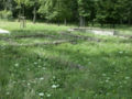
The Kapersburg fort is a good two kilometers southwest of the Steinkopf on the western border of the Wetteraukreis and the Hochtaunuskreis . With a distance of two and a half and three and a half kilometers, it is relatively remote from the nearest localities Pfaffenwiesbach , a district of the municipality of Wehrheim , and Ober-Rosbach , a district of the town of Rosbach vor der Höhe . The area of the Taunus, in which the fort is located, was already used for forestry in Roman times . The Köppern ammunition depot is right next to the fort .
history
The Kapersburg fort was built in the Trajan period at the earliest, i.e. from 98, but maybe not until around 130. The coin series points to a beginning around the middle of the 2nd century. The forerunner was possibly the small fort in Ockstädter Wald (see below).
The end of the system is also not reliably within reach. Around the middle of the 3rd century, part of the crew was probably withdrawn, as a demolition of the fort facilities can be proven during this period: The remaining crew withdrew to the northeast quarter of the facility around the grain store, the outer ramparts fell into disrepair. At the place of the former hall of the Principia a small, square and heated stone building was built, presumably the accommodation of the centurion . In order to close off the section of the fort that is still in use, a wall was drawn between this stone structure and the north gate.
The fort came to an end during the internal and external political and economic crisis of the empire around the middle of the 3rd century ( Limesfall ). However, no traces of violent destruction can be found. The coin row shows an Antoninian of Postumus as the final coin , another Antoninian of Gallienus (minted 255/56 AD) was found in the northern tower of the east gate.
investment
exploration
The Kapersburg fort was first mentioned in a document as Karpesserburgk in 1482 . The origin of the name is not certain. In the 19th century and again in the 1940s there were a few explanations, none of which could prevail.
The first archaeological investigations took place from 1879 to 1881, and systematic scientific research was carried out in 1896/97, 1901 and 1905 by the Reich Limes Commission (RLK). Further uncovering and conservation work took place between 1906 and 1914. Most recently, the fort was completely restored in connection with the recognition of the Upper German-Rhaetian Limes as a World Heritage Site in 2005 and the entire fort area was converted into an archaeological park.
Fort
A total of three construction phases could be detected in the investigations:
- Wood and earth fort with an area of approximately 0.8 hectares, which was built at the end of the 1st century AD.
- Fort with dry stone walls of around 1.3 hectares, built around the middle of the 2nd century ( late Hadrian or Antonine ).
- Fort with a mortar wall of 1.6 hectares in size, which replaced the previous building towards the end of the 2nd century.
The walls that are visible today are those of the last expansion phase.
At this stage, the warehouse, measuring 134 × 122 meters, measures over 1.6 hectares and has a rectangular floor plan with rounded corners and four gates.
The corners of the fort are rounded, the north-west corner was the only one reinforced with a tower. The entire fence is surrounded by a simple pointed ditch. The fort with the Porta praetoria (main gate) is not directly facing the Limes, which passes the Kapersburg about 60 meters to the west, but is oriented to the north towards the small fort Ockstädter Wald. Except for the Porta decumana (rear gate), all gates are provided with double towers.
The north-south axis of the camp is asymmetrically shifted to the west, which was caused by the fact that the fort expansions were oriented towards the Via praetoria and the Via principalis of the older, smaller predecessor buildings, i.e. the camp grew more or less unilaterally towards the southeast .
The principia (staff building) were located in the center, which was also shifted , but only the foundations of the flag shrine (Aedes) and a few office rooms on the southern edge of the building are visible. In addition, the Principia had a hall that stretched over the Via principalis and some outbuildings, including the armory. The principia were originally designed in half-timbered construction, the stone foundations that are available today come from a later expansion phase. In the late phase of the fort, the northern and eastern sections were demolished and built over. The flag sanctuary in particular seems to have been used up to the end of the fort, as the discovery of a genius statue from the 3rd century shows. Further walls can be found in the northeast quarter of the interior of the fort, these are the remains of the horreum (granary) and the praetorium (commandant's residence). The Horreum , visible today in remains , was built in 208 or 209 above the demolished original praetorium. Other remains of the wall in this area probably belong to the commandant's bathroom. All other internal structures are likely to have consisted of half-timbering and are no longer visible today.
garrison
A numerus nidensium could be proven as the occupation of the Kapersburg . The name of the auxiliary group suggests that the unit was recruited in nearby Nida (today: Frankfurt-Heddernheim ), the main town of the Civitas Taunensium . The number of around 150 men was reinforced by a small cavalry department (Veredarii) . The find of an Epona relief with an inscription, which is now in the Wetterau Museum, fits the mounted troop .
Foundation of the principia with apse of the flag shrine

Stone foundation from the last construction phase of the fort, presumably the commandant's apartment

Foundation of the grain store, in the background presumed foundations of the commandant's bath

Foundation of the west gate, flanked by two watchtowers from the perspective of the interior of the complex


Fort bath and vicus
Between the fort and the Limes are the very well-preserved foundations of the fort bath, which was built in the middle of the second century at the latest, and which is a beautiful example of the uniaxial thermal bath architecture of the Romans (so-called row type ). The apodyterium (changing room) probably consisted of half-timbering and is no longer preserved. The structures of all other rooms (a frigidarium (cold bath), two tepidariums (leaf baths), a caldarium (warm bath) and a sudatorium (sweat bath)) have been preserved, so that the structure of such a balineum is very easy to understand for the visitor . The individual departments were aligned with the west gate of the fort in the logical sequence of the bathing process. The bathing facility was supplied with energy via three prefurnia (firing points), with the exception of the apodyterium and the frigidarium , all rooms were heated by hypocausts . The water supply was ensured by a nearby spring that still exists today.
The extensive area of a vicus (camp village) and a burial ground could be located around the fort, but their full dimensions could not be recorded. The vicus is mainly located on the eastern side of the camp facing the Saukopf mountain. The remains can only be seen with a trained eye.
Surroundings
In Roman times the Kapersburg fort could be reached via the Limesweg, via Köppern and via Ober-Rosbach from the Civitas Taunensium . The traffic over the Taunus ridge into the Usingen Basin, which has been relatively densely populated since the ceramic era , could be controlled here. The old trade route from the south-east still bears the name “Hühnerpfad” (in Köppern “Im Hahnereck”), which could indicate a pre-Roman use of this route.
In the north of the well-preserved course of the Limes in this area, there are two former small forts and a reconstructed stone watchtower adjacent to the Kapersburg fort. It concerns the small fort Ockstädter Wald and Kaisergrube as well as the guard post on the Gaulskopf .
The small fort Ockstädter Wald , located only 700 meters north of the Kapersburg, was an approximately 0.2 hectare, single-gate wooden fort from a very early construction phase of the Limes. The gate of the camp, which was surrounded by a simple ditch, was facing away from the Limes and facing southeast. The small fort in Ockstädter Wald was only in use for a short period of time; the unit that later built the Kapersburg may have been stationed here. After the fort was abandoned, a watchtower was built here, which is counted as Wp 4/11. A total of one wooden and two stone construction phases of this watchtower could be verified. The second stone tower site has a hexagonal floor plan, possibly an indication of a very rare hexagonal stone tower. The traces of these systems are still clearly recognizable as deformations of the terrain (wooden tower site) and as rubble mounds of the stone tower sites.
A good two kilometers further was the Kaisergrube small fort , a warehouse only around 730 square meters in size, where a wood and a stone construction phase could be demonstrated. The fort was damaged by a neighboring modern mine, but it is still clearly visible in the area.
Finally, on the next north elevation is the stone watchtower on the Gaulskopf (Wp 4/16) , which was reconstructed in 1926 . The remains of a particularly high and impressive Limes watchtower were found and restored here. The impressive tower, from which one can enjoy an excellent view, is one of the best reconstructed watchtowers in the entire Limes. The ancient original tower was certainly plastered and may also have been a little higher.
Monument protection and remains
The Kapersburg Fort and the surrounding Limes are part of the Upper Germanic-Rhaetian Limes and have been part of the UNESCO World Heritage since 2005 . In addition, they are ground monuments according to the Hessian Monument Protection Act . Investigations and targeted collection of finds are subject to approval, and accidental finds are reported to the monument authorities.
Finds from the excavations are exhibited in the Wetterau Museum in Friedberg .
The Kapersburg fort is part of the administration of state palaces and gardens in Hesse .
See also
literature
- Dietwulf Baatz : Kapersburg (Taunus) . In: The Romans in Hesse . Nikol, Hamburg 2002, ISBN 3-933203-58-9 , pp. 364-367.
- Dietwulf Baatz: The Roman Limes. Archaeological excursions between the Rhine and the Danube . Gebr. Mann, Berlin 2000, ISBN 3-7861-2347-0 .
- Bernhard Beckmann: The Roman fort Kapersburg and the small fort Ockstadt in the Taunus . Archaeological preservation of monuments in the State Office for the Preservation of Monuments Hesse, Wiesbaden 1988, ISBN 3-89822-059-1 .
- Heinrich Jacobi in the series Der Upper Germanic-Raetian Limes of the Roemerreiches (Eds. Ernst Fabricius , Felix Hettner , Oscar von Sarwey ): Department B, Volume II, 2 Fort No. 12 (1906).
- Margot Klee: The Roman Limes in Hessen. History and sites of the UNESCO World Heritage. Pustet, Regensburg 2009, ISBN 978-3-7917-2232-0 , pp. 112-116.
- Margot Klee: The Limes between Rhine and Main . Theiss, Stuttgart 1989, ISBN 3-8062-0276-1 .
- Elke Löhnig, Egon Schallmayer : New excavations in the Limes fort Kapersburg. In: hessenARCHÄOLOGIE 2003 Theiss, Stuttgart 2004, ISBN 3-8062-1912-5 , pp. 106-109.
- Markus Scholz : Ceramics and history of the Limes Fort Kapersburg. An inventory . In: Saalburg Jahrbuch 52/53, 2002/03 (2006), pp. 9–281.
- Markus Scholz: Reduction from the late Limes period versus medieval installation in Limes forts. In: Egon Schallmayer (Ed.): Limes Imperii Romani. Contributions to the specialist colloquium “Limes World Heritage Site” in November 2001 in Lich-Arnsburg. Bad Homburg v. d. H. 2004, ISBN 3-931267-05-9 , pp. 135-145. (Saalburg writings 6).
Web links
- Kapersburg Fort on the side of the German Limes Commission
- Kapersburg Castle ( Memento from July 8, 2007 in the Internet Archive ) on the German Limes Road side
- Kapersburg Fort on the website of the private Limes project taunus-wetterau-limes.de
- Fort Kapersburg on the side of the administration of the State Palaces and Gardens of Hesse
Remarks
- ↑ Heinrich Jacobi sums up the beginnings of the 19th century in The Upper Germanic-Raetian Limes of the Roemerreiches , Dept. B, Vol. II, 2, Petters, Heidelberg 1906, pp. 1-3, as follows: “The name of the Kapersburg is nice known very early. In 1482, a wisdom of the County of Alten-Weilnau dated November 22nd called it twice as "Karpesserburgk". The Obereschbacher Salbuch of Landgrave Ludwig knows 1570 a "Kerperss- und Korperssburgk". As a Roman fort, however, it only seems to have been recognized by the meritorious Hesse-Homburg government councilor Elias Neuhof, who also describes the Saalburg for the first time. In his "Message from the Antiquities" it is referred to as "Kapersburg". The later writers all go back to Neuhof, but without giving more than the name. This will soon be called Kapersburg, Capersburg, Kapperburg, Kappers- and Küppernburg, or Kappenburg, but Carbersburg and Kerbersburg also appear. Since this name expressly refers to the fort and is not taken from a neighboring location, as is usually the case, an attempt was made early on to explain the word in which the Roman name was believed to be preserved. If this question should also be touched on briefly here, the justification for this is that, as an exception, we have before us a certain old name that comes from a very early and reliable, so to speak official source. That with the word Kapersburg first to the Roman caper and the capricornus, the heraldic animal of the XXII. Legion , which appears there with remarkable frequency on brick stamps, was thought of with special reference to the neighboring "goat mountain", was too obvious for no one to have resorted to this derivation. The Ammian's capellatium, which has still not been accommodated, also had to serve, but is just as out of the question as the caper or even the families of Carbene and von Kerben. If an interpretation of the place name may be attempted here, one can only think of the very old village of Köppern (formerly also known as Küppern or Kupern), which lies behind the fort on the plain and is connected to it by a Roman road, which was the site of pre-Roman antiquities has long been known. There are numerous burial mounds in the vicinity, and on its north side the mighty Wälters- or Haltersgraben move towards the mountains in order to cut through the pile ditch at an old Limes passage not far from Kapersburg am Pohlsborn. The first detailed description of the fort is given by the well-known Hessian antiquarian Ph. Dieffenbach , who commemorated Kapersburg as early as 1829 in his "Program on Antiquities in and around Friedberg" in his "Prehistory of the Wetterau" in 1843. "
- ↑ The subject was taken up again in the 1940s by Wilhelm Braun, who wanted the name of the Kapersburg to be traced back exclusively to the von Carben family and rejected the other approaches. Wilhelm Braun: What does the name "Capersburg" mean? In: Friedberger Geschichtsblätter , 15, 1940, pp. 127–129.
- ↑ The term is derived from the "giants" who were transfigured as a prehistoric, legendary giant people.
Individual evidence
- ↑ Marcus Reuter: Studies on the numeri of the Roman army in the middle imperial period . In: Report of the Roman-Germanic Commission , Volume 80, 1999 (2001), pp. 516–519.
- ↑ a b CIL 13, 07441 (4, p 125) .
- ↑ Klaus Kortüm : On the dating of the Roman military installations in the Upper German-Raetian Limes area. In: Saalburg-Jahrbuch 49, 1998. Zabern, Mainz 1998, pp. 5–65, here: p. 36.
- ↑ Markus Scholz : Reduction in the late Limes versus medieval installation in Limes forts. In: Egon Schallmayer (Ed.): Limes Imperii Romani. Contributions to the specialist colloquium “Limes World Heritage Site” in November 2001 in Lich-Arnsburg. Bad Homburg v. d. H. 2004, ISBN 3-931267-05-9 , pp. 135-145. (Saalburg writings 6); same: ceramics and history of the Limes fort Kapersburg. An inventory . In: Saalburg Jahrbuch 52/53, 2002/03 (2006), pp. 78–80.
- ^ Helmut Schubert: The coins found in the Roman period in Germany (FMRD) Dept. V: Hessen . Vol. 2.1: Darmstadt . Mainz 1989, ISBN 3-7861-1292-4 , pp. 253-267.
- ↑ Inscription: CIL 13, 7438 , on the relief Marion Mattern: Roman stone monuments from the Taunus and Wetterau Limes with hinterland between Heftrich and Grosskrotzenburg. Corpus Signorum Imperii Romani , Germany, Vol. 2, 12, Mainz, Bonn 2012, No. 163.
Lochmühle small fort | Kapersburg Castle | Small fort Ockstädter Wald | Small fort Kaisergrube | Small fort "Am Eichkopf" | Langenhain Castle | Small fort Hunnenkirchhof | Butzbach Castle | Small fort Degerfeld | Small fort Dicker Wald | Small fort in Holzheimer Unterwald | Small fort Hainhaus | Arnsburg Castle | Small fort Langsdorf | Feldheimer Wald small fort | Small fort "Auf dem Wingertsberg" | Inheiden Fort | Small fort Massohl | Small fort at the castle | Haselheck small fort | Echzell Castle | Lochberg small fort | Small fort Staden | Fort Ober-Florstadt | Small fort Stammheim | Altenstadt Castle | Small fort "on the book head"